So far, so good. My week in the Lakes had started very well and I’d bagged eleven of the seventeen tops on my list in just three days. You might think I’d be confident in completing the final six with three walking days left, but I wasn’t. Some were in far-flung locations, Black Combe and Muncaster Fell were each a trip in their own right, and others like Little Stand would require (or merited) a day walk. Added to the geographic complexity was my fitness, or lack of it. Ordinarily I’d have five walking days and then a rest day but I was going to have to walk at least six days straight to get this done. As it turned out, I walked seven days straight.
Tuesday
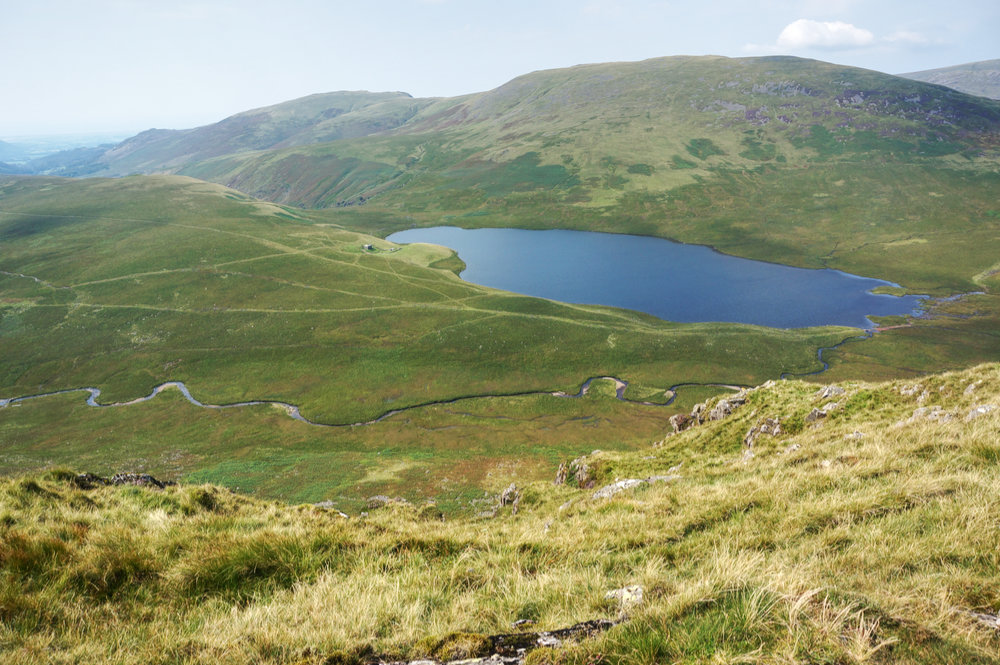
Despite a forecast of mixed weather, so far this week I’d woken to find only beautiful mornings. On Tuesday, that trend continued. The early morning sun was thin and watery as I took my breakfast down to the lake edge and ate, watching as the world woke up. On the opposite shore, a cloud inversion was all that remained of the overnight rain.

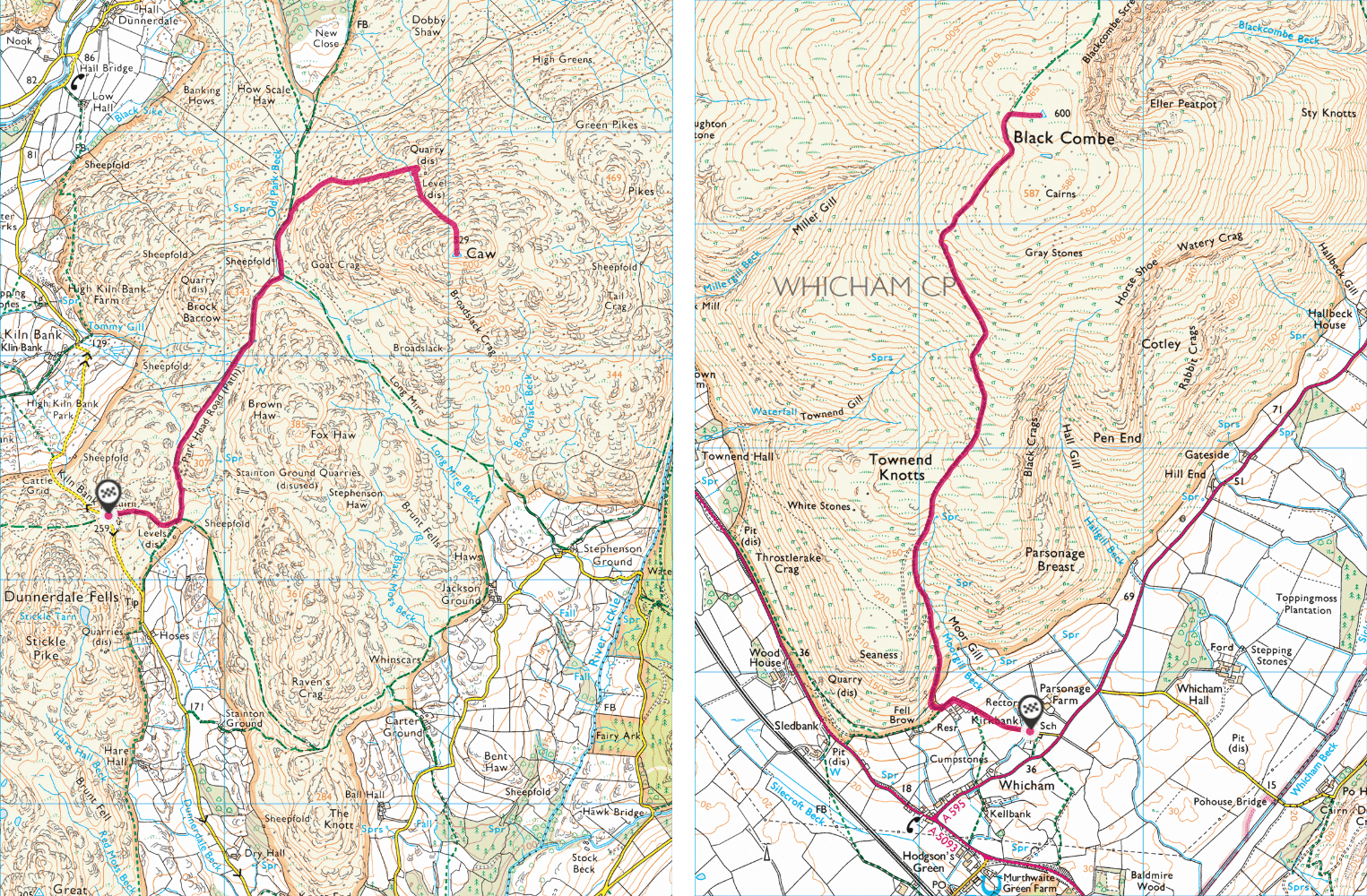
After breakfast, I headed back to Kiln Bank Cross to take on Caw. On the way, the car let me down again. It lost power on the A590. Fortunately, I was able to pull into a lay-by. This had happened before and I knew the situation might be recoverable without calling Green Flag. Fortunately the car responded after a sequence of restarts and I wondered whether I should be risking taking it along the winding, single-track roads ahead. I decided I had nothing to lose, so I pressed on gingerly.
I arrived at Kiln Bank Cross, feeling a little on edge, having expected the car to falter at any moment, but I’d made it and it was a beautiful morning. All colours seemed more saturated after the rain and my only companions at the parking place were half a dozen sheep, munching on the short turf.
Putting my automotive problems to the back of my mind, I checked the map and set off north, quickly finding the so-called Park Head Road, actually a rough track.
Viewing this route from Stickle Pike the previous evening, it had looked to be quite complicated, but now en route, it seemed like a breeze, the track was clear, easy to follow and it was a beautiful morning.
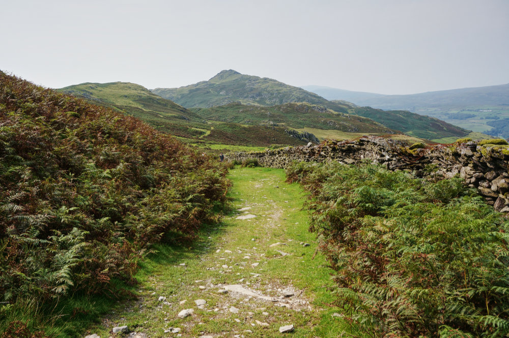
About two kilometres into the walk, and just before the Park Head Road starts to drop down into Seathwaite, I looked for the miners’ track that would take me up to the disused slate mine. There were a couple of likely candidates but none looked quite right. I’d used enough miners’ tracks in the past to know that they were usually good, flat and broad. Eventually, I spotted a beautiful green sward, forking to the right, and knew I’d found the right one.
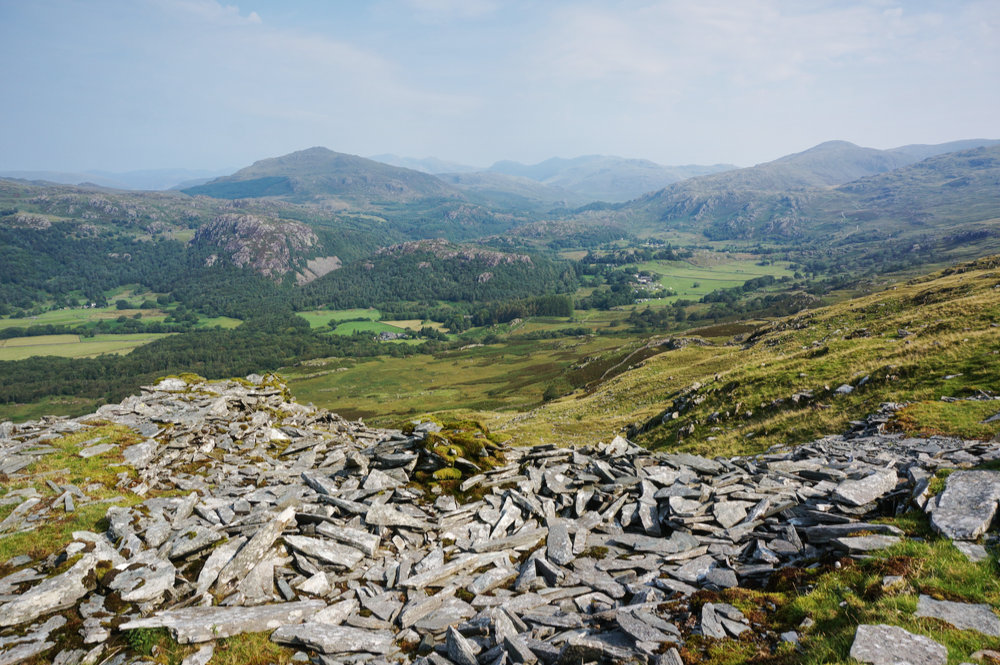
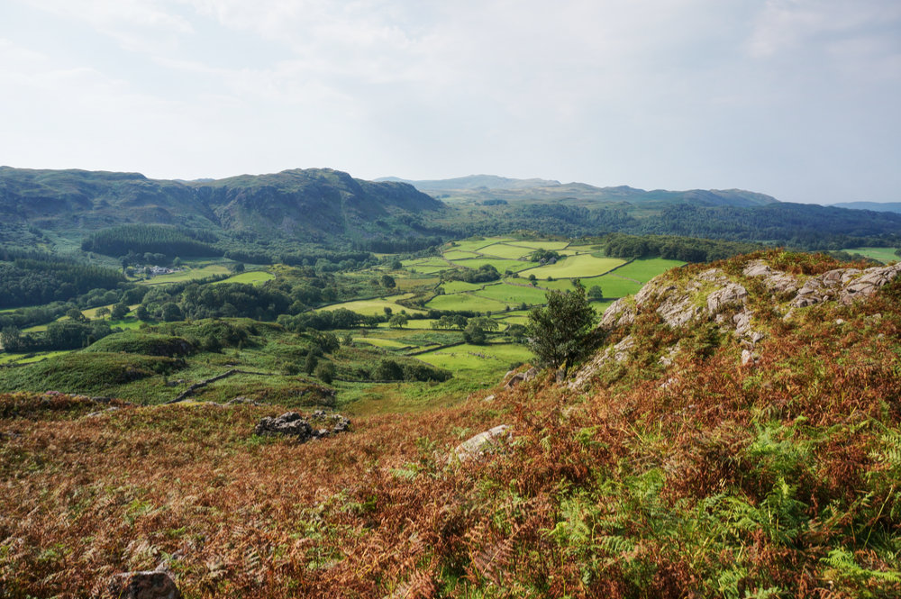
As usual for a track of this type, the incline was easy and the surface mostly good. As the track rose, there were lovely views to the north, over Seathwaite and across to Wallowbarrow crag, where I’d had a fantastic walk the day before. The air was clear and cooler after the rain and conditions were near-perfect for fellwalking. I felt lucky to be at this place, at this time and to have it all to myself.
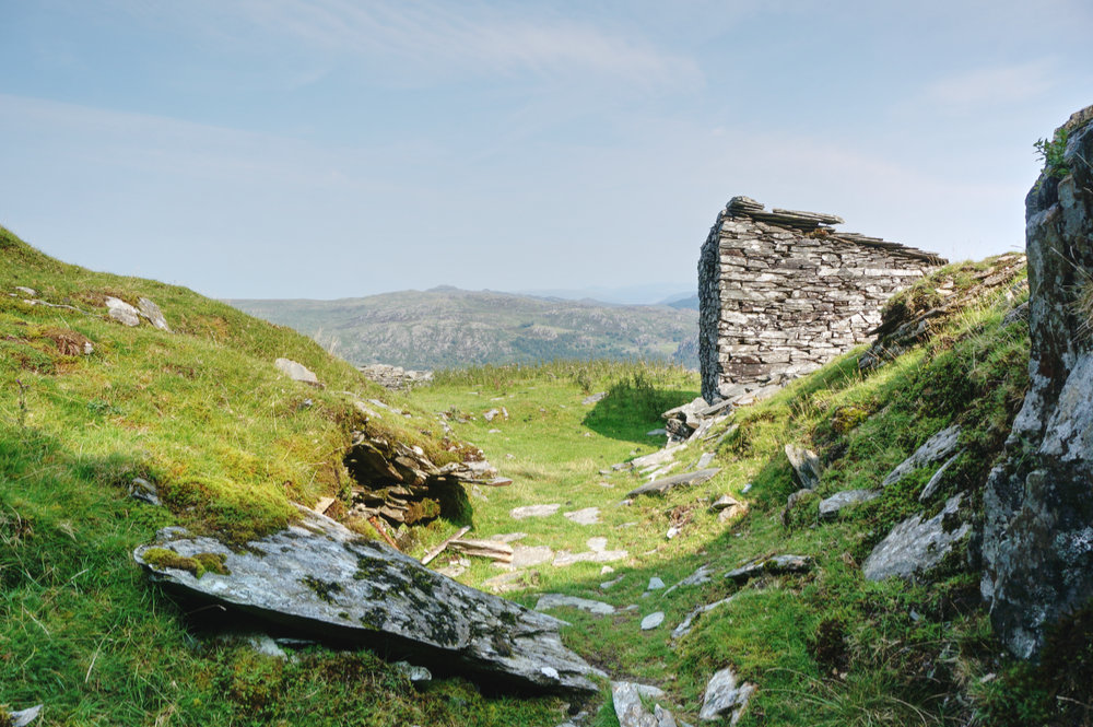
All too soon, I found myself among heaps of discarded slate and realised that I was already at the old mine. There were a few dilapidated buildings and an open shaft, the gentle decline of which disappeared into blackness.
It’s odd. I never get spooked on the open fells. I can be miles from anywhere and completely alone in rough terrain and feel perfectly at ease. But wherever I find abandoned buildings, I feel just a little uneasy. Maybe it’s the ghosts of past occupation or simply the fact that there could be something hidden behind those solid walls… I don’t know.
I paused at the mine workings and after a good mooch around, I identified the steep gully route to the summit and set off, glancing behind me regularly to see the marvellous view down into the Duddon valley (and to ensure there were no ghostly miners following me).
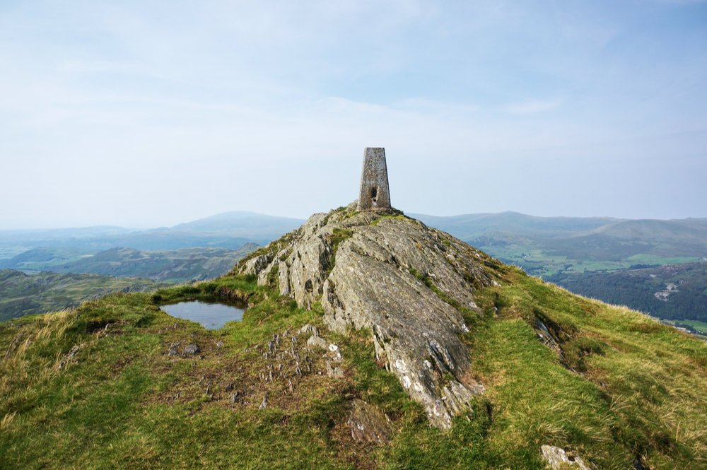
The final haul to the summit is steep and a little indistinct but well worth the effort. This is a summit worthy of summit status. A rock dome upon which is perched a concrete Ordnance Survey pillar. It looks as impressive close up as it does from a distance.
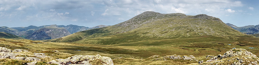
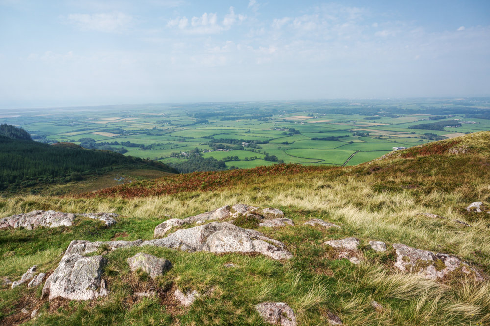
From the top there are extensive views to the Scafells in the north, the Coniston Fells in the north-east and to Black Combe, more than ten kilometres to the south-west. Being one of the outer fells, you get a real sense of the scale of the Lake District fells as a whole and their full geographic context, right down to their connection with the coast. Wainwright describes it thus; “The view is one of depth as well as distance, the abrupt summit being sufficiently elevated above its supporting slopes to give an uninterrupted downhill view into the deep enclosing valleys of the Duddon and the Lickle… Far away in the east is the skyline of the Pennines, with Ingleborough dominant. Southwards one surveys Morcambe Bay as from an aeroplane, with the estuary of the Duddon in intimate detail.”
I remained at the summit for a little while, taking in the views but knowing that this was just the first leg of the day. Once back at the car, I’d have a drive to the coast and the long climb of Black Combe.
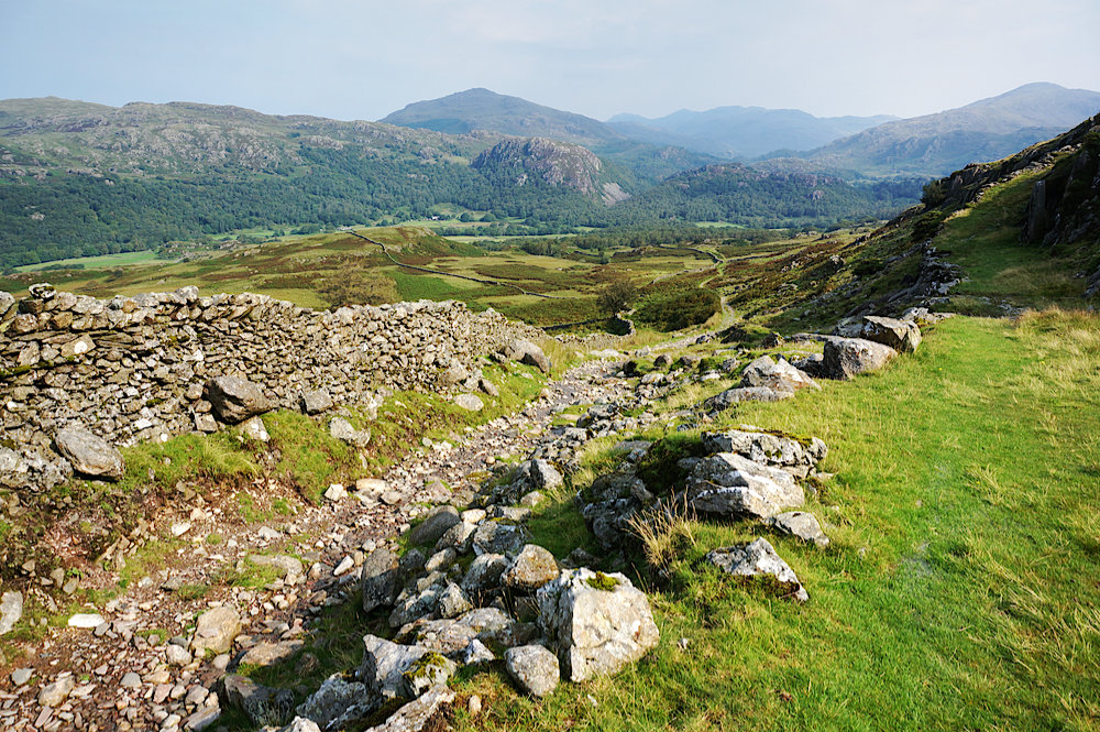
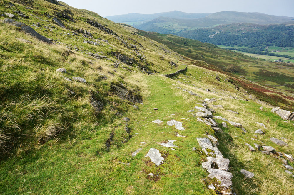
Reluctantly, I made my way down from the summit and back to the slate mine. Turning onto the miners’ track, I noticed how impressive a structure it is. A low retaining wall on the downward side allowing for a level incline, suitable for the ponies used to haul the mined slate.
Back on the Park Head Road, I met a family headed in the direction I’d just come. They asked for directions to the summit and I duly obliged. The sun was high in the sky, the shadows deep and the temperature was rising.
I arrived back at the car at around 12.30pm feeling as though I might like to take the rest of the day off but knowing that to stand any chance of completing my objective before the week was out, I’d have to bag Black Combe, which I could see in the distance, looking a little sombre.
I sat on a large boulder for a while, eating an early lunch with the sheep, who didn’t seem at all phased by my presence. After lunch, I summoned enough enthusiasm to get back into the car and set off for Black Combe.
I arrived at the Whicham church car park just before 2pm, changed my shoes, ensured I had plenty of water, and set off on the popular route to the summit.
The first part of the route is a hard slog as the path rises steeply beside Moorgill Beck. The sun was beating down, my legs were weary and I found myself stopping to drink at regular intervals. Despite being near the coast, the air was motionless and the heat was quickly sapping what energy I still had. I told myself I’d have the day off tomorrow. Eventually, the path levels out a little and the walk became a little more enjoyable.
I have to take exception to Wainwright when he describes the route as “…considerate to the old and infirm: the grass bridleway to its summit from Whicham is amongst the most delectable of Lakeland fell paths. Which other can be ascended in carpet slippers?”
Well, that was not my experience, but as I know by now, context is everything and the quality of any route has a direct correlation to how you are feeling at the time and to the prevailing weather conditions.
After an hour and a half, I made it to the summit, where there were a group of elderly (older than me) walkers sitting in the generous wind shelter. We chatted about where we had walked from. I explained that I had bagged Caw that morning and was moving on to Muncaster Fell later in the afternoon. They looked at me as if I might be slightly mad and I wondered then whether that might be the case.
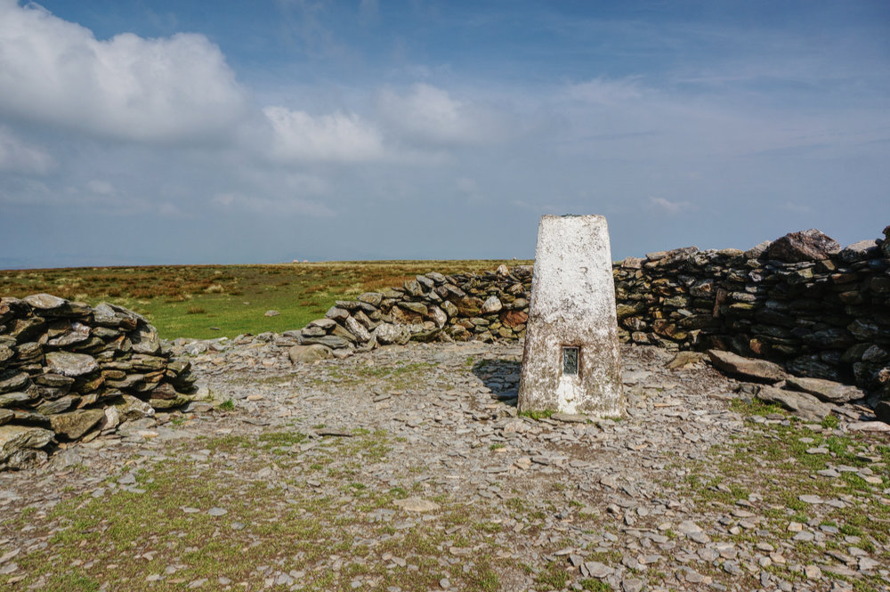
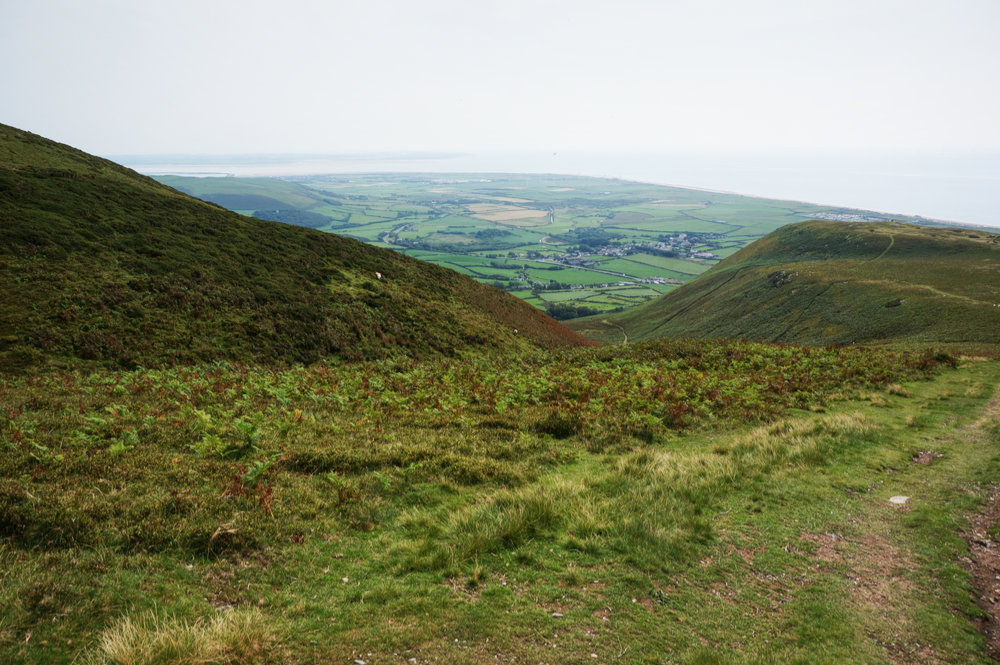
I was glad to have reached the summit and to have ticked Black Combe off my list but the views from the top were disappointing. The air had become more hazy as the day had worn on and the broad dome of the top meant that, unlike Caw, there were no local views.
I left the summit and made my way back to St. Mary’s Church, knowing that, on this occasion, it really was downhill all the way. I got back to the car at 4.45pm and although there was still plenty of daylight left, I knew I couldn’t possibly manage Muncaster Fell – that would have to wait for another day.
I drove back to YMCA Lakeside, noting that my FitBit step rate had steadily declined as the week had progressed and knowing that I was going to have to have a rest day.
Wednesday
Wednesday was another beautiful morning and I was in no hurry to leave Lakeside, having decided I needed a day off. The concept of “off”, however, is relative. I decided that it would be a crime to waste such a beautiful day and that a nice day out would be in order – something on the coast that involved ice-cream. I decided that Ravenglass would be a good destination and that if I felt up to it, a nice easy stroll to Muncaster Fell probably wouldn’t be too taxing.
It was an hour’s drive from Lakeside to Ravenglass. I took my time, there would be no strict itinerary today. I drove past Black Combe, remembering how tired I’d been the previous day but secure in the knowledge that it was in the bag, and continued on the A595 until the turn off into Ravenglass village.

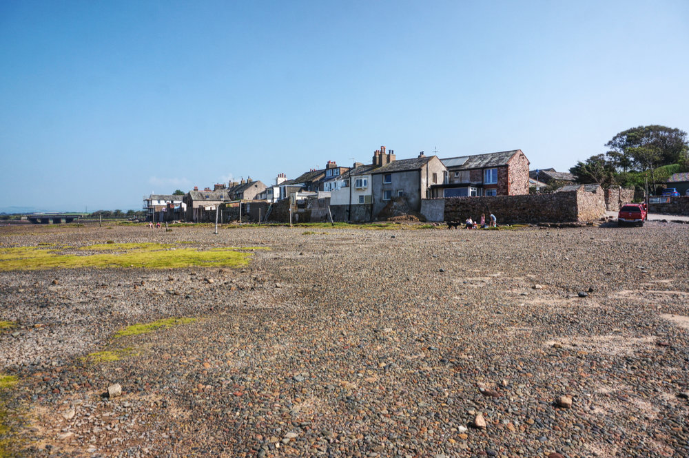
I parked up in the village car park and quickly dispensed with the conceit that I was only here on a day out, although I did wander down to the water and strolled along the beach before returning to the car to prepare for my walk.
The weather was pleasant, not as hot as the previous day and the walk was mostly at grade, no steep climbs – a gentle stroll on a day off. A mere 10km there and back and a very modest ascent of just 295m.
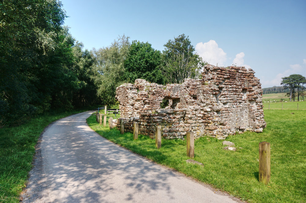
From the car park, I crossed the railway and set off on the route which took me past the Roman bath house, through the grounds of Muncaster Castle and then along Fell Lane, eventually emerging onto open fell.
This is a popular route and there were plenty of people around. I met a grandfather, taking his 9 year old grandson for a low-level fellwalk. The boy asked me whether I’d walked all the way from the car park at Muncaster Castle, as they had. I said, no, I’d walked from Ravenglass. The boy looked at me with admiration and said, “Wow, that’s a long way!” I was just about to be modest when the grandfather nodded at me approvingly. I wished them a good day and continued to Hooker Crag, the summit of Muncaster Fell.
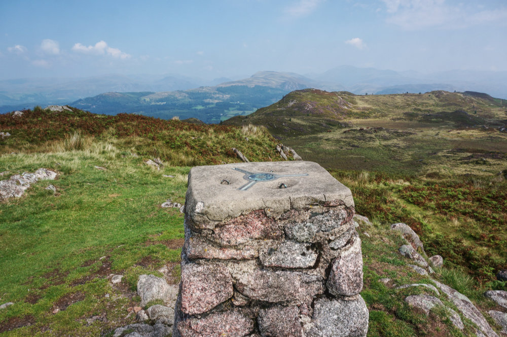
My timing was impeccable. I arrived at the OS trig pillar at exactly 1pm – time for lunch. When I arrived, there was a young family already in residence, so I sat at a respectable distance, with lovely views to the north and east, and ate my customary apple and muesli bar.
While I was still eating, the family packed up their lunch things and left the summit, leaving me alone. The weather was calm with a pleasant breeze, which brought regular toots from the La’al Ratty engines as they made their way, too and fro from Ravenglass to Dalegarth Station.
I returned to Ravenglass the way I’d come, stopping off at the station cafe for a cold drink and an ice-cream and then sat in the shade of a shelter on the mainline platform as a group of enthusiast engineers tinkered with a beautiful narrow gauge steam engine.
It was only 3pm but I decided to get back to Lakeside and spend some time hanging out and planning my final walks of the week.
Back at base, I prepared a picnic supper and sat overlooking Lake Windermere. In theory, this would be my last night at Lakeside and I was almost resigned to the fact that I would have to return home with one peak left to bag. That is until I realised that there was no obvious reason why I had to return the following day.
By the time I’d come to that conclusion, the reception at Lakeside had closed, so I searched online to see if there was a vacancy – there wasn’t. So I checked out the YHA and found one remaining camping spot at YHA Borrowdale – not ideal but the only one available, so I booked it. As usual, I’d brought camping gear with me, just in case.
Thursday
Thursday morning, I was up early and headed over to reception to ask about another night. As it turned out, there was no problem. Despite the website showing no vacancies, my room was available for another night, so I booked it and immediately cancelled the camping pitch at YHA Borrowdale – hopefully, someone else would be able to use that.
Fantastic, now I was back on target to complete the Fellranger fells before going home. I had a pleasant breakfast down on the lake and then prepared for today’s adventure.
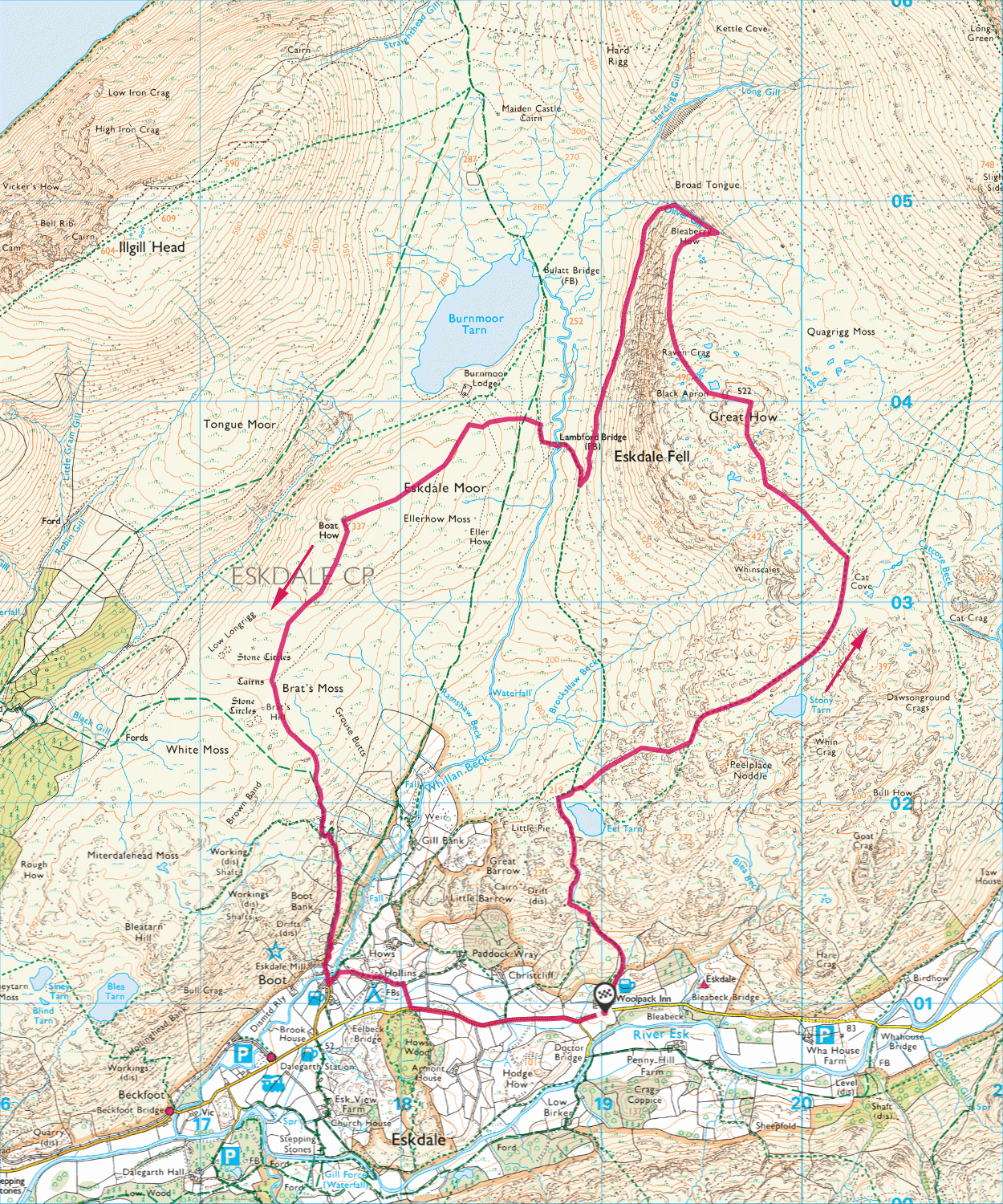
If I’m honest, I’d been putting this walk off. Technically, it looked difficult. There were few paths and, on the map, I found it difficult to come up with a route that made sense. Although Great How and Boat How are both in the same vicinity, they are rarely combined into a single walk, and being on opposite sides of Whillan Beck means options are limited. Added to that, neither are particularly popular destinations, so I knew this might be a bit tricky.
From my base on Lake Windermere, I headed back east, in the direction I’d been driving out to on every morning this week. My start point today was the Woolpack Inn at Eskdale, so I drove via Ulpha and then along the beautiful Birker Fell road, taking satisfaction in the fact that all the tops either side where now ticked off. It was a long drive but very lovely once off the main roads and I wasn’t in a rush. Although this walk looked a bit tricky, it wasn’t particularly long at 13km.
I arrived at the Woolpack Inn just before eleven. Despite the fine weather, there was plenty of space in the car park, so I parked up and quickly got on my way, promising myself a cold beer when I returned.
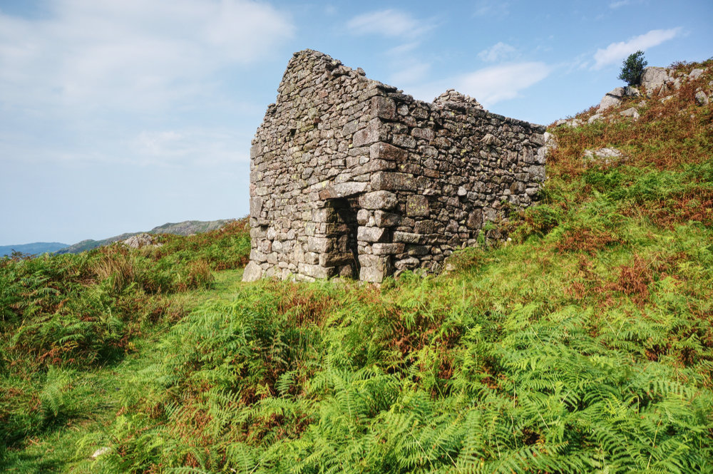
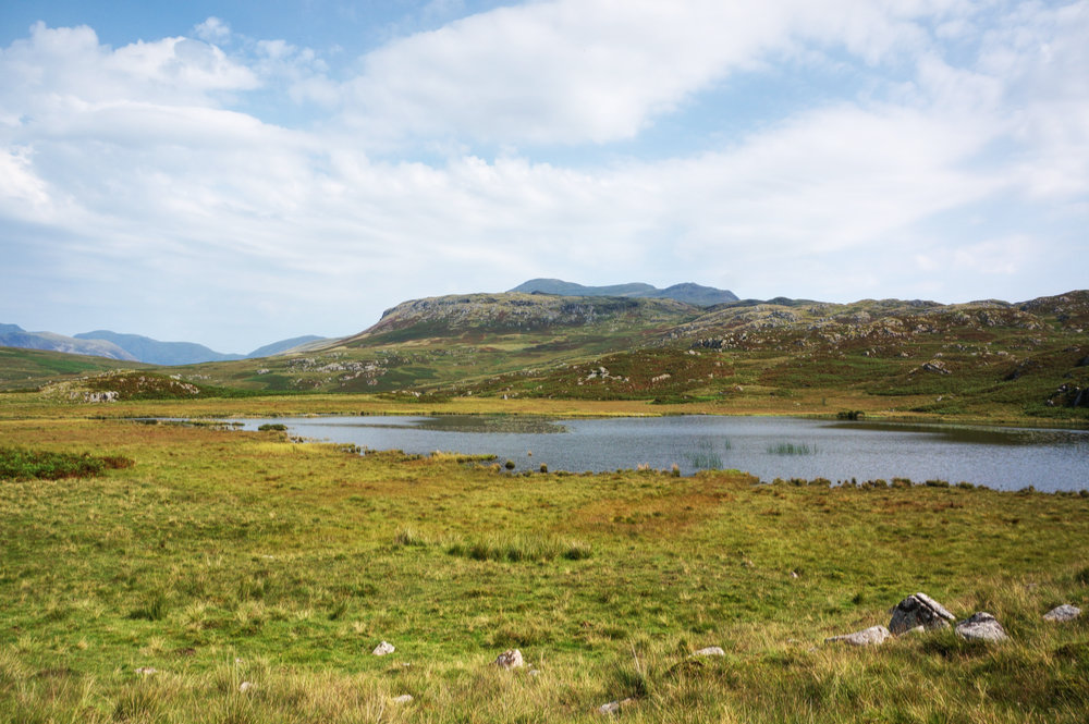
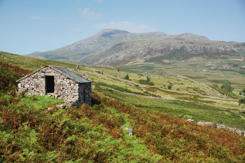
The path leads off behind the back of the inn and then rises steeply along a well-defined grassy path, flanked by bracken, to a derelict stone peat hut. From the hut, there’s a moment of confusion as the path disappears but I found the onward route and continued to Eel Tarn.
From this location, I could see Great How ahead but there was no chance of a direct line. From the northern head of the tarn, there’s a footpath marked on the map trending south-east before swinging north-east and up into the curiously named Peelplace Noddle, but when I got to the point where the path should be, there was no sign of it. I decided this was the point where I’d have to make my own way across trackless moor, but this moor was not flat, it was a higgledy-piggledy mess of mini hills and valleys, making it very difficult to see further than fifty metres ahead.
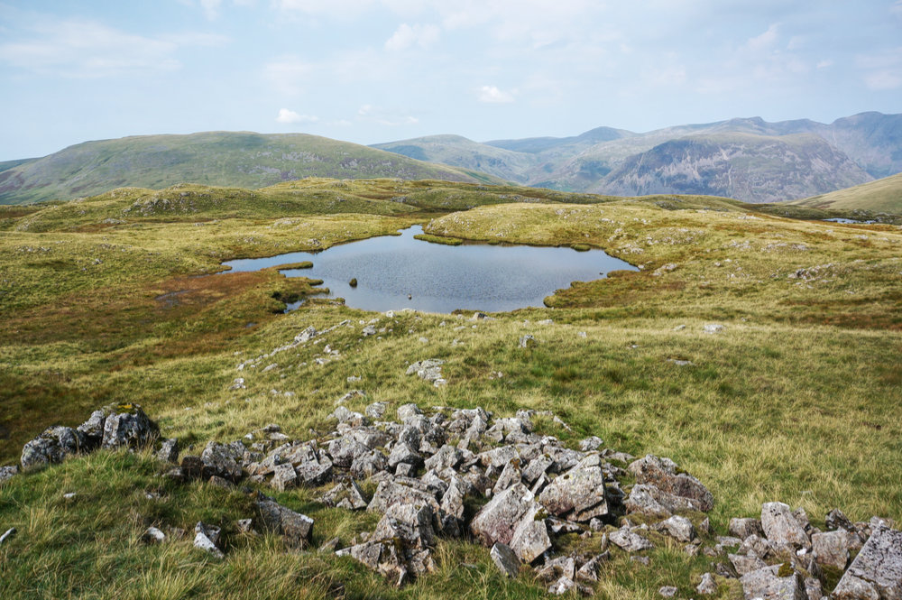
I pretty much followed my nose, checking my phone regularly to ensure I was heading vaguely in the right direction. When Stony Tarn came into view, I realised I’d already climbed higher than the intended route but I kept to my line and headed north between Winscales and Cat Cove.
Once above Cat Cove, I could see the route to Slight Side I’d taken almost a year before. On that occasion, I’d hoped to take in Great How but ran out of time. I struck off north-west, about one kilometre from the summit, and although I couldn’t see my objective, the landscape became more intelligible and my route more obvious.

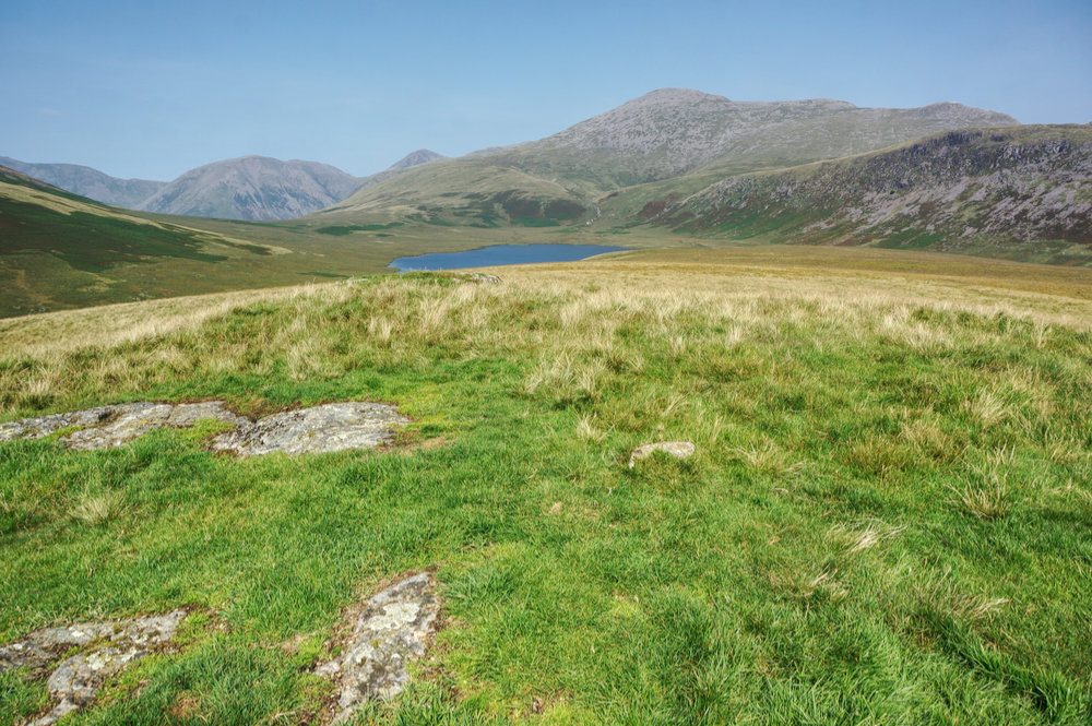
Eventually, after another couple of twists and turns, I made it to the summit. The walk had taken two hours. As I arrived, there were another couple of walkers arriving at the same time from the opposite direction. I hadn’t seen a soul since leaving the car and here, at the summit of a not very popular fell were two others! Of course, it was now lunchtime and many walkers (including me) like to time walks so that lunch can be had at a wonderful viewpoint, and this one was not half bad.
Great How is surrounded by higher mountains but with land falling away on all sides, it gives that sense of being right in the centre of things. Across Quagrigg Moss, to the north-east is Slight Side and Scafell, of which, Mark Richards comments, “From here, Scafell looks like a massively boring heap…”. I’m not sure I entirely agree but he is right that, “Slight Side has the greater visual impact”. To the east and beyond Slight Side, Bowfell and Crinkle Crags make an appearance. To the north-west, Yewbarrow is prominent, with the Western Fells beyond, and to the west lies the backside of Illgill Head.
Great How summit is a wonderful place to be on a beautiful day. I ate my lunch slowly, giving time for the other couple to finish theirs and depart so that I could have the place to myself.
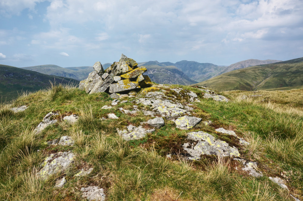
Thinking that the more difficult part of the walk was behind me, I set off confidently to find the cairn above Raven Crag. This is another great viewpoint. The ground drops steeply away to the west with lovely views the whole length of Miterdale and across Burnmoor Tarn to Whin Rigg and Illgill Head.
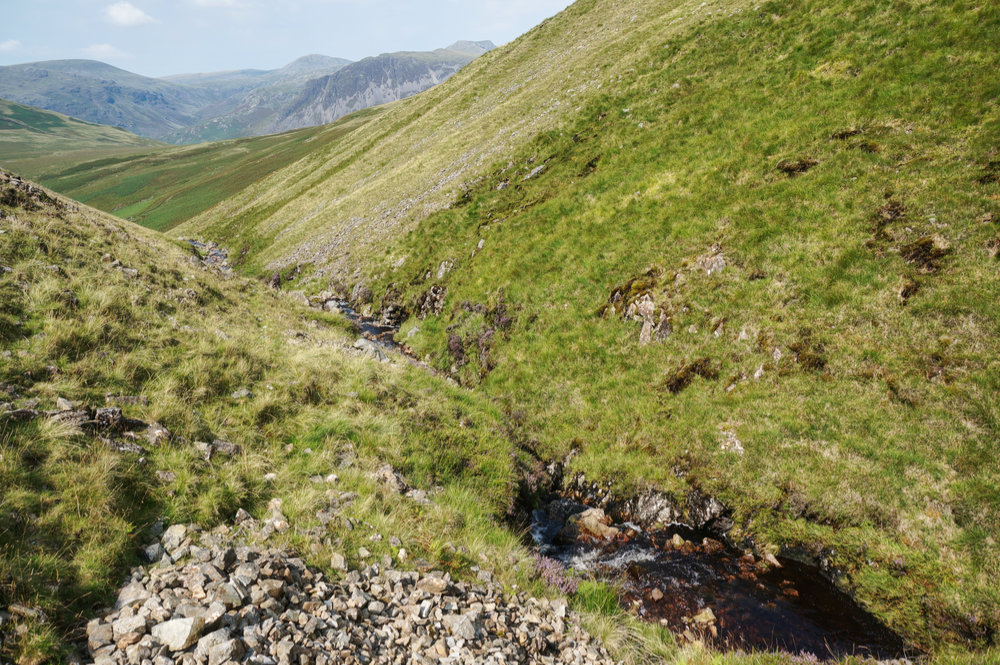
From Raven Crag, I headed north, along the top of the escarpment, keeping my fingers crossed that I might find a descending route at the northern end, as the Fellranger guide suggested I might. The closer I got, the less likely it looked, so I swung east and dropped down steep ground to Oliver Gill at the point where two tributaries joined. The ground here was firm and relatively flat, but the valley sides were very steep, and I couldn’t see an obvious route along the gill.
I considered retracing my steps and trying another route but told myself that I was here for adventure and that I should just go for it. So, without knowing whether a viable route lay ahead, I set off along the southern side of the gill.
I kept my eyes peeled for signs that others had come this way but the best I could come up with where occasional and intermittent sheep trods. One slip is all it would take to see me tumbling down the steep slope and into the gill, but after about 200m of careful walking and shuffling, an end was in sight as the valley broadened.
I was hoping I might be able to follow the gill down to Burnmoor Tarn, and there pick up the path towards Boat How, but as the views opened up, the gill plunged over a cliff and down a beautiful waterfall – this was a hanging valley! There was no easy way down, so I followed the contours south and eventually found a path that was marked on the map. My original walk plan wasn’t going to work but I had an alternative plan. I’d follow this path down to Lambford Bridge and cross Whillan Beck at that point. It would make for a slightly longer walk, but I didn’t mind, I was just glad to be back on an obvious path.
The route from Oliver Gill to Lambford Bridge is pretty unforgiving and is almost 1.5km in length. It is bouldery in places, running along the foot of a steep scarp slope, where rock has fallen from the crags above, and for much of the way, the route is obscured by bracken. Although the path pretty much follows the contour, it was tiring, and it seemed to take forever. In fact, it took me just forty minutes to get to Lambford Bridge, where I crossed the beck and sat down for a break.
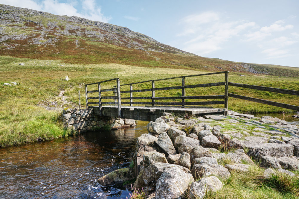
Lambford Bridge looks to be in a poor state of repair. I imagine another couple of hard winters with high water will make it impassable, but for now, it remains the key crossing point of Whillan Beck.
After a ten minute break, I set off up slope, hoping to find a crossing path that would take me in the direction of Boat How. Eskdale Moor is open country with a confusion of pathways, some obvious, some less so but it is covered in that clumpy grass that makes walking difficult and potentially ankle-twisting. I took obvious paths as much as I could but there came a point where I had to strike off across country towards Boat How. Again, the going was slow and uncomfortable but eventually, I arrived at my penultimate Fellranger.
Reaching the “summit” was a disappointment and I later realised that approaching from the north-east does not provide the best experience of this minor top. There is no cairn and no real sense of place. Views back across to Great How and Scafell are impressive but Boat How is really a small island in a sea of moorland grass.
The reason for the name, “Boat” How only became obvious once I’d left the top and followed the faint but obvious path south. Looking back, I could see the rock outcrop looking distinctly like the upturned hull of a small boat.

I picked up the more obvious path at Brat’s Moss and followed it as it descended towards Boot. That section of the walk and the descent to Boot is rather lovely, with excellent views across Eskdale to Harter Fell and Green Crag. Eventually, the path comes to a group of disused stone huts, looking picturesqe in the afternoon sunshine. It was four o’clock and although I’d been walking for five hours, I was feeling good. Yesterday’s easy walk was paying off.

Walking into Boot after a little while in the wilderness felt like returning to civilisation. Everyone at the popular campsite seemed jolly and ice-creams were being eaten. I followed the footpath as far as I could before having to drop down to the road for the final stretch back to the Woolpack Inn.
I got back to the car just before five, took off my gear and went for a cold bitter shandy. What a treat! This was the first walk of the week that had ended at a pub and even the strict one-way system and required face-covering at the bar couldn’t dent my enjoyment of that pint. I sat in the pub garden soaking in the local atmosphere. A group of farmers were discussing their work that day and life seemed good.
To be continued…
11th August 2020
Caw (529m)
Black Combe (600m)
12th August 2020
Muncaster Fell (231m)
13th August 2020
Great How (523m)
Eskdale Moor – Boat How (337m)