Today would be the day. The day I’d complete the challenge I’d set myself to summit all of the Wainwright fells and all of the Fellranger fells, 235 in total. My adventure had begun on 17th June 2015 with a tentative walk to Low Pike, High Pike and Dove Crag from Ambleside. Today, it would conclude with a high-level walk in Langdale, taking in the final Fellranger on my list, Little Stand.
This walk was going to be my reward for a tough week of walking. Although I had enjoyed visiting the final Fellrangers on the list, they almost all were what Wainwright calls the Outlying Fells, and that meant they were lower and more scattered than the popular and better known fells in central Lakeland. My reward for a week tramping the Outlying Fells would be a day walking in the high fells, with Bowfell the prize.
Friday
The previous evening I’d packed as much of my things as I could so as to make for an easy departure. It was another lovely morning and I took my breakfast, once again, down to the lake. After breakfast, I looked at my surroundings and thought how lucky I’d been to spend a full week in this wonderful place when, only a few weeks earlier, finding any place to stay in the Lakes looked unlikely.

I packed the car with all my things, said goodbye to the staff and headed off for Langdale. The novelty of turning right, out of the YMCA, was not lost on me, when I’d spent all week turning left, down to Newby Bridge. It felt good to be headed back to the heart of the action after being out on the periphery.
After a mostly pleasant drive (the junction at Clappersgate being the only heart-in-mouth moment), I arrived at the Old Dungeon Ghyll car park at around 10.30am. Despite this being peak season, I had no problem finding a space. In normal years, you’d have to arrive very early to stand any chance.
It was a glorious morning. The sky was clear blue, there was very little haze, and although warm, it wasn’t as hot and muggy as it had been earlier in the week. In short, it was a near-perfect day for walking in the fells. I had been so lucky with the weather on this trip. Although there had been some rain at night, I’d had seven days of good weather.
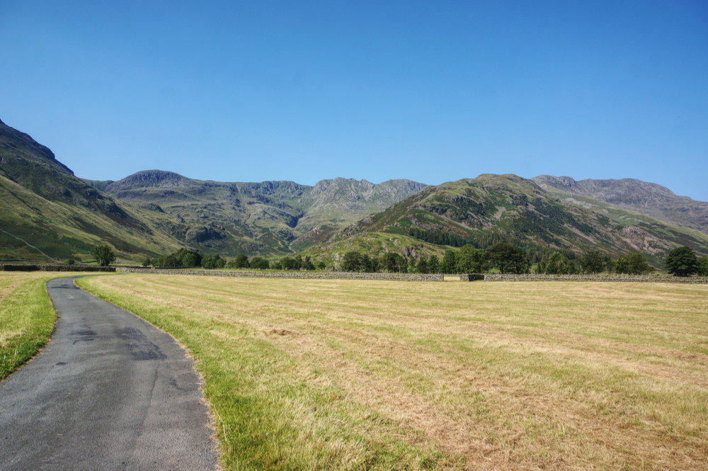
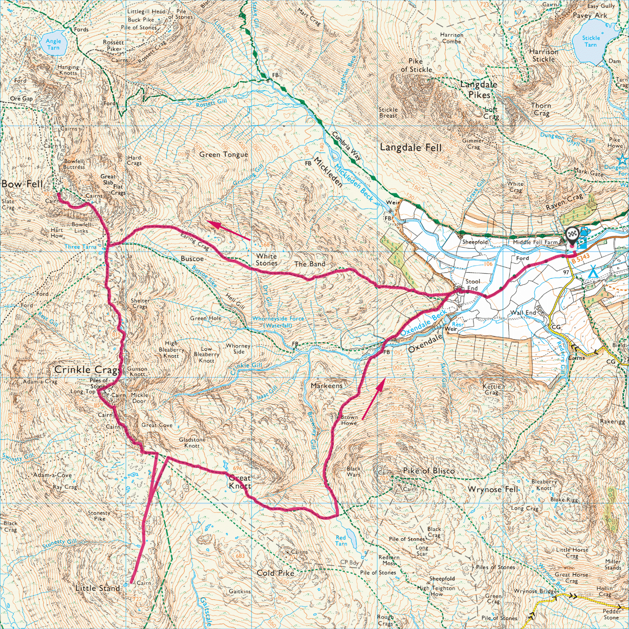
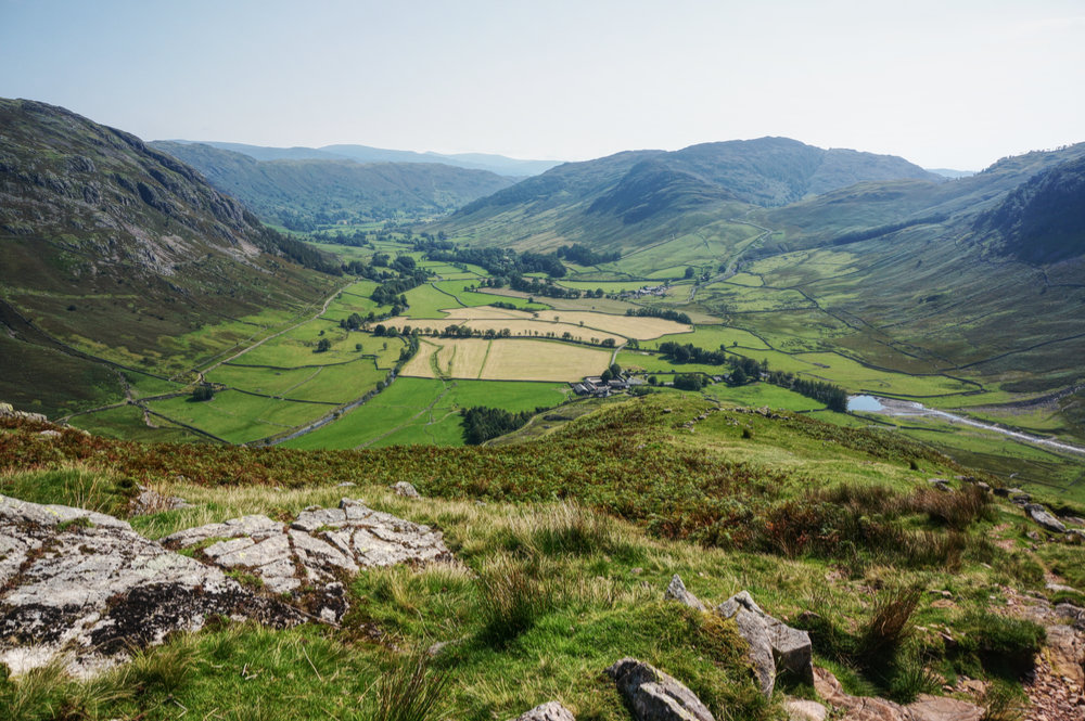
I strode off towards Stool End Farm, surrounded by mountains and feeling like the luckiest person in England. I’d been looking forward to this walk all week. Although I’d visited Bowfell before, I’d never approached by this classic route, via The Band. On the map, it looked nice and simple, with a consistent rate of climb.
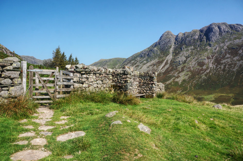
I walked through the farmyard and found the start of the route as it rose towards the first point of interest, the Hamer memorial seat, dedicated to S. H. Hamer, National Trust secretary, 1911-1934. Through a kissing gate, the route narrows and steepens as it ascends the nose of land between the valleys of Oxendale and Mickleden.
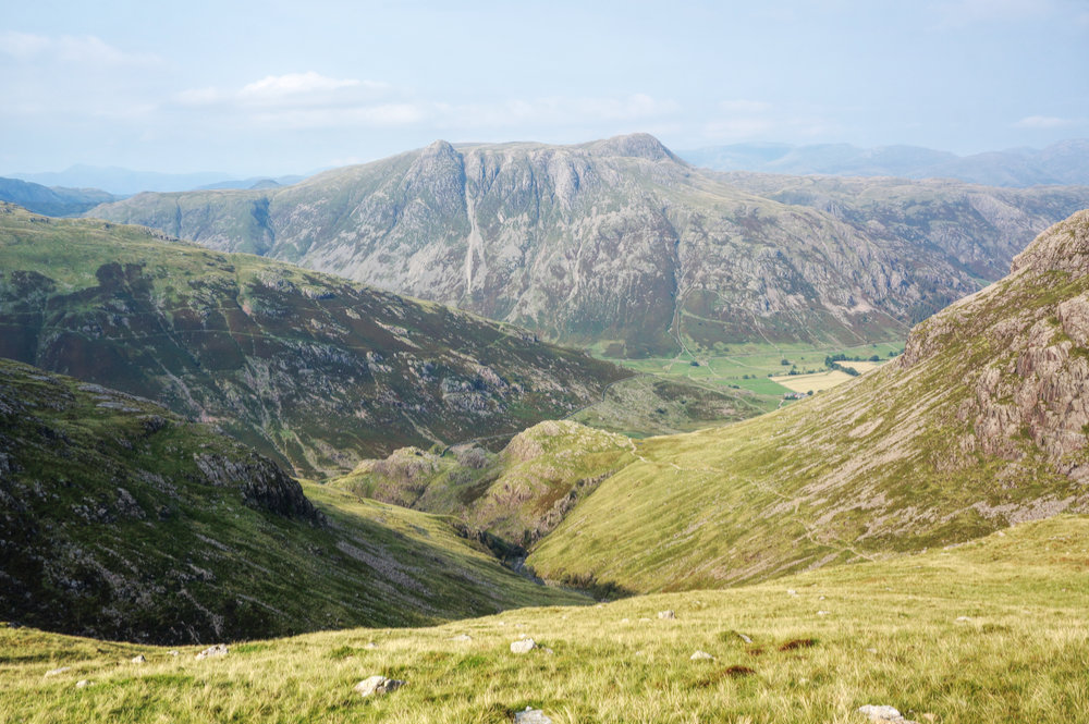
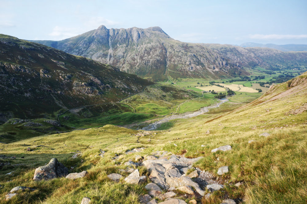
Initially, views are all to the left, where Pike o’Blisco is dominant, but eventually, the path tops the ridge and fantastic views open out to the right, revealing the Langdale Pikes, with Pike o’Stickle looking imperious. All the while, behind you, the view down into Mickleden with Great Langdale beyond just get better and better. No wonder this is a popular route.
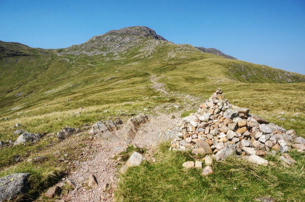
At the top of the steep initial climb, the route becomes less steep as it passes below White Stones and then swings around the head of Buscoe, ending in a steeper section as it rises to meet the Crinkle Crags ridge path at Three Tarns.
There were plenty of people around but the place never felt crowded. Everyone I met seemed in high spirits, elated to be out in the hills on such a fine day after enduring months of lockdown. It almost seemed as though the pandemic had never happened. The only real sign that things were different was that there were fewer people here than might be expected at this time of year.
In the run-up to this trip, the weather had not been good. The end of July and early August had been very wet and I’d approached this visit in hope rather than expectation. Clearly, I’d been very lucky and, even better, the wet weather prior to my arrival did mean that the greens were all greener and the becks were full of foaming water and the landscape generally felt vibrant.
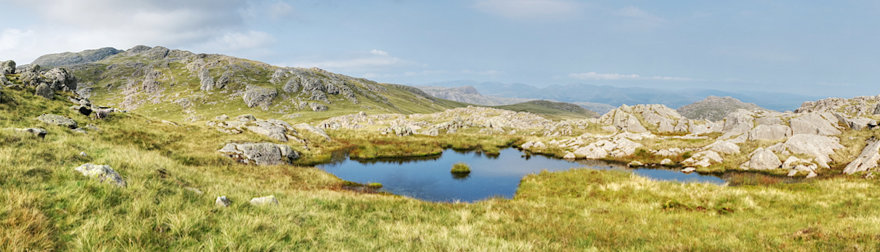
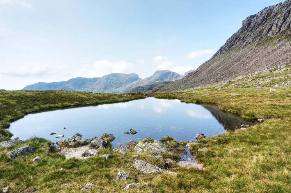
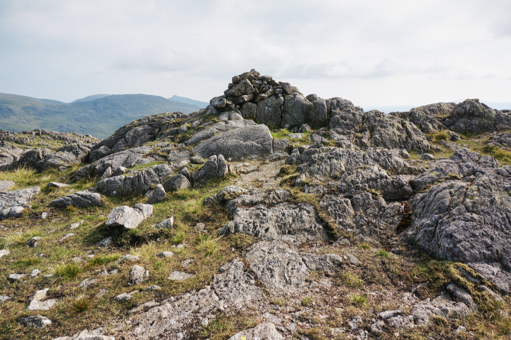
Another indicator of recent wet weather was the presence of three tarns at Three Tarns Hause. As Mark Richard’s notes in his Fellranger guide to Langdale, “it’s rare to find more than two pools here.” But here they were, three tarns, full of clear water, and I have the photographs to prove it!
From Three Tarns, its a steep, rocky scramble up to the next level, but once reached, the route to the summit is a breeze, and quite beautiful. The sense of being high is tangible as views open up to the farthest parts of the district.
Bowfell is the sixth highest mountain in the Lake District, and although I’d visited before, it was no less exciting. The summit itself is a small cockpit, formed by shattered rock, and although there were no crowds, there were still enough people here to make an extended stay at the highest point undesirable.

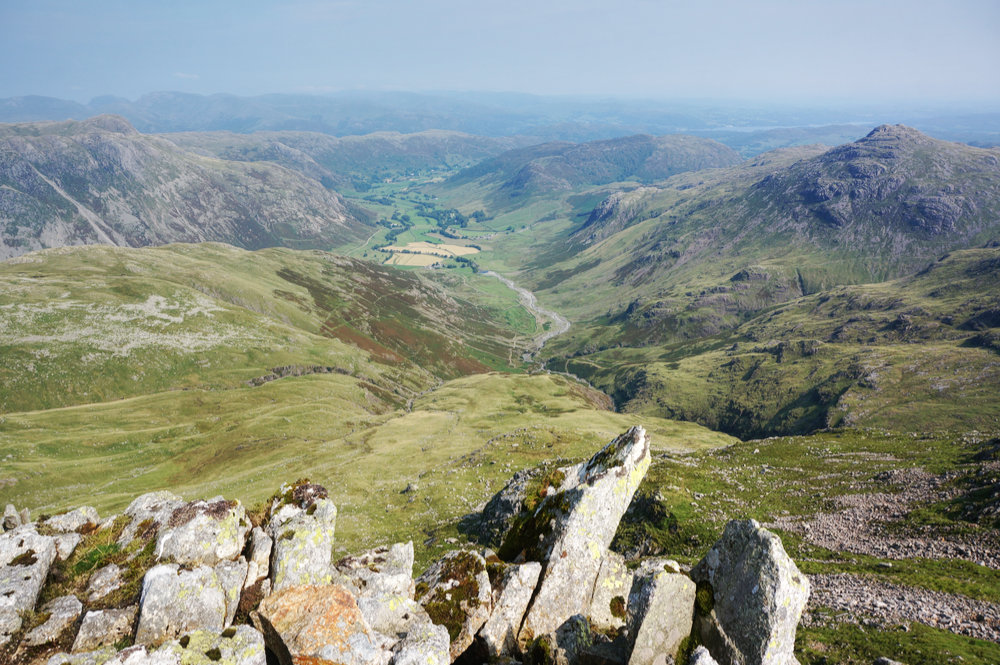
I found a secluded spot with excellent views, away from the summit and sat down to take it all in. One of the best lunchtime views I’ve ever had. Over to my right, Scafell and Scafell Pike were so clear that I could easily see the raised dias on the summit of England’s highest mountain. To my left was Crickle Crags, where I could make out the route I’d be taking after lunch. The sky was still blue and what little haze there was just served to enhance the depth of the scene.
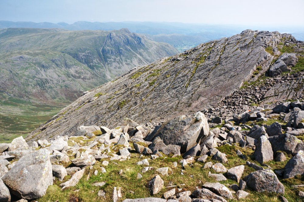
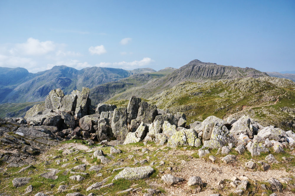
I stayed for around twenty minutes and then headed back the way I’d come, stopping off to admire the Great Slab before descending the rocky drop to Three Tarns. From there, I picked up the path to Crinkle Crags.
The last time I took this route, I was travelling from south to north, but now I was taking it in the opposite direction and it felt distinctly more difficult. There are plenty of ups and downs and and lots of hands on rock. Perhaps I was just feeling less fit this time.
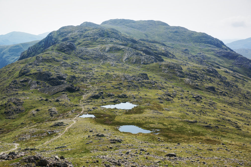
The tricky route continues for well over a kilometre until, eventually, the summit at Long Top is reached. Along the way, there are plenty of opportunities to look back at Bowfell, with it’s gullied southern flank, known as Bowfell Links. There are also occasional views down into Oxendale with Great Langdale snaking away into the distance.
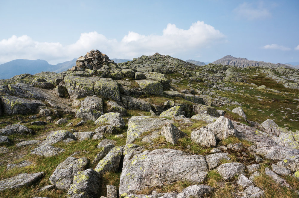
Surprisingly, the further south I walked, the fewer people I saw, and by the time I got to Long Top, it was deserted. However, I wasn’t inclined to spend any time there, it’s not the best of summits and I was keen to get to Little Stand, so I kept moving and soon arrived at the drop at the end of the first Crinkle.
There’s no obvious path to Little Stand. Almost everyone who comes this way follows the clear path east towards Great Knott and Red Tarn. As Little Stand is not a Wainwright, it’s left to the more discerning fellwalker to find it and that inevitably means crossing rough, trackless ground.
In truth, it’s not complicated and the only difficulty is in finding the easiest line between one point and another. But it is slightly deceptive, it looks as though the summit might be within easy reach but Little Stand is not visible from the approach and is actually located beyond a significant fall and rise in levels. I was only slightly discouraged when I realised this and after just a moments hesitation, continued my march over hummocky fell.
Nearing the summit, the route passes a rather lovely tarn. Mark Richards describes it as being, “cradled by a great slab” and I could certainly imagine spending some time by these calm waters, completely alone.
I reached the summit at Little Stand just after four o’clock and although I wasn’t expecting fireworks, there was a definite feeling of anti-climax. It’s not the most spectacular summit and views from the top are limited but there is a real sense of place about it. Nevertheless, I’d come to the end of a five-year odyssey and I couldn’t help feeling a little deflated. Even the sun had decided to abandon any pretence of celebration. Cloud had bubbled up and weakened the light.

I didn’t even feel inclined to spend much time at the summit. The cairn was surrounded by a cloud of the flying insects I’d seen at Stickle Pike and at other summits earlier in the week – what the heck are they, and why do they like summit cairns?
I made a short video note to self, to record the moment and then headed back the way I’d come. There was a pint waiting for me at the Old Dungeon Ghyll Hotel and a not insignificant walk to get there. Fortunately it would be downhill all the way. I just needed to get back to the main route, and once that was won, I could pretty much follow my nose.
After only a minor loss of direction, I rejoined the popular route at the base of the first Crinkle and turned right, following it down to Red Tarn. It’s further than I remembered at one and a half kilometres but the path is well pitched and relatively easy going.
From the crossroads at Red Tarn, I turned left onto the path that descends into Oxendale. I’d been looking forward to this part of the route. I’d seen it from the far side of Oxendale that morning during the ascent and it looked spectacular from a distance. It was pretty good close up too.
The thin path descends across the western flank of Pike o’Blisco, initially following Browney Gill, before swinging north-east at Brown Howe. There are several beautiful ascents and descents in Langdale but I think this may be my favourite. Many of the routes are now pitched for significant sections and although that makes for good walking, it takes something away from the wildness of the place.
Eventually, the path leads down to the footbridge across Oxendale Beck, where another path leads back to Stool End Farm. Once there, I retraced the steps I’d taken that morning, arriving back at the car around six thirty.
I sat in the hotel garden with a cold bitter shandy, looking at the Langdale fells in the evening sun, pleased that I had successfully completed my objective, not only for that week but also for a lifetime. I’d already completed the Wainwrights, and now I’d completed the Fellrangers, and no one could take that away from me.∗
14th August 2020
Bowfell (903m)*
Crinkle Crags (860m)*
Little Stand (739m)
* Previously Bagged
Tagged: Lake District, Wainwrights