Having not had quite enough of north-western Scotland in the summer of 2021, we decided to head back there in June 2022. This was a holiday of extremes. We had the high of seeing Tilda’s graduation ceremony in Dundee at the beginning of our first week but we also had the low of Hannah and then me being struck down by COVID during the second week. In between times there were some lovely walks and some intermittently good weather.
In planning for this trip, I’d hoped to do several Munro walks but the combination of unpredictable weather and illness meant that we went home having bagged just one, Beinn Sgritheall.

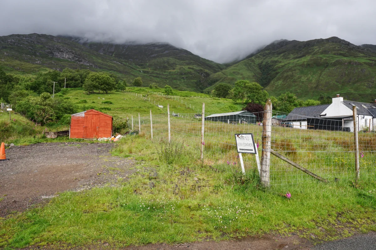
After a lovely few days in Dundee, celebrating Tilda’s graduation, Tilda, Hannah and I set off on Saturday to travel from east coast to west coast. We were headed for Glenelg, where we had rented what sounded like a rather eccentric cottage for the first week of our holiday.
We arrived in good spirits and explored our temporary home. The good news was it was mostly comfortable but the bathroom facilities were rather primitive – even by our standards! We settled in for a week of relaxation and outdoor activities. Sadly, the weather wasn’t looking good. Although we’d arrived in fine weather, the following days were “changeable”.
On Monday, Tilda’s boyfriend, Ben came across to visit. I was longing to get out and do some walking, but the weather that morning was poor. However, the forecast for the afternoon was better. So, after an early lunch, Tilda, Ben and I set off to Arnisdale to attempt a climb of Bienn Sgritheall. Hannah elected to stay at the cottage.
When we arrived at Arnisdale, the summit was nowhere to be seen, lost in low cloud. Having faith in the forecast, we set off in any case, hoping that conditions would improve during our climb.
We began our mission at exactly 1pm. It was dry but there was a lot of low cloud and we just had to have faith that Bienn Sgritheall was up there somewhere. Initially, the going was relatively easy but the higher we climbed, the steeper it got. Fortunately, I was still feeling reasonably fit after my week in the Lakes a couple of months earlier. Naturally, Ben and Tilda had no problem.
Our ascent almost came to an end when, about halfway to Bealach Arnasdail, Tilda fell into an eroded channel and landed awkwardly. At first, she was clearly in pain and couldn’t put any weight on her leg. We decided to wait a while to see if it would improve, but I wasn’t optimistic – it seemed bad. However, after 10 minutes or so, she was keen to continue. I wasn’t sure this was a good idea, knowing what was ahead of us, but I figured we could always turn around at any point if things became too difficult.
As we climbed, the cloud started to lift, the sky brightened and Tilda seemed to move more freely. By the time we reached Bealach Arnasdail at twenty past three, conditions were looking good.
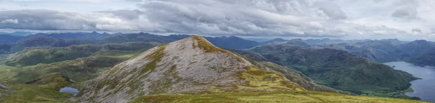
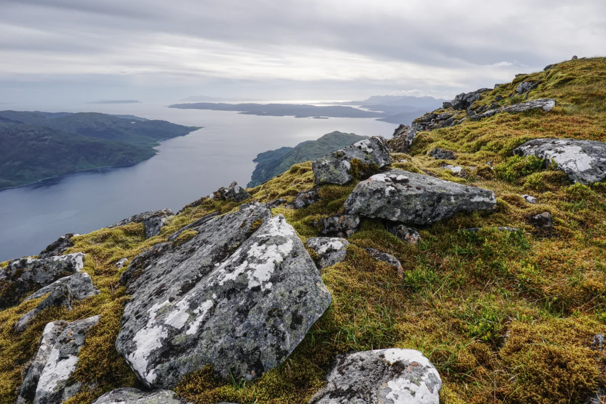
From Bealach Arnasdail it’s a very steep climb to the eastern summit of Bienn Sgritheall, initially on grass and then over scree as the “path” steepens further. Eventually, after a few hairy moments, we reached the top, knowing that the worst was done. All that was left was a rather lovely ridge walk to the actual summit, about a kilometre further on.
Despite the improving conditions, it was very cold on the ridge. I got out my hat and gloves and was very pleased to have brought them, even though this was the end of June.
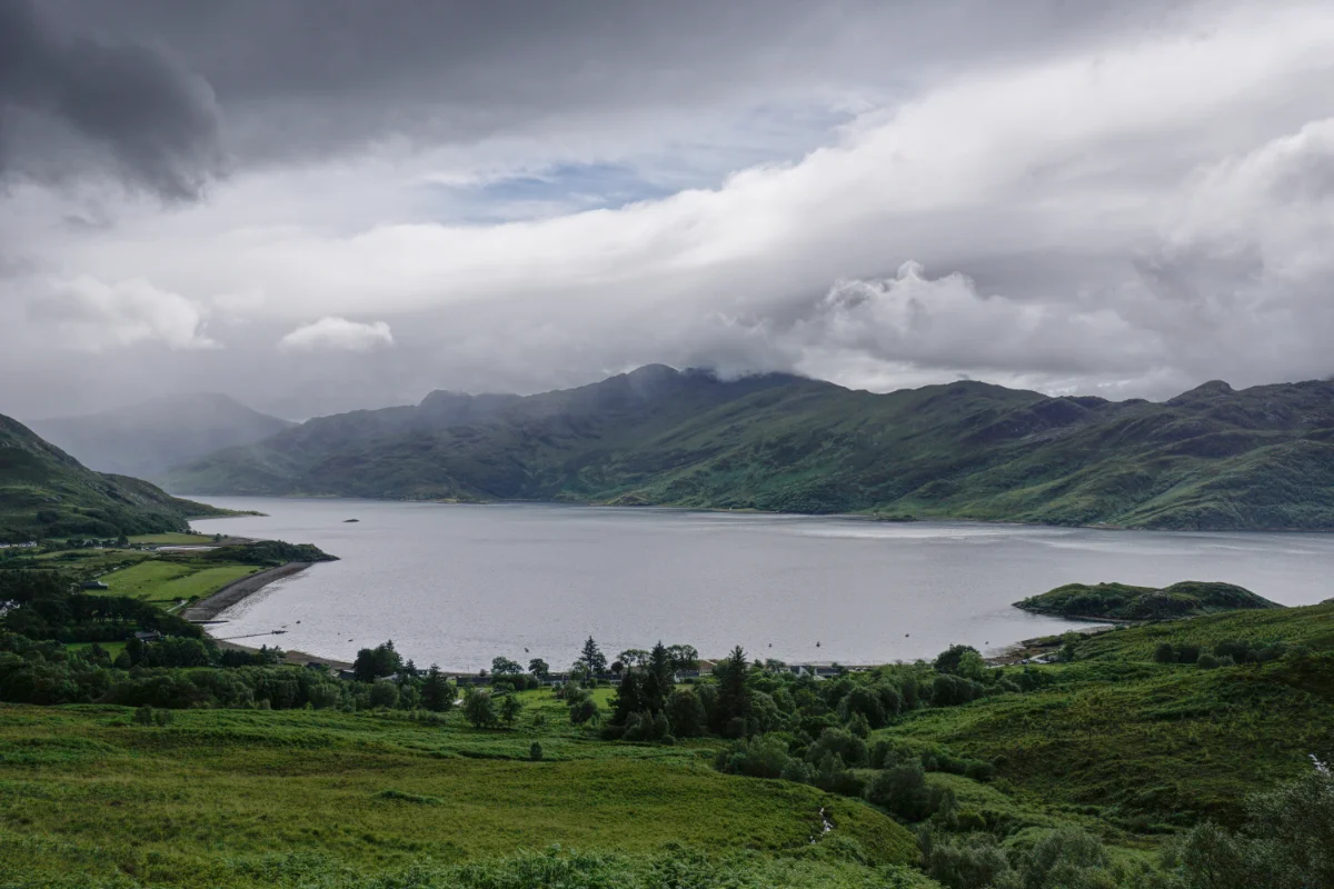
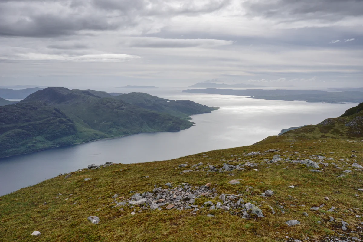
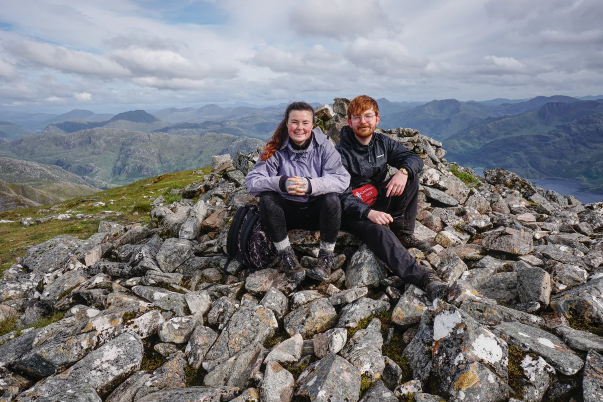
Pretty soon, the three of us were at the summit. As predicted, the cloudbase had risen and we had clear 360 views of the surrounding mountains and lochs. Loch Hourn, far below was silvery in the hazy sunlight.

We’d arrived at the summit at ten to five and we spent 25 minutes exploring the top, taking photographs, snacking and generally enjoying the fruits of our labour. Reluctantly, we had to leave the top to the birds. We were not yet half way round our walk, and although it was now downhill all the way, we didn’t want to be too late getting back.
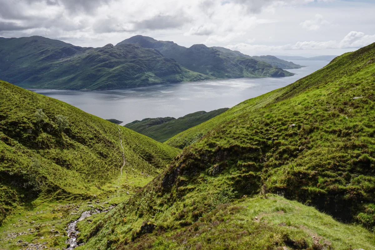
The onward route was a mostly gentle, long descending ridge with easy walking and clear navigation. So clear, in fact, that we missed the left-hand turn that would take us down to the road. Fortunately, I pretty soon realised our error and we didn’t lose too much time in retracing our steps.
Once we’d found our route, a steep track lead down through thin woodland. The recent rain had made it slippery under foot and we all slipped over at some point. Fortunately, I had my walking poles with me and they came in very handy.
On the way down, we passed a couple who we’d seen at the summit. We compared notes on the route and they said they had also missed the turn. They thought the GPS trail from Walk Highlands was wrong.
Eventually, we reached the road. It felt good to have something solid, flat and grippy under foot, but we still had a 3km walk back to the car. However, we managed that in just 45 minutes, arriving at Arnisdale at eight o’clock. It had been an excellent seven hour walk and I’d bagged a second Munro.
We drove slowly back to Glenelg where Hannah was waiting for us.∗