
So, this is the start of another fell-walking season. It’s been a long, snowy, wet and cold winter and despite this being April, we haven’t seen that much of the sun yet. In fact, it’s only a few weeks ago that we had drifting snow blocking our local Hampshire lanes.
The rate of change in the higher education sector continues apace. Notwithstanding the political barrage universities are experiencing; rising student expectations and greater demands from management mean that the life of an academic is becoming more and more pressured. Term two teaching is now over and I’m headed up to the Lakes for some well-earned decompression. I’m beginning to wonder whether fell-walking has become more of a coping mechanism than a hobby.
At the end of last season, I told myself I wouldn’t plan any trips ahead of time because the weather had been so unpredictable but when it came to it, planning a trip immediately after the end of teaching seemed like a luxury I couldn’t do without.
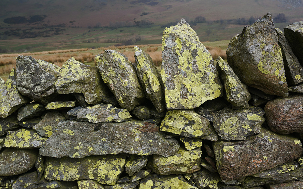
I’d begun the Southern Fells last year but had been frustrated by the weather, so for this trip I decided to shift my focus to the Northern Fells, hoping I’d have better luck. Clive Hutchby’s revision of Wainwright’s walking guide to the Northern Fells (Walkers Edition) has recently been published and, having read it, I wondered whether it might be possible to complete all 24 tops in a single week. So that was the challenge I set myself for this trip. Not impossible but a big ask since the most I’d managed on any previous trip was 20 back in July 2016.
As usual, I took the opportunity to stop over with mum, whose 80th birthday we celebrated back in December. Bright and early on the Monday morning, I set off from Southport, heading north to the Lakes with the promise of a beautiful day ahead. The closer I got to Penrith on the M6, the more obvious it became that the weather was going to be near-perfect, so I decided to take on the biggest walk I’d planned, the Skiddaw group. Ordinarily, I like to begin a new season with something more gentle to ease myself in but good weather is a rarity and I wasn’t going to waste it on a gentle stroll. I wasn’t too worried about my fitness as I’d been maintaining a pretty good step-rate on Fitbit right through the winter. My only reservation was that I would be wearing new boots and although I’d worn them for a few days out and about in Hampshire without any soreness or blisters, this would be a much stiffer test.
Monday
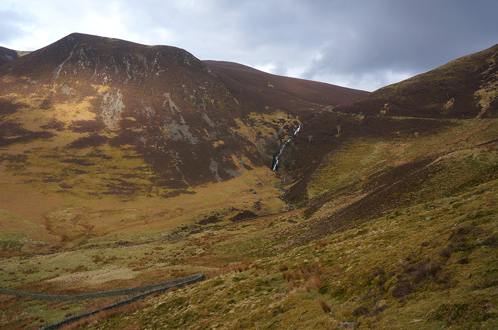
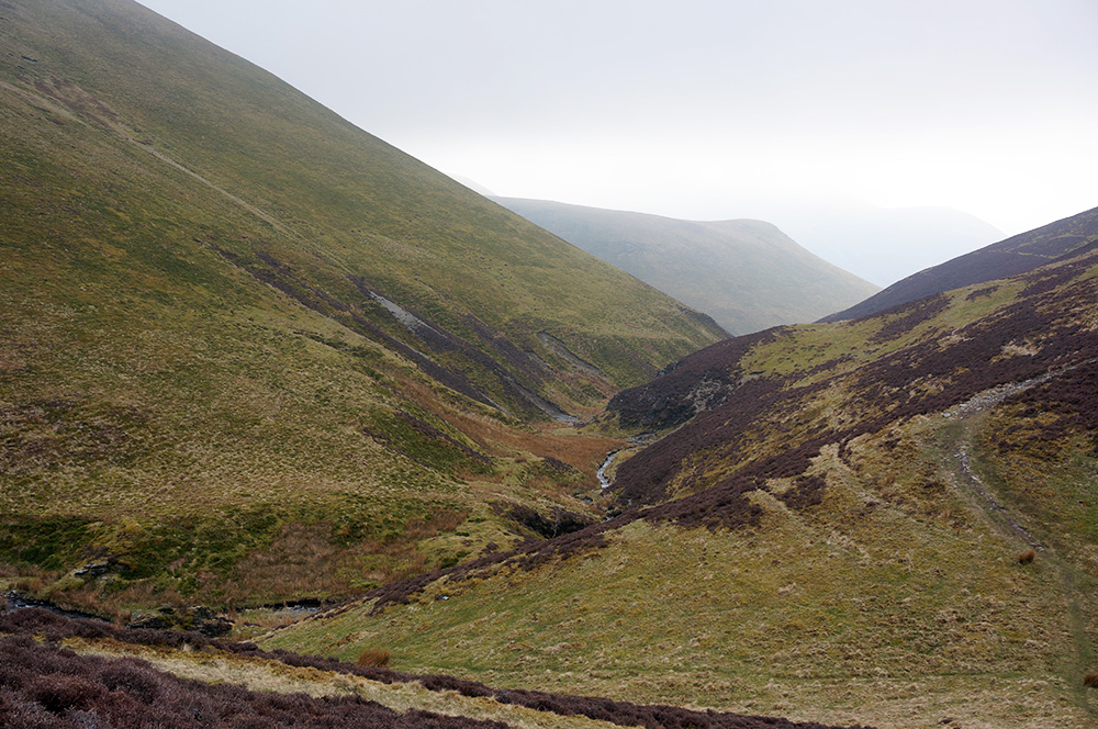
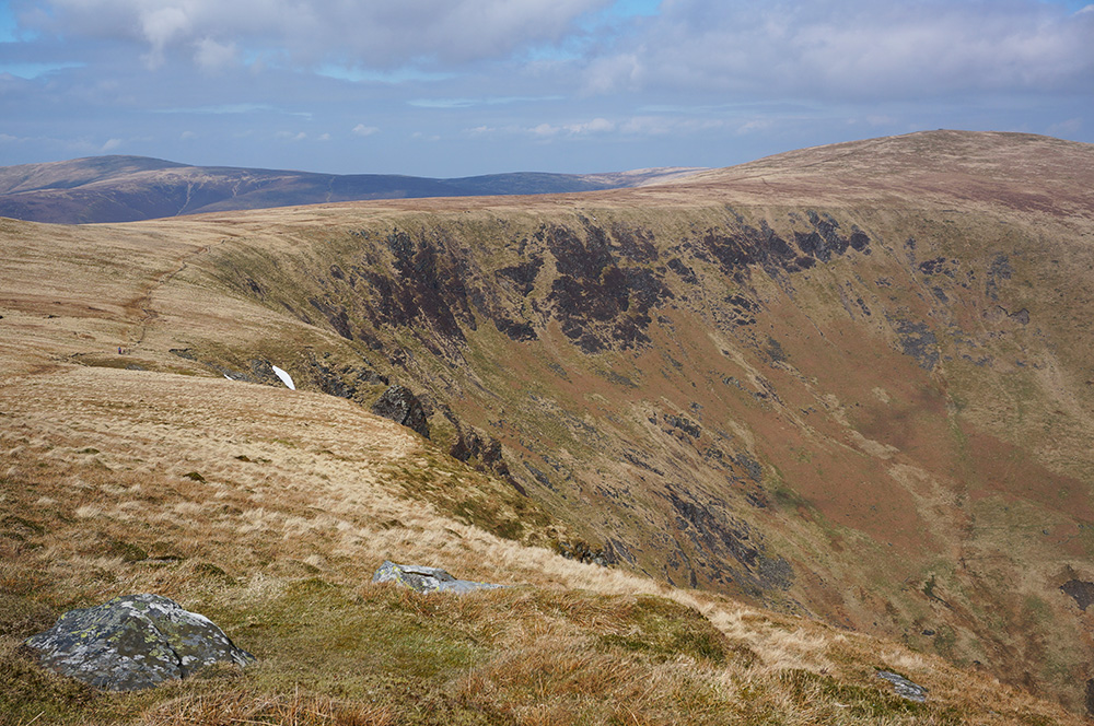
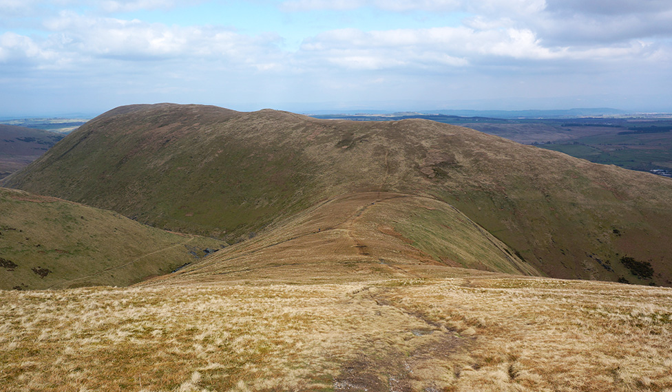
I parked up at Peter House Farm at just after 10am, donned my new walking boots and set off, south-west, along the road. It really was a beautiful day and as I walked, I kept getting glimpses of Skiddaw to my left. The top was still covered in a light, swirling mist but I was pretty sure it would lift by the time I got there. After a couple of kilometres of road-walking, I found the gate onto farmland and a track that led straight up the slope and eventually joined the bridleway. The path narrows as it winds its way to Ling How and onto Skiddaw’s north-west ridge, known as The Edge.
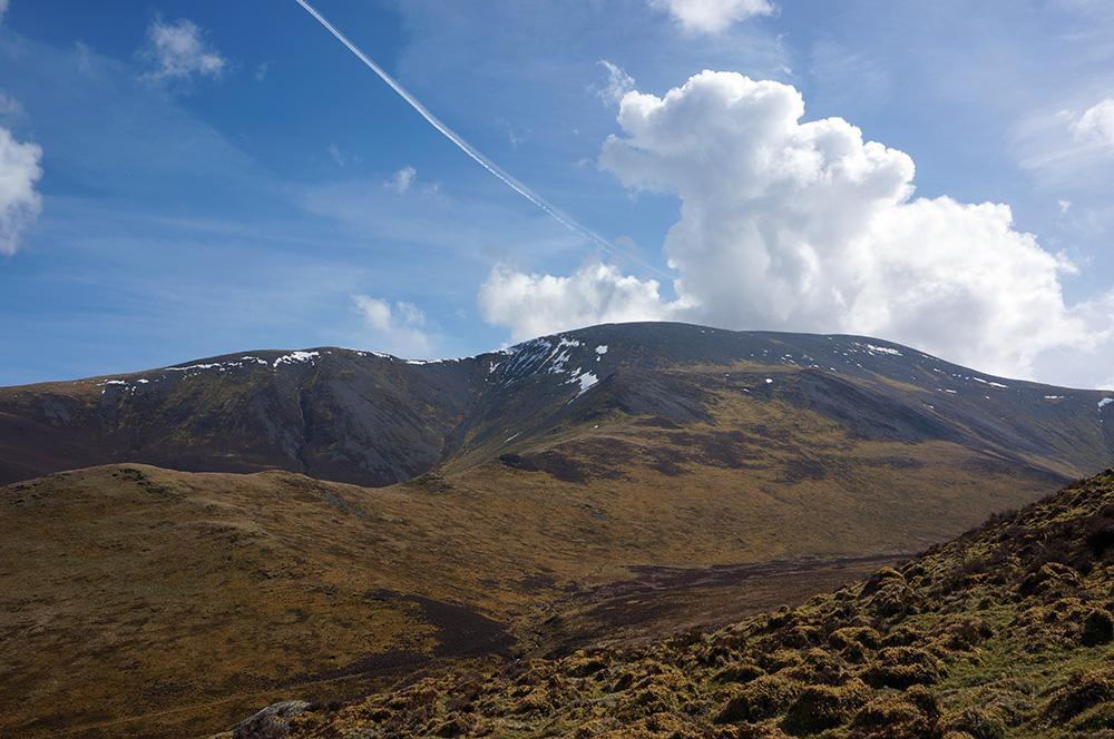
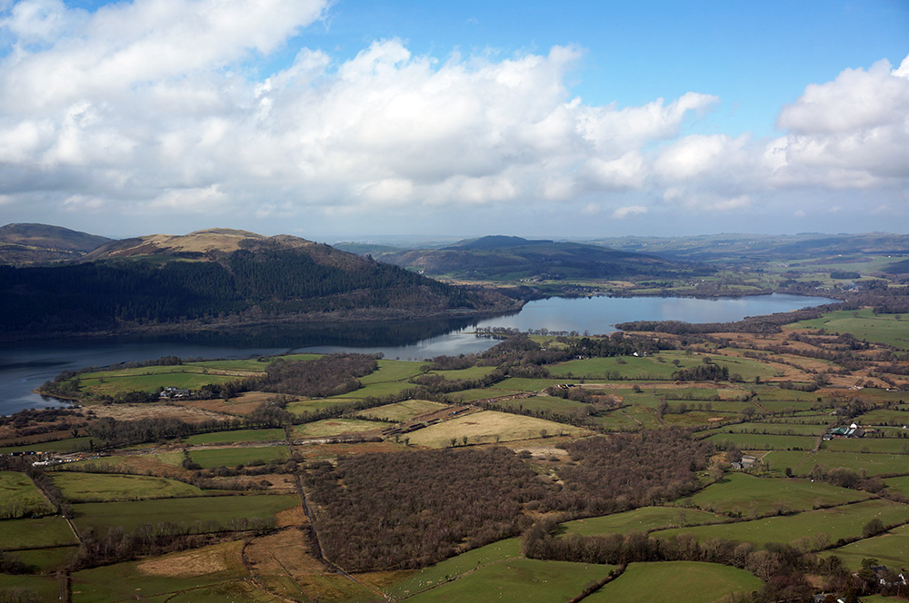
This is a fantastic approach to Skiddaw, the whole mountain is always in view, looming over the walker, and as the ridge path rises, fantastic views into Southerndale open up on the left, creating great drama. At the same time, on the right, beautiful views across Bassenthwaite Lake to the North Western Fells add to the drama, making this one of the best ridge walks I’ve so far encountered.
The weather, the views and the relatively gentle rise of the path made the gaining of my first Wainwright of 2018 seem easy. Although I’d never visited Ullock Pike before, I felt like I was back where I belonged and since it was lunchtime, I settled down to admire the fantastic views and ate my lunch.
From Ullock Pike, it’s a short 600m stroll to the summit of Long Side, the second Wainwright of the day and from there just another 800m to the summit of Carl Side. Before 2pm I’d increased my Wainwright total by 3 and in the most spectacular of surroundings – this walk was turning into a real treat.
However, there was some hard work ahead. From Carl Side I could see the two steep scree paths to the Skiddaw summit ridge and they both looked tricky. I had planned to take the right-hand of the two but it looked impossibly steep from my viewpoint, so I elected to take the seemingly easier left-hand path. It was certainly a steep climb and the scree was loose but with a bit of careful zig-zagging, I got to the top, just about 300m south of the summit.

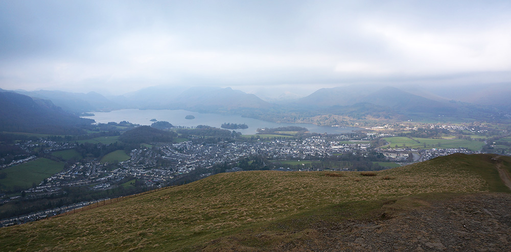
Saving Skiddaw summit for later, I turned south on the ridge path and headed for Skiddaw Little Man. When I reached Skiddaw south top, I was a little discouraged to see that, having struggled to gain the ridge, I was now going to have to lose most of the height on the way to Little Man. On the map, it hadn’t looked too much of a deal but in reality, things looked quite different. I hesitated for a few moments, wondering whether I could include Little Man in another walk but decided to stick with the plan. So I descended from the summit ridge along what is disparagingly known as “the tourist path” before forking left and then a 60m climb to the summit of Little Man. Although there had been plenty of people on the tourist path, I had Little Man to myself. There are great views over Keswick and to Derwentwater to the south and a clear line to Lonscale Fell to the east.
The air was wonderfully clear and Lonscale Fell looked within easy bagging distance. I was tempted but realised it was a 4km round-trip from my current position plus a loss of another 150m in elevation. I decided Lonscale Fell would save for another day, so I retraced my steps, descending from Little Man summit, and climbed back to the Skiddaw summit ridge. I have to admit that for the first time that day, my legs began to feel a little weary on that slog back to the summit but I was encouraged by knowing that once I’d gained the summit ridge, it was down hill all the way back to the car.
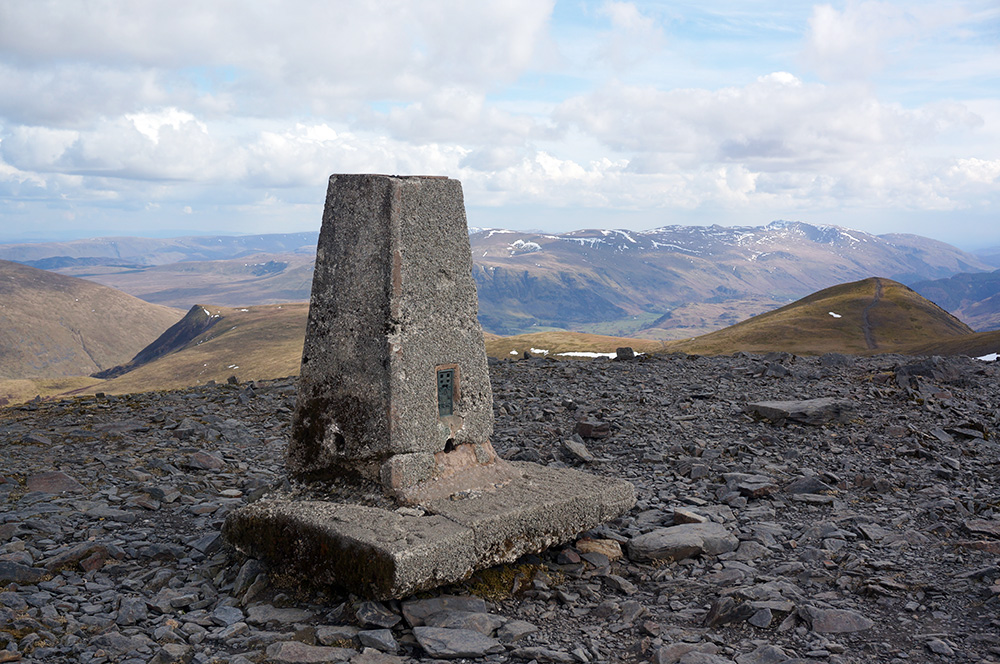
Skiddaw is a popular destination, particularly in good weather and when I arrived, the summit was busy, there was even a woman recording her exploits for the benefit of her YouTube fans. This, she was telling them, was a major achievement for her. I was quite chuffed to have made it too and patted the OS trig column to mark my fifth Wainwright of the day and the top of the fourth highest mountain in England.
After a short pause at the highest point of the day, I set off north along the summit ridge and noticed that low cloud was rolling in from the west. As I began to drop down from the summit ridge, a wall of mist appeared to my left and completely blocked out the sun. It was a weird sensation. To my left was this wall of white, opaque mist and to my right was clear air and panoramic views over to Great Calva and beyond.
For a while, the mist ebbed and flowed across my path but eventually retreated to the west, leaving my way clear and once again my surroundings were flooded with sunlight.

Before I knew it, I was at Bakestall. It was quarter past four and the light had taken on a lovely evening feel. The lengthening shadows threw the surrounding landscape into relief and there were beautiful views south-east to Lonscale Fell and Blencathra.
As always, I was reluctant to give up these views and the height I’d gained by descending further but I had it in the back of my mind that I might have time to add Great Calva to the day’s itinerary, given that I still had around four hours of daylight remaining. So I turned right at the Bakestall cairn and followed the fenceline as it dropped steeply, following Birkett Edge.
The descending path eventually joins the Skiddaw House supply road (the word “road” is a bit of a stretch – this upper section is a rough, rocky track) just above Dash Falls. The waterfall is impressive but it’s difficult to get a sense of how impressive from close by because the entire fall can only be seen from further down the valley.
So now I had a decision to make. Should I turn right and climb Great Calva or should I turn left and head back to the car? To be honest, it wasn’t such a difficult decision. My first walk of the season had been fantastic but I was feeling tired and not up to extending the day unnecessarily. So I headed off down the supply road, passing Dead Crags on my left and with impressive views of Dash Falls opening up on my right.
From Dash Falls, it’s a two and a half kilometre trek back to Peter House Farm and the car. By the time I arrived, in light rain, I was feeling very weary but really pleased to have had such a great day on the fells and that the weather had been so kind.
After changing my footwear, I drove to Ambleside and checked in to the YHA for the first of six nights there.
Tuesday
Tuesday was a very different day but closer to the norm for the Lake District; low cloud, blustery wind and squally rain. It wasn’t going to be much fun on the high fells, so I decided to bag a couple of the lower tops and thought Dodd and Binsey might make a good pairing.
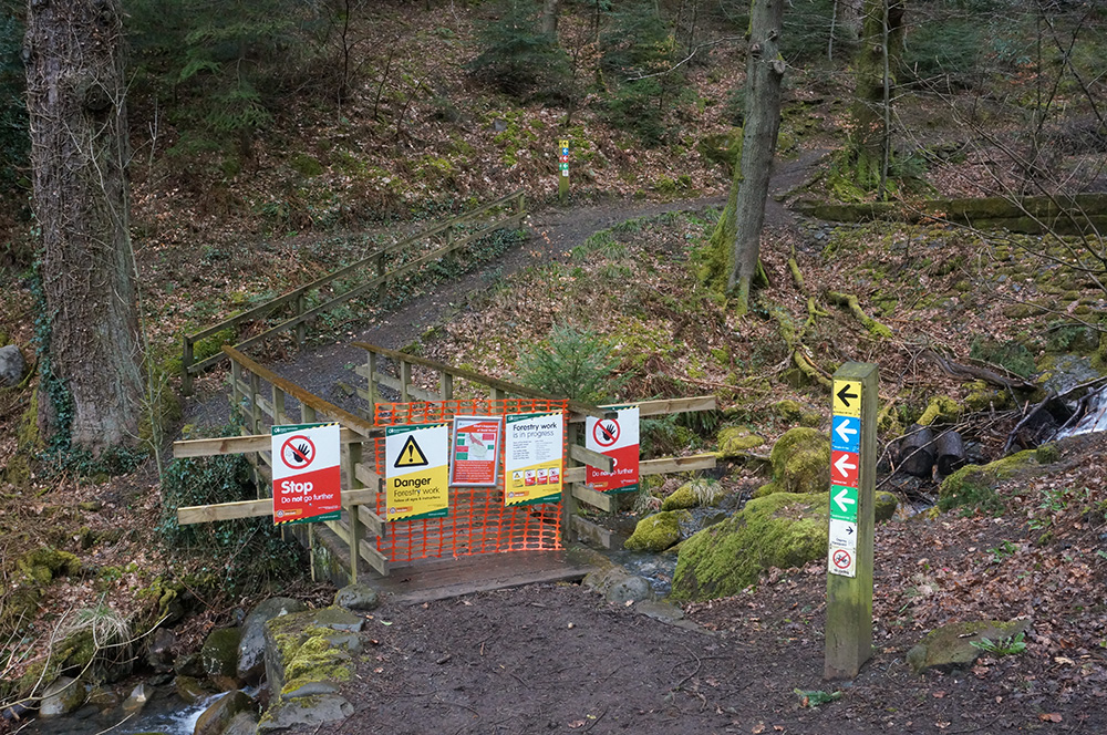
I’d passed the Dodd Forest parking area on the way to Peter House Farm the previous day and it looked like most of the walk to the summit was through woodland, which would give some cover from the wind and rain, so that seemed like a good way to start the day. I parked at the information centre and paid for 2 hours of parking, figuring that would be plenty. What I hadn’t noticed was all the forestry work going on. This meant that the more direct route to the summit was inaccessible. I set off on the diverted route and it became clear that this was going to be quite circuitous. Fortunately, there was plenty of tree cover and although it was wet and windy, the walk wasn’t unpleasant.
The RSPB were out in force that morning. At a couple of locations, Osprey viewing points had been setup where there were clear views over Bassenthwaite Lake. Personally, I don’t have the patience for bird-watching but I do enjoy seeing a different range of bird species when I’m in the Lakes than I would normally see at home.
Eventually, after a bit of a slog, the trees cleared and I started the final climb to Dodd summit. It was still raining lightly but the wind had become quite strong and at the small summit plateau, I could barely stand up straight. There is a slate memorial stone at the summit so I took off my rucksack to take my usual summit photo but once I’d done that, I couldn’t get my bag on again, the wind was so strong. I quickly retreated from the top, holding my bag and camera until I found some shelter further down.
It had taken close to an hour and a half to reach the summit and it seemed likely that I’d overstay my welcome at the car park. However, an alternate route back was indicated by the temporary signage, so I took this and arrived back at the car just in time. In good weather, a trip to Dodd summit would be very pleasant but that morning, it seemed like it took much more effort than was strictly necessary. But that’s the odd thing about the fells, sometimes the small ones are surprisingly difficult and the larger ones surprisingly easy; it’s not always possible to tell from the map.
After such a wet and blustery morning, I thought I deserved a warming lunch, so I drove to Keswick and had a lovely lentil and bacon soup and a caesar salad sandwich at the Treeby & Bolton Cafe.
The cafe was warm and dry and I was tempted not to return to the hills but after a desultory stroll around the town, I knew I should crack on. So I drove out to Bewaldeth and took the winding road, through Fell End Farm to the start point of the Binsey walk.
By now, the cloud base had lowered and even the lower fell tops were swathed in mist, Binsey no exception. I laced up my boots for the second time that day and entered the fell via a hand-gate (not a wall stile as the Wainwright guide suggests). Good turf and an easy gradient made this walk much easier than the morning’s outing and before I knew it, not much more than twenty minutes later, I was at the summit and surrounded by mist.
It’s an interesting summit with all the artefacts you might wish for on a mightier fell. There’s the obligatory cairn, a stone-built triangulation column and a Bronze Age tumulus, now in the form of a wind shelter. Sadly, the most obvious missing element was a view. Even at 447m above sea-level, the mist was too thick to see any distance.
There was nothing more to do, so I retraced my steps, wondering whether that was the easiest of all the Wainwrights.
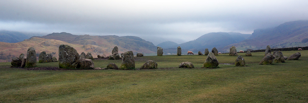
On the journey back to Ambleside, I stopped off at Castlerigg Stone Circle. I’d been meaning to visit the site for a while and although the weather wasn’t ideal, this seemed like a good opportunity. It’s a lovely setting and so I decided this visit would just be a recce and that I’d return when the light was better to take some descent photos.
Wednesday
Wednesday promised to be a dry day but mist had settled over the fell tops and didn’t look likely to shift. I decided it might be a good idea to take on the Uldale fells since they were relatively low; only Knott exceeds 700m. If the cloud base did lift, I might get some views later in the day.
I drove out to the start point at Longlands, passing Peter House Farm on the way and parked up. When I arrived, even Longlands Fell at just 483m was shrouded in mist. I waited a while in the car to see if the cloud base were rising but once I’d established that it wasn’t, I thought I’d better just get on with it.
Not wanting to waste any more time, I took the direct route to the top of Longlands Fell but when I arrived, conditions were discouraging. There was thick mist above 350m and an unpleasantly strong wind. The small cairn looked forlorn and I decided that this was probably not a day to be out on the fells.
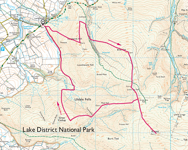
I took the clear ridge path down from the summit, intending to return to the car but as I dropped below the mist, my location became clear and I noticed a group of walkers, most of them elderly, advancing up the Charleton Gill bridleway. I decided that if they could do it, then I certainly could. So a little further down, I crossed from the ridge path to the bridleway and proceeded to the point where the gill was to be crossed.
The crossing point is in a deep ravine and the way down to the gill and up the other side were both very steep and there was plenty of erosion, making it a tricky undertaking. I hesitated for a while, thinking that I could take a longer but safer route by staying on the bridleway but eventually decided to give it a go. I’ve begun to realise that, in most cases, things are rarely as difficult as they initially appear and that was the case here. I crossed the gill and huffed and puffed up the steep, grassy slope, once again moving into mist.
No one enjoys walking in mist and I’d promised myself that I’d avoid it when I can but the whole process of navigation in low visibility has become so much easier with the advent of GPS and the OS Maps phone app. Using this in combination with a compass, it’s relatively easy to find your current position and your direction of travel and that’s how I got to the summit of Brae Fell without the aid of an obvious path.
When I arrived, an elderly couple were sitting at the generous cairn. They were from Buckinghamshire and he was aiming to complete his second round of the Wainwrights before his seventieth birthday, which was fast approaching. We discussed our plans for the day and it turned out we would be following similar routes. Shortly after, they departed with a “see you later”.
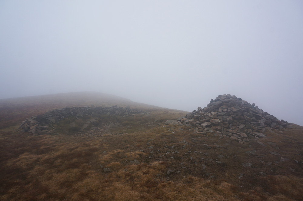
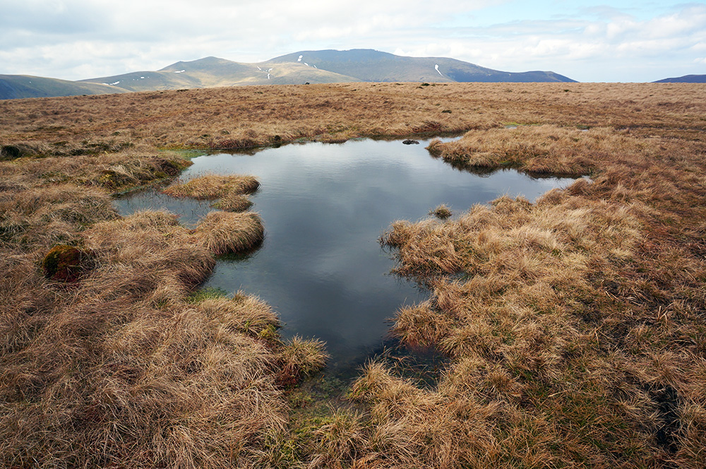
The next stop on my list was Great Sca Fell, so I checked my compass and headed south. This section of the route was pretty confusing. There were a number of almost parallel paths that slowly diverged from the one I was on and it was difficult, even with GPS to know I was following the correct route. I had aimed to by-pass Little Sca Fell but pretty soon, a small plateau with a cairn emerged from the mist and I realised I was slightly further west than I had intended. No matter, this was an interesting place (or as interesting as a place can be in the middle of a misty moorland) and there was a clear path going forward towards Great Sca Fell. This I took and in only another 400m, I arrived at a rather disappointing cairn at what appeared to be a footpath crossroads.

There was no place to sit at this summit so I took my summit photo (small cairn in mist) and moved on, continuing in the same direction, towards Knott and thinking of lunch and, to be honest, feeling a little more confident about navigating in mist.
Knott is about one kilometre from Great Sca Fell on a gentle rise across rough moorland. I checked my phone app regularly but here the route was fairly obvious and there was little chance of becoming lost. When I arrived at Knott summit, I was greeted by the couple I’d met earlier at Brae Fell. They were tucking into lunch in the company of two other walkers doing the same. The cairn was just about generous enough to accommodate all five of us so we sat, ate and chatted. While we were doing so, two other characters appeared out of the mist and after exchanging a few words, went on their way. It’s odd that in the middle of nowhere (for Knott really is in the middle of nowhere), seven people came together to share a short break and then all went their separate ways, unlikely ever to meet again. On a clear day, it might have seemed more normal but the mist made it seem rather unlikely.
From Knott I walked back to Great Sca Fell and turned left at the crossroads heading towards Meal Fell. Losing 100m of height on the way, I was hoping the mist might, by now, be clearing from the lower tops. When I arrived, it hadn’t cleared but it had thinned a little. Meal Fell summit is dominated by a large and well-built wind shelter and although it’s the obvious focus of the place, it’s not the highest point, this is marked by a small cairn. Again, this would be an interesting place to explore in good weather but not in mist.
Checking my compass, I set off south-west to Trusmadoor, a pass created thousands of years ago by glacial melt-water and the only way to my final Wainwright of the day, the curiously named Great Cockup.
As the path descended from Meal Fell, the mist cleared for the first time that day and I emerged into a world where I could see further than 20m around me. Just before I got to the bottom of the pass, I stopped and sat to take it all in. There is a lovely, view along Burntod Gill to White Hause and Broad End, framed by the slopes of Burn Tod and Great Cockup. Perhaps it was a result of being deprived of good views all day but I thought how easy it must be for some people to underestimate the beauty of this landscape.
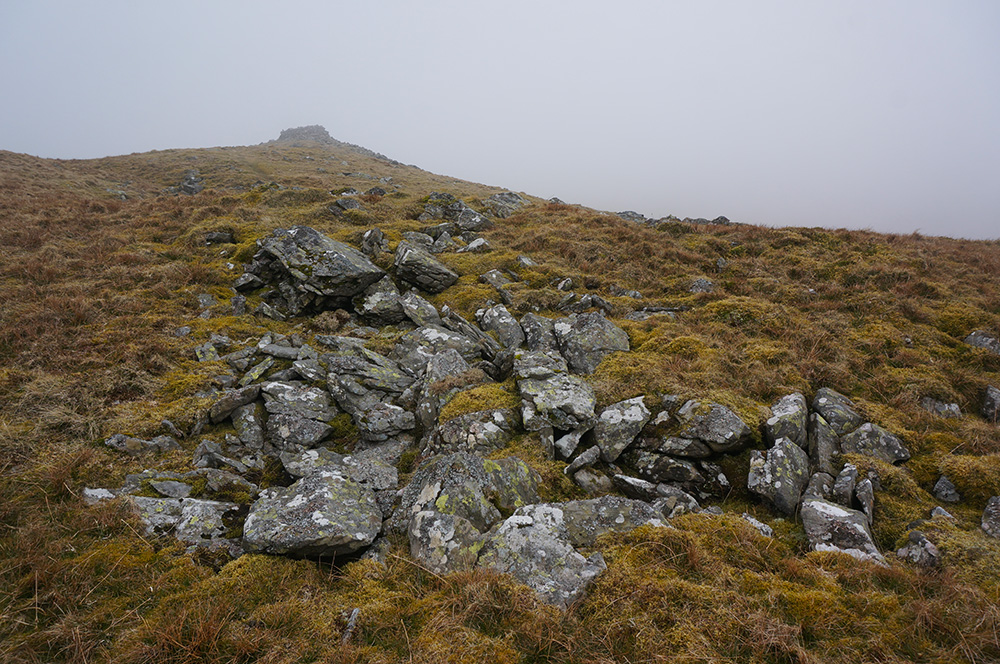
After my contemplation, I dropped into Trusmadoor and started the steep climb to the summit of Great Cockup, arriving there half an hour later. I was greeted by a small collection of stones, not substantial enough to warrant the term “cairn” but an obvious indicator of the highest point in a field of grass.
The next section of my walk was pathless, across rough fell and although the air was still hazy, I had a clear view of my destination about a kilometre away. So I set off, following my GPS route and with an eye on my destination. Eventually, I reached the path that crossed my own route at a rather boggy junction and took it, following it for a very pleasant three kilometres back to the car.
A pleasant walk is always a reward but I felt I’d earned this final leg of the day. I was happy to have persevered through the mist and my confidence in such conditions had definitely improved as a result.
Thursday
Thursday seemed like a slightly better day than Wednesday. It was certainly brighter but mist still clung to the fell tops and I resigned myself to another day of walking in mist.
I had some mopping up to do. There were a few outliers that hadn’t easily fitted into my other planned walks and I thought this might be a good day to tidy things up, leaving just two additional walks to complete the Northern Fells.
My first call was the Gale Road car park to take in the diminutive Latrigg and the not so diminutive Lonscale Fell. I parked up and, in the company of a few others, made my way to the popular top of Latrigg. This is no more than a gentle stroll over good footpaths and it had more the feeling of a saunter in municipal gardens than the usual fell-top experience. I bagged my fell and returned to the car park in the company of dog-walkers, children and old ladies. This certainly trumped Binsey for the easiest Wainwright!
Lonscale fell was an entirely different matter. I followed the Cumbria Way up to Whit Beck and then around the lower slopes of the fell until it met the fence that leads straight up. I followed an intermittent but obvious path along the fence-line for a one and a half kilometre slog up the very steep slope, eventually climbing into mist.
The line of approach naturally leads first to the east top of the fell. Although not the highest point it is the most prominent in all views from the north. As I made my way to the east top, the mist thickened and I was careful to stay away from the edge of Lonscale Crags. On a clear day there would be fantastic views down into Glenderatera Beck and across to the Blencathra massif. But at this moment, there was just mist.
I found the tiny cairn at the east top and the strangest thing happened. The wind became a dead calm, everywhere was silent and the air around the cairn became crystal clear for a radius of about fifteen metres. It was a very odd sensation, like nothing I’d experienced before. I sat on the springy, brown turf and tried to make sense of what was (or wasn’t) going on around me. I had the sensation that I was in a cylindrical room made with translucent walls and filled with natural light. This transcendental state lasted for maybe five minutes and ended when a light breeze blew up and the mist, which had previously been held back by the walls of my room, blew into my space.
Shortly after this experience, I thought I might have imagined it but looking at the photographs later, I can see that it really did happen. Of course a photograph cannot possibly capture the essence of such an experience but it clearly shows a curved boundary between clear air and mist.
I am not a spiritual person and I know that what I experienced was simply the result of natural processes but I feel privileged to have been there at exactly the time it happened.
The tramp to the fell summit was a bit of an anti-climax after that. I was glad to have bagged my fifteenth Wainwright of the week but as the mist thickened and the wind rose, all I could think of was getting back to the car.
After finding the correct path off the summit ridge, I quickly dropped down the steep slope alongside Whit Beck, meeting up with the Skiddaw tourist path and following it back to the car park where I ate some lunch, still wondering what had happened at the east top.
After lunch, I knew I had to return to Peter House Farm and face the walk to Great Calva. It was not an encouraging prospect as the mist showed no sign of lifting but by this time I really had my teeth stuck into the week and was determined to hit my goal of completing all of the Northern Fells.
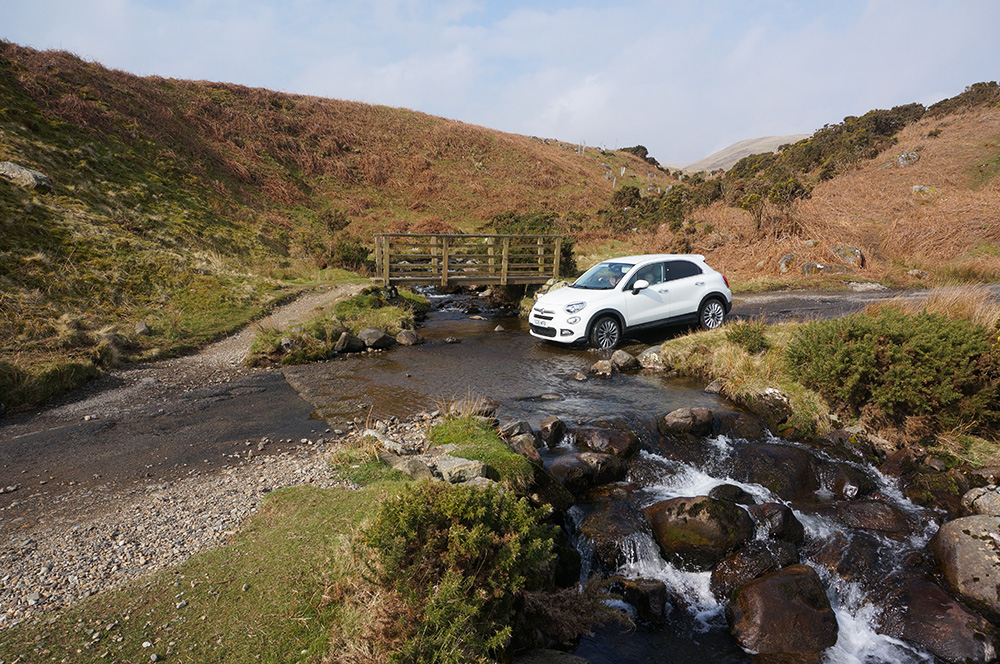
So for the second time in a week, I parked up at the access point of the Skiddaw House supply road and set off back towards Dead Crags and Dash Falls.
It’s a four kilometre walk to Dead Beck, the point where I was to leave the supply road and start climbing open fell. The point is marked by a single, stunted Hawthorn, the only tree anywhere in sight.
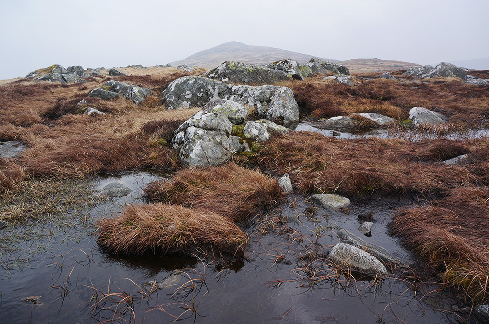
The ground was very wet as I tramped through sodden peat and it occurred to me that today, for the first time this week, I’d not been conscious of the fact that I was wearing new boots, they were feeling like a part of me.
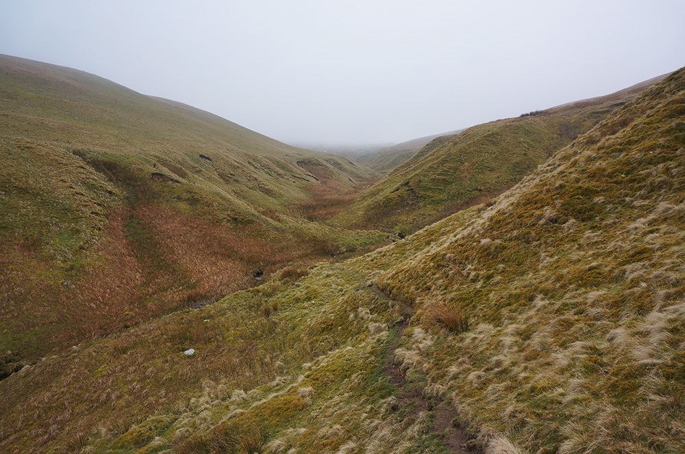
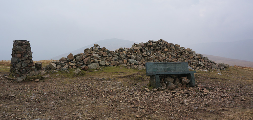
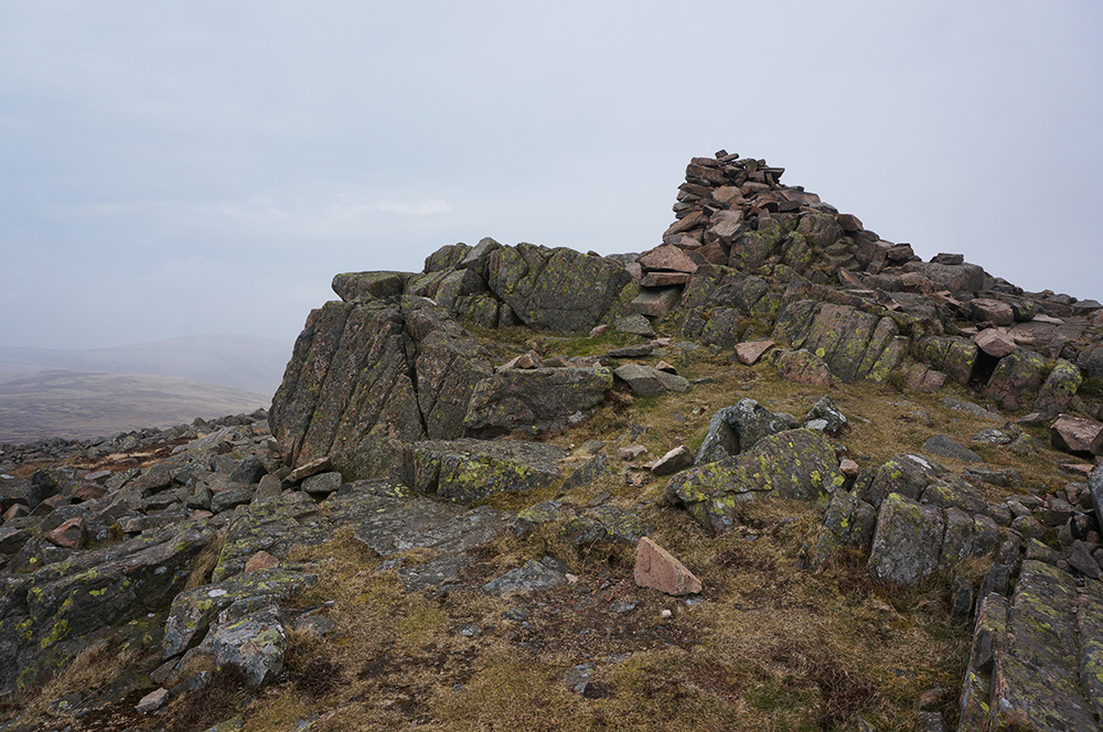
Pretty soon, I was once again in mist but fortunately, previous boots had worn a clear path in the black peat. It was a very damp but uneventful climb and I reached the cairn and shelter at the (lower) south top first. This was certainly the spookiest place I’d visited this week. Tangled metal fence posts have been incorporated into the cairn and, in the mist, it had the appearance of some primitive, scared place.
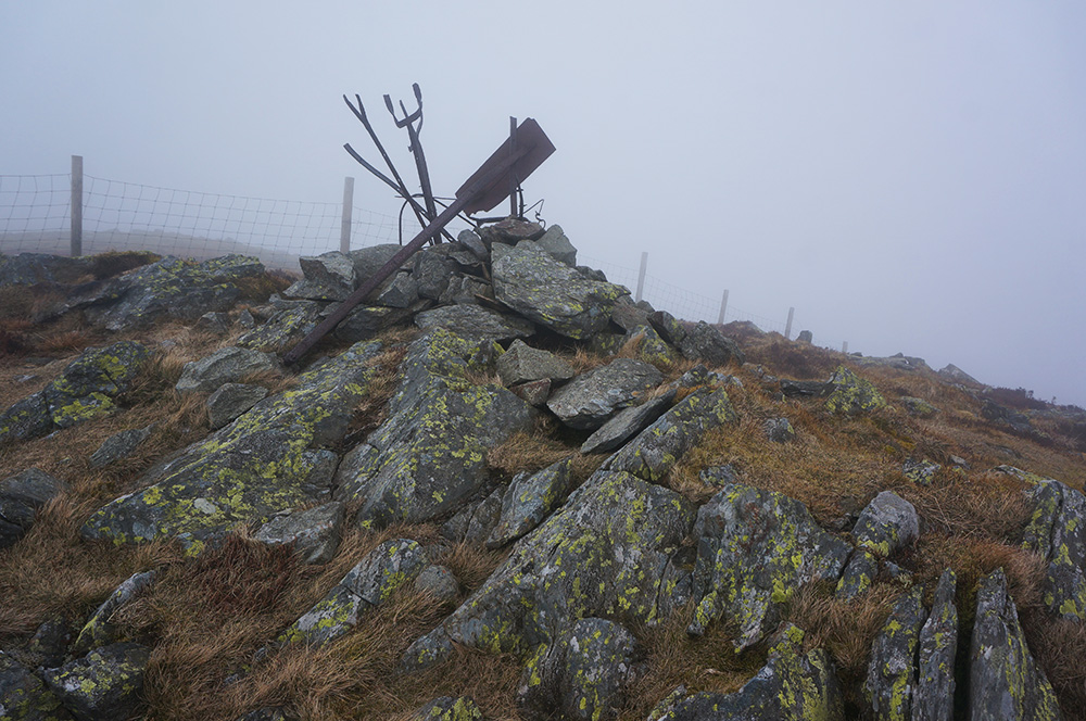
After a pause to take in my surroundings, I made the short walk north to the summit cairn, a similarly spooky place whose cairn also incorporates twisted and angled metal posts.
Although I’d achieved my targets for the day, I didn’t feel like hanging around for too long. I retreated to the south top wind shelter for a quick snack and then followed the ridge path down, hoping it might be a bit drier than the path I had come up on. Fortunately it was and I was soon back on the supply road and heading back to Dash Falls. After Dash Falls, the road becomes rocky and falls quite steeply. Along this section I started to feel rather weary and the final two and a half kilometres of the return journey were quite slow.
I got back to the car after the most strenuous day of the trip so far, realising that I was probably in need of a rest day.
Friday
I’d chosen a good day for a rest. The morning was very wet so I hung out at the hostel and prepared all the summit photos from this trip and updated the progress tables. For lunch I went into Ambleside and had soup and a sandwich at Daisy’s Cafe. After a mooch around Ambleside, I returned to the hostel later that afternoon and went for a walk along the back road to Rydal. By the end of the day I was feeling positively rested and ready for another day of walking.
Saturday
The weather forecast for Saturday was more encouraging. After some early fog and mist, it looked as though it might turn out to be a great walking day. That could only mean one thing – the Blencathra Group walk.
I set off for Mungrisdale and parked in front of the newly refurbished village hall, dropping my two pound parking fee into the honesty box.
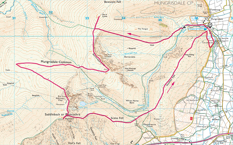
I crossed the Glenderamackin River at the footbridge, turning right behind the pub and then left at the red telephone box, I was soon on open fell and facing a rather intimidating sight – The Tongue. Fortunately, my route skirted to the left of this mini-mountain but my first task was to negotiate the swamp leading onto my path.
During the December 2015 floods, the original path was swept away and has not yet been reinstated. The only alternative is a boggy wade, and that’s what I did, trusting the waterproofness of my new boots.
The gently rising miner’s track up to Bowscale Fell is a dream to walk. A very even incline all the way and not too steep. Those miners knew a thing or two about walking the fells! When I arrived at Bowscale Fell summit, it was breezy but reasonably clear. Only Blencathra was still topped by mist and I was pretty sure it was lifting.
From Bowscale Fell I followed the path around to Bannerdale Crags and by the time I arrived there, the clouds were parting and there were even some patches of blue sky.
The fells are always busier on a weekend and there seemed to be plenty of small groups out for a walk today, many of them on their way to Blencathra summit.
My next destination was Wainwright’s least celebrated fell, Mungrisdale Common. Mark Richards didn’t even bother to include it in his guide to the Northern Fells and one of my lunching party at the Knott had been complaining about how dreary it was. Frankly, I was intrigued.
I set off on the path down from Bannerdale Crags and around the shoulder of Atkinson Pike, soon making good progress over rough, open fell and since the path followed the contour line, this was no more than a pleasant stroll. However, it was wet under foot and it was necessary to step carefully. I met one chap walking in the opposite direction who told me he’d sunk knee deep.
Eventually I arrived at the cairn, located in a small pool of water. It’s probably not correct to call it a summit because the cairn is not located at the highest point as indicated on the OS map neither is it obviously the highest point in the vicinity. No matter, a point in this flat-ish landscape has been chosen and I’d arrived. Taking into account all I’d read and heard, I was pleasantly surprised. For three hundred and sixty degrees all around, there are higher peaks and it certainly feels like the centre of something. Wainwright says, “Mungrisdale Common’s natural attractions are of a type that appeals only to sheep: it is more an upland prairie than a hill”. All of that is true and in poor weather, it would not be worth a visit but today it had something worth being there for.
I left the cairn and headed south-east for the climb towards Atkinson Pike. The going was still wet but as the path steepened, the ground became drier. Eventually I arrived at Atkinson Pike and settled down by a cairn to have lunch.
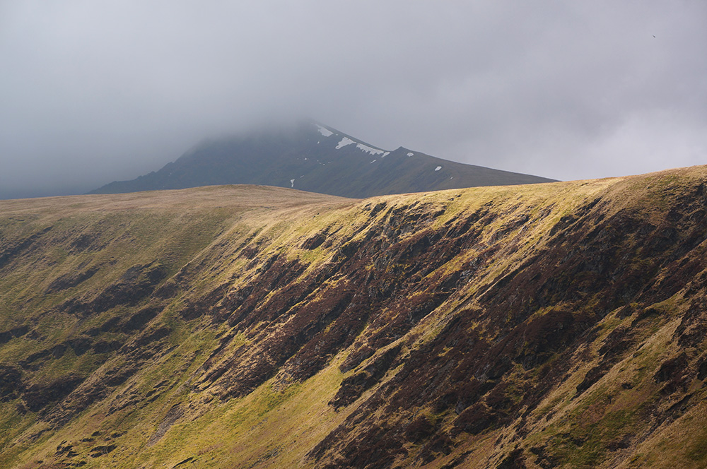
The final pull up onto the summit ridge is steep and over loose scree but with some care and a number of pauses for breath, the ridge is gained and from there it’s a relatively short jaunt to Hallsfell Top, Blencathra’s summit. There is no great cairn or even an OS trig column at this summit. It is marked by a small concrete ring, placed there by Ordnance Survey. Still, the surroundings are impressive and the views extensive, despite the hazy atmosphere. The few patches of remaining snow certainly gave it a sense of elevation.
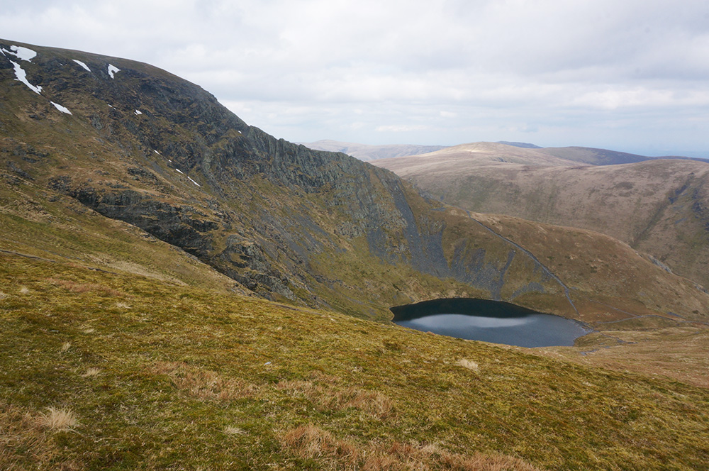
After a short pause, I headed for the zig-zag path leading down to Scales Fell. As the path descends there are good views across Scales Tarn to Sharp Edge and I could see one or two brave souls negotiating the arête on their way to the summit ridge.
Further down the descending path there is a wonderful view of the causeway between Scales Fell and Souther Fell, which forms the most perfect topographical saddle I think I have ever seen. On the left, the saddle falls to the Glenderamackin River and to the right it falls to Mousthwaite Comb. If I were writing a geography text book, I’d want a photo of this to illustrate a “saddle”.
Souther Fell itself is rather dull, being no more than an elongated ridge. The summit, when reached does not appear significantly higher than its surroundings and the view no better than anywhere else along the ridge. Still, it was my fifth Wainwright of the day and the last one on this walk.
I followed the ridge path as far as I could, and then turned onto the footpath taking a rather circuitous route back to the car.

So far, the week had been extremely successful. I’d completed twenty-two of the twenty-four Northern Fells. Only High Pike and Carrock Fell remained and with one day left, that seemed possible. The only problem was that the weather forecast for the next day was poor. I contemplated trying to squeeze these two tops in before dark but decided against it. The day had been good, I didn’t want to spoil it with an abortive end.
Sunday
This was my last day in the Lakes and since the predicted weather was poor, I didn’t spring out of bed too early. However, when I did pull back the curtains, it didn’t look anywhere near as bad as forecast. I quickly showered, packed up and had breakfast. It looked like the morning might be OK.
I checked out of YHA Ambleside and drove to the curiously named Apronful of Stones, just north of Mosedale, and parked up at the informal lay-by.

The High Pike and Carrock Fell walk is well-known and appears in both Mark Richard’s Great Mountain Days in the Lake District and in Terry Marsh’s The High Fells of Lakeland. In both cases, the author suggests that this is a walk for clear weather. Sadly, I didn’t have that exactly but I could just about see the tops in the hazy distance.
I set off in good, bright weather heading north along the road. Crossing the Carrock Beck ford via a footbridge, I soon turned off onto the miner’s track and made for the disused mines. The going was good and the gradient pretty easy most of the way. A steeper section immediately above the mines was a little more testing but pretty soon I was closing in on High Pike summit.
I has set myself a good pace because I knew I only had a few hours before the weather turned for the worst. The guide book suggests this is a four and a half hour walk. I was aiming to do it in three and a half!
I arrived at High Pike summit an hour and a quarter after leaving the car. The assortment of artefacts at this summit is quite curious. It’s the only Lakeland summit with a seat. It’s made of green slate and bears a finely carved mis-quote from a poem by Percy Bysshe Shelley; “He is a portion of that loveliness which once he made more lovely”. The original quote is “of the loveliness”. According to Wainwright, the seat replaced an earlier, wrought-iron affair in late 1960. I guess we may never know whether the mis-quote was intentional.
From High Pike, I set off around Drygill heading towards Miton Hill, where the track gave way to rough, open fell. The outward journey, on a good surface, had been quick but the rough and boggy nature of the return leg to Carrock Fell was much slower. There is no obvious path and numerous detours were required to avoid very wet ground. However, by the time I reached Round Knott, the line of approach to Carrock Fell summit was clear and becoming drier.
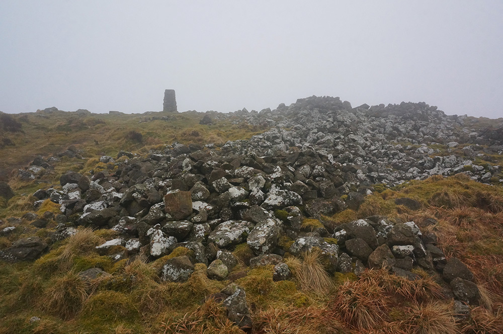
Despite the difficulty under foot, I arrived at the summit just over two hours after leaving the car so I reckoned I could afford a break for a snack. The top of this fell is an ancient hill fort and although the construction is now mainly in disrepair, the remains of a circular stone enclosure still give a good impression of the original layout.
The wind was getting up and clouds were rolling in so I didn’t linger longer than I needed and soon began the steep descent back to Apronful of Stones.
The first part of the descent, although steep, is pretty straightforward but about halfway down you enter a very steep gully where there has been some serious erosion. I thought twice before proceeding but found that, with care, it wasn’t too bad.
Passing under the crags, I could now see the car below. I met a couple on the way up who said they thought I’d probably had the best of the day and I agreed.
I arrived back at the car just under three hours after leaving, really pleased with my pace. It started raining. I jumped into the car, removed my excellent boots and reclined on the back seat while the rain hammered down on the roof. I was warm and dry and I’d completed all of the Northern Fells in just a week.
Images and memories
A number of times this week, I mused on the effectiveness of the photographic image in cementing memories. I’ve come to the conclusion that the JPEG file format is not able to encode any form of emotion and for that reason, it’s often wholly inadequate at recording memories. There were occasions this week where I found myself looking at (and feeling) a scene and deciding not to reach for my camera, preferring simply to take in the experience but not to record it. Just because I find something to be beautiful, doesn’t mean I need to capture the image – that is only a part of the experience and it so often falls well-short of memory.
Daffodils
Each time I visit the Lakes there is usually one plant species that dominates the landscape and on this occasion it was the daffodil that caught my attention. Many road verges now have naturalised daffodils and this week, in particular, they were looking spectacular. I don’t know whether it was Wordsworth’s poem that encouraged more daffodil planting or whether he was moved by what was already here but either way, the effect is often dramatic.∗
9th April 2018
Skiddaw Group
Ullock Pike (690m)
Long Side (734m)
Carl Side (746m)
Skiddaw Little Man (865m)
Skiddaw (931m)
Bakestall (673m)
10th April 2018
Dodd (502m)
Binsey (447m)
11th April 2018
The Uldale Fells
Longlands Fell (483m)
Brae Fell (586m)
Great Sca Fell (651m)
Knott (710m)
Meal Fell (550m)
Great Cockup (526m)
12th April 2018
Latrigg (368m)
Lonscale Fell (715m)
Great Calver (690m)
14th April 2018
Blencathra Group
Bowscale Fell (702m)
Bannerdale Crags (683m)
Mungrisdale Common (633m)
Blencathra (868m)
Souther Fell (522m)
15th April 2018
High Pike (658m)
Carrock Fell (662m)
So that’s the Northern Fells complete and 24 to add to my total, bringing the new total to 158 with just 56 Wainwrights still to do.
Kit notes
At the end of last season, my boots started to let in water. Not much but enough to make walking on damp ground uncomfortable. In addition, I’d found that they were exacerbating a problem I’d developed with my big toe joint, making them very sore at the end of and often during long day walks.
They’d been a great partner for seven years and had seen me up 134 Wainwrights but it was clearly time for a new pair.
I did plenty of online research and thought the shape and lacing configuration of Meindl boots might be a good fit for my feet. I narrowed down my choice to the Bhutan and the Vakuum, they both had a long toebox and good lacing systems.
Early one morning I went to Go Outdoors in Basingstoke where both were in stock. I tried on both but the Vakuums were much the better boot, giving more protection to the toe and ankle and feeling generally more comfortable.
I took them home and wore them round the house for a few days before realising that I’d made the rookie error of trying on new boots in the morning. Feet swell slightly during the day and what had felt firm and supportive in the morning were feeling over-tight by the evening.
Fortunately, Go Outdoors have a good returns policy and as I’d only worn them indoors, there was no quibble about exchanging them for a pair a half size larger.
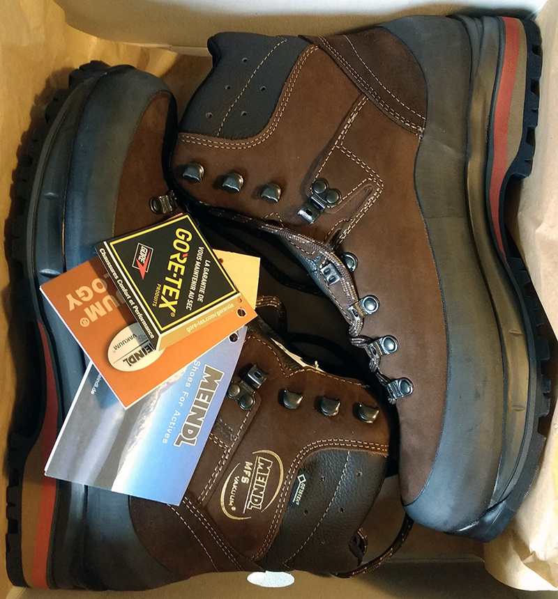 So I’m now the proud owner of a lovely new pair of Meindl Vakuum GTX in a size 10.5 and they feel great on, combined with my favourite Darn Tough boot socks.
Modern boots don’t need much breaking-in but I wore them out and about as much as I could before this trip to the Lakes. On the first two day walks, I developed a couple of hot spots but they didn’t blister. By the third day, they were starting to feel like a part of me and by the end of the week I was really impressed with how they performed.
My new boots are better in all but one respect compared to my previous pair. They are noticeably less breathable. I’m guessing this is because of the generous rubber rand and if that’s the case, I’m happy to sacrifice some breathability in exchange for greater protection.