The government “Roadmap out of Lockdown” hit the next step as planned on 17th May, and my stay at YHA Ambleside was confirmed. I was going back to the Lakes, and I couldn’t wait to get out on the hills.
Although I’d had a week off in April, I wasn’t really feeling refreshed and I was hoping that a concentrated period of solo walking might do the trick, and that’s how I’d planned the first part of the week. The end of the week would be a couple of days walking with my brother and nephew, both of whom had recently started taking walking more seriously, and I was looking forward to having some new walking companions.
As usual, I stopped over in Southport on the way up. I arrived at Ullswater around lunchtime on Sunday. The view along the lake from the north and down towards the Eastern Fells was a great welcome back to a landscape I’d been missing since my last visit in August 2020.
Sunday
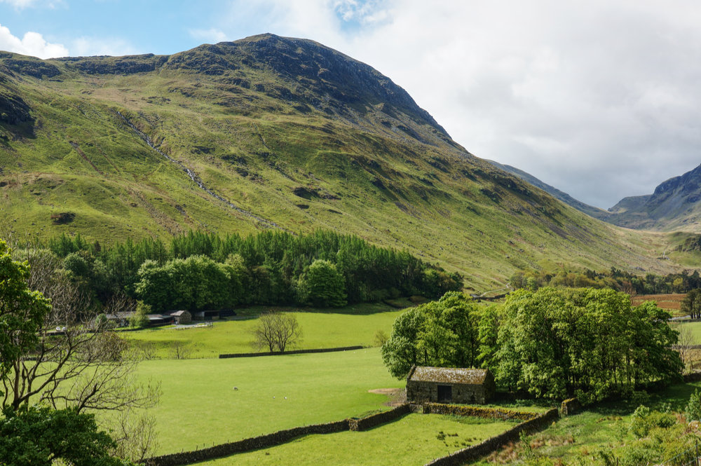
I parked up at the Glencoyne car park. Despite it being a Sunday, there was plenty of space and I assumed that only the weather had put people off – it was “changeable” with light rain in the air.
My plan on this trip was to complete a second round of the Eastern Fells – not that I was fully committing to completing a second round of the Wainwrights, but that’s what seems to be happening. This time though, there will be no targets and no time limits. I’ve got nothing to prove and I’ll just be doing the walks I want to do and at a more leisurely pace. That should offer more time for enjoying the landscape, taking photos and maybe even some sketching. If it turns out that I never complete a second round, so be it.
Of course, it’s all very well making statements like that, but when it comes to it, I’ll probably find the box ticking to be completely irresistible!
The sky was overcast and rain was threatening, but there was no way I was passing up the chance to go hillwalking. I had new boots to test out and new camera kit to work with. My objective this afternoon was a modest walk to Sheffield Pike and Glenridding Dodd – nothing too strenuous. I figured it would be a useful prelude to longer walks in the days to come.
After a quick visit to the lake shore to check that I was really back in the Lake District, I booted up, pulled on my waterproof jacket, and set off on the planned route. The first time I bagged Sheffield Pike, it was from the south, this time I would be approaching from the north.

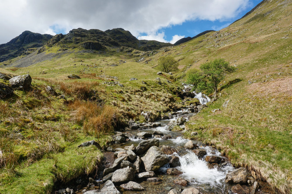
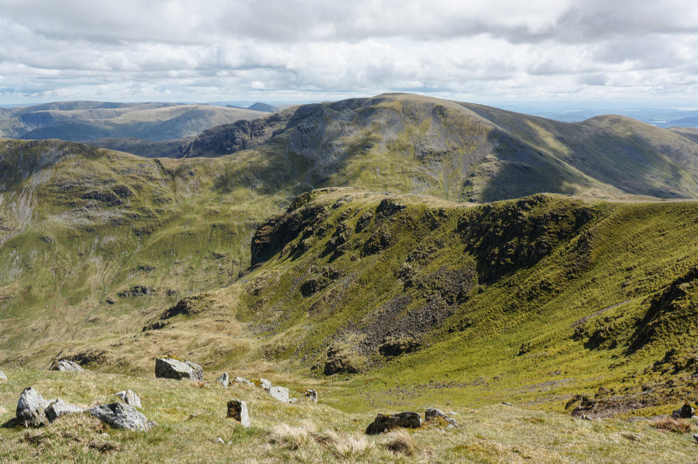
After the initial approach on the access track, and passing by the farm at Glencoyne, the rising path along the southern valley side, above Glencoyne Beck is delightful, and gives a real sense of moving away from civilisation. Glencoyne Head, with White Stones and Hart Side are dominant in the expanding view, and I felt excited about my return to walking in out-of-the-way places and knowing that I would be visiting those higher fells later in the week.
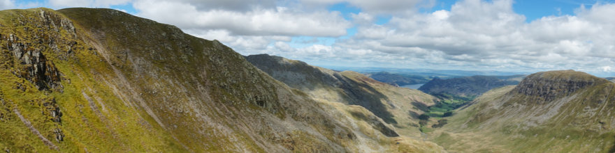
As I approached Nick Head, the sky darkened and a light rain fell. I didn’t mind, just happy to be there. The wind was coming in from the west, and I’d been relatively sheltered in Glencoyne. Once I reached Nick Head, I got the full force of it as magnificent views over to Helvellyn and Catstycam opened up. It was chilly rather than cold, but Catstycam’s beautiful pyramid was flecked with snow. I couldn’t quite make out Helvellyn as it was shrouded in cloud but the lower slopes were dusted with snow. I stopped a while to absorb the scene and take a few photographs. I don’t think I’ve ever seen Catstycam look more majestic.
Swinging round to the east, I followed the ridge line to the summit of Sheffield Pike. All the while looking back towards the drama behind me. By the time I got to the summit, it was properly raining, although it didn’t feel it was set for the day, so I found a sheltered spot, out of the wind, and waited it out.
After about ten minutes, the rain eased, and I felt able to get my camera out. Views over to the Helvellyn area were still amazing, and in the other direction, I could see back down to Ullswater.
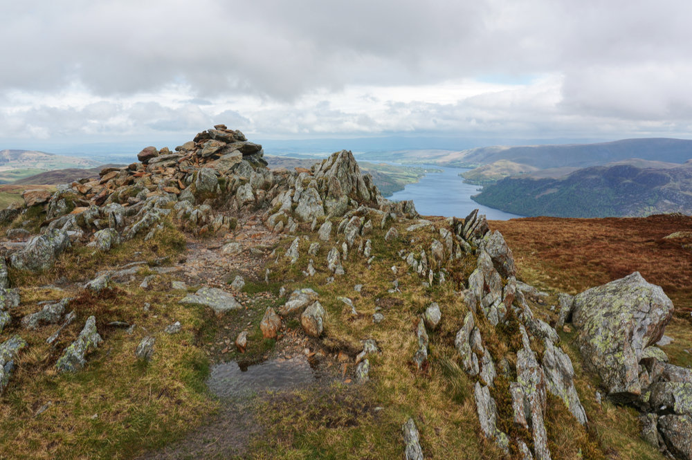
I followed the ridge down towards Heron Pike. There’s no clear or obvious path, but eventually, I made it to the viewpoint and looked across the steep crags to Glenridding, Ullswater, and to Place Fell. From there, the path is steep and loose in places, made worse by the intermittent rain, but it all added to the sense of adventure. Eventually, I made it to the col below Glenridding Dodd, and took the short, steep climb to the summit.
I didn’t stay long. Cloud was rolling in and it was getting wetter. I dropped down into Glenridding, and took the lake shore path back to the car. It had been a shortish walk, and I’d got wet, but I’d loved every minute of it.
Monday
Monday morning brought fine weather, and the forecast suggested that it might be the best day of the week, so I decided that today would be the day to attempt the biggest walk of the week, the Helvellyn Skyline, based on a walk in Mark Richards’ Fellranger guide for Patterdale.
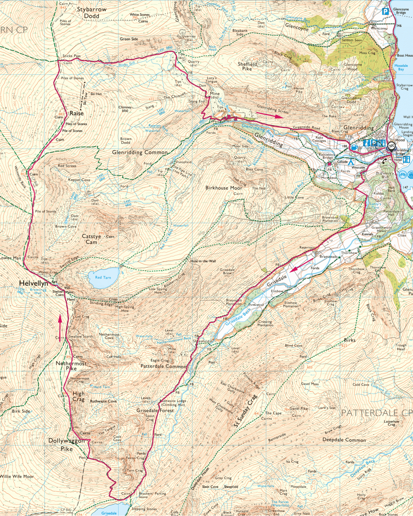
The previous day, I’d worn a new pair of boots, the Keen Ridge Flex. I’d found them to be very comfortable, although the sole was a little soft for my liking, making the going slightly uncomfortable over rough ground. However, the main disappointment was that these “waterproof” boots were nothing of the sort. Granted, Sunday had been wet, but the boots were very damp, both inside and out. Unfortunately, communal areas at YHA Ambleside, such as the drying room, were still out of bounds, so there had been no opportunity to dry them. Fortunately, I’d brought my trusty Mammut boots, and my only reservation about them was that they had begun to cause some pain in my toes on long walks. Still, they seemed to be the right boots for what was going to be a big walk of 20km, almost 1,300m of ascent, and much of it over rough ground.
I drove to the main car park at Glenridding and bought an all-day ticket. The weather was just about perfect for both walking and photography; deep blue skies with big, white cumulous clouds, and not too hot.
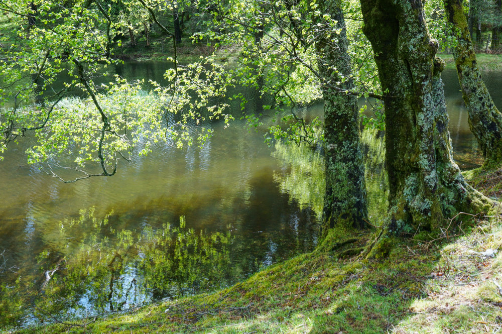
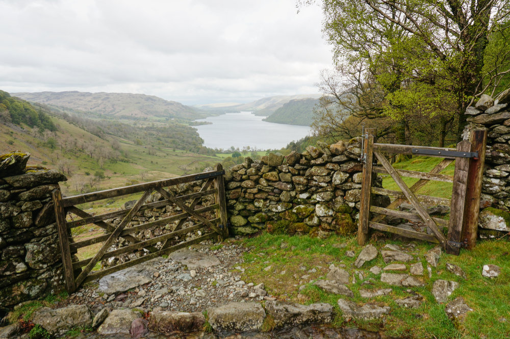
I set off along the south side of Glenridding Beck, and then took the footpath to Lanty’s Tarn. As the path rose, there were excellent views across to Heron Pike and Glenridding Dodd where I’d been in the rain, now bathed is lovely sunshine.
I’d not visited Lanty’s Tarn before, and it turned out to be a beautiful haven; a small body of water within a woodland setting. There is something about being is a shady woodland, looking out through the trees to glorious sunshine beyond that lifts the spirits. It felt like the natural gateway to Grisedale.
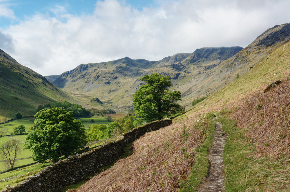
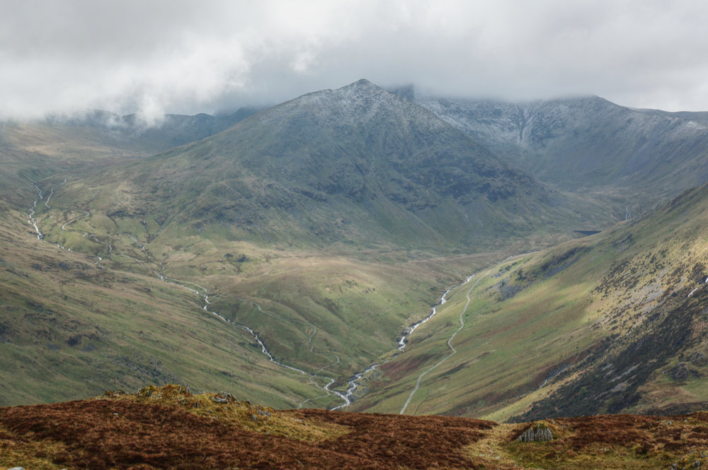
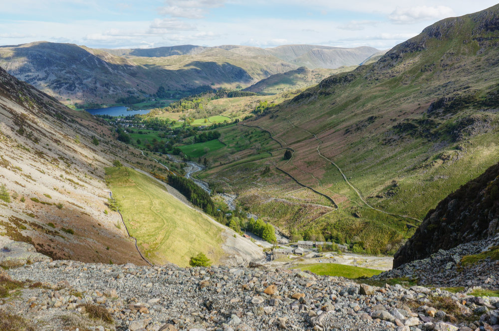
Leaving the tarn, and the woodland behind, I emerged into the bright valley of Grisedale. I’d walked the length of Grisedale before, but using the southern route, this time I was following the north side of the valley and it seemed to me, at that moment, to be the superior of the two, both in terms of views and in giving a general sense of moving into the mountains, and away from civilisation.
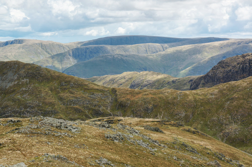
I’d forgotten just how far the walk out to Grisedale Tarn really is, but I was grateful for the gentle incline that rises 400m over a distance of around 7km. Along the way, the mountains get bigger until eventually, the path starts to climb more steeply with St. Sunday Crag towering to your left, and the slopes of Dollywaggon Pike hard to the right.
Just when you feel you might be entering the Heart of Darkness, the path meets the lip of Grisedale Tarn at a large cairn, and the scene opens out to reveal the bowl contained by Fairfield, Seat Sandal, and Dollywaggon Pike, and a plane of still water, reflecting blue sky.
Here at Grisedale Tarn, the first phase of the walk ends and the second begins. I didn’t pause by the water, there were too many people about, and I was hoping for intimacy with the landscape. I walked on and embarked on the steepest section of the walk; the zigzag path up the southern slopes of Dollywaggon Pike. It’s a tough climb but as always, the reward is the opening views to distant tops.
At the top of the zigzags, and before the summit plateau is gained, there is a lovely tongue of land with stunning views back down Grisedale, across to St. Sunday Crag, and over Deepdale Hause to Hartsop above How, and as far as High Street in the Far Eastern Fells. Here I stopped for lunch and watched the landscape as light and shade played over the layered scene.
The half hour break for lunch was very welcome and at 2pm I continued the climb to the summit of Dollywaggon Pike. The summit cairn (if you can call it a cairn) is looking a bit sorry for itself. It’s no more than a random assortment of stones, covering the highest point and really deserves some care and attention because the view is deserving of a better marker. As Mark Richards’ puts it, “The view, particularly across Ruthwaite Cove, is the stuff of magic mountain dreams”.
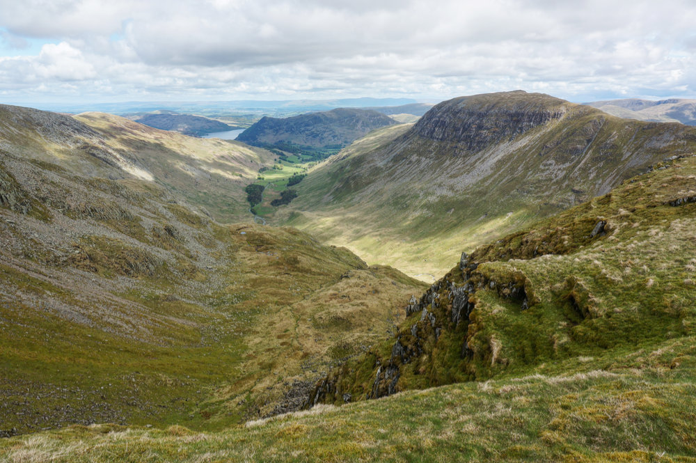
From Dollywaggon Pike, the main path is located away from the edge of Ruthwaite Cove, but there is a less obvious path that follows the lip, and this is the one I took. It has two distinct advantages; it is not busy, and it allows for fantastic views to the east.
I followed the path over High Crag and then onto the plateau of Nethernost Pike. Wainwright describes the summit in these words, “[it] is of considerable extent and so remarkably flat that it is not easy to understand why the name ‘Pike’ was given to the fell…”.
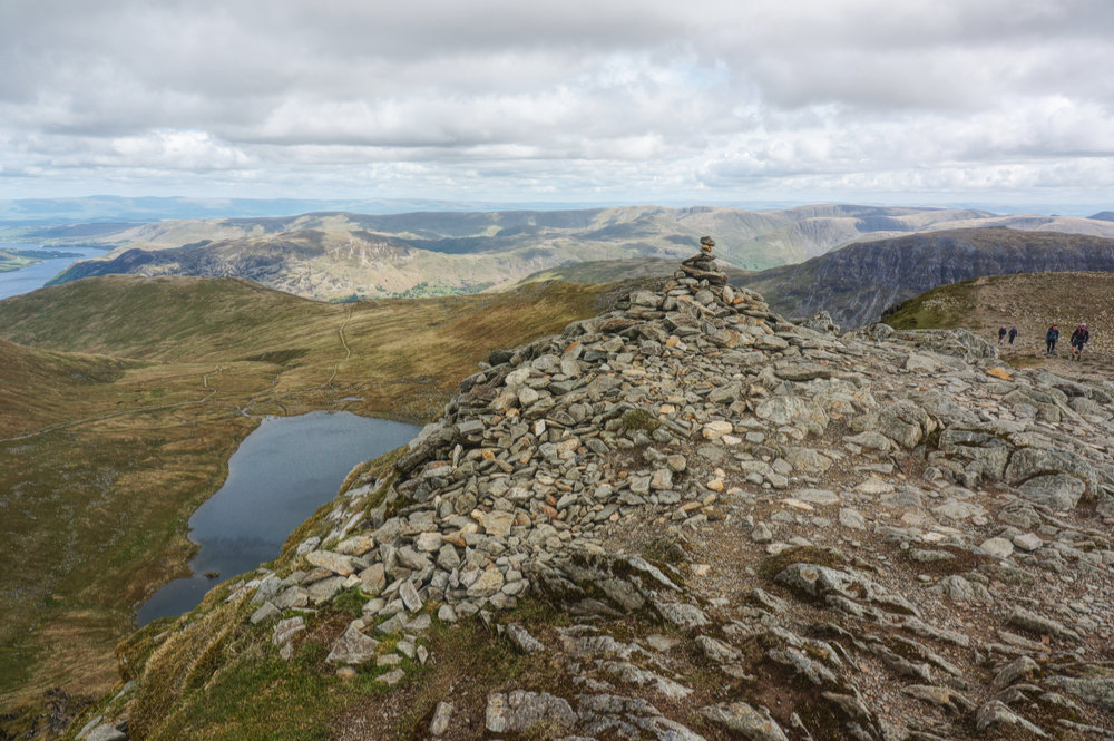
From Nethermost Pike, it’s just a one kilometre saunter up the gentle slope and along the busy thoroughfare to the summit of Helvellyn. This is the only point in the walk when it is simply impossible to avoid people. Helvellyn is always busy. However, being a weekday, and being early in the season, it was bearable and didn’t feel crowded.
I’ve always found it curious that most people at the summit head straight for the OS triangulation column, assuming it to be the highest point. Perhaps this is because the actual summit is rather low-key with hardly a cairn at all.

I paid my dues at the real summit and then moved along, allowing others to do the same should they feel inclined. A short break was in order as this was the highest point on the walk and the half-way point. I found a good perch on the edge, looking down to Red Tarn.
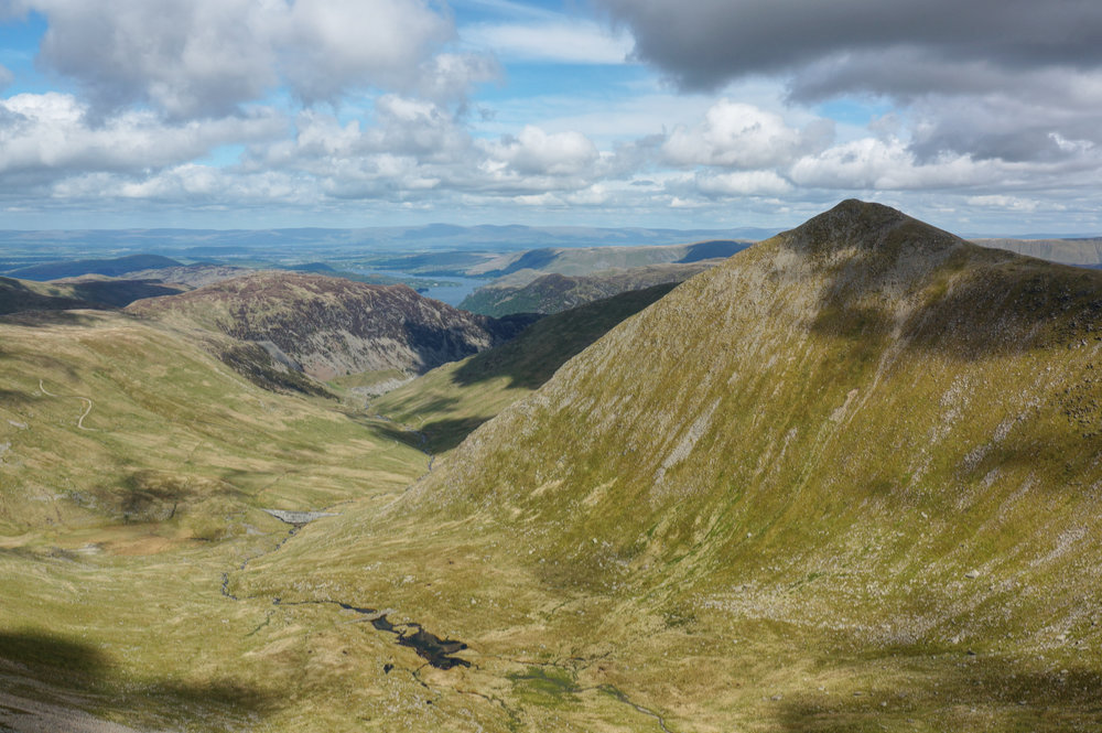
All along this section of the walk there are great views of Catstycam, first of the southern flank and then, after Swirral Edge, of the northern flank and down into Brown Cove. The sense of space is exhilarating.
The path leads on to Lower Man and then down and up again to Whiteside. Along the way, I met a woman who asked if I would take her photograph with Catstycam in the background. Of course, I was happy to do so and she seemed pleased with the result.
At Whiteside, I had a choice to make, I could either follow the route in the book, taking the zigzag path down across Glenridding Common, or continue to Raise and then down to Sticks Pass, returning to Glenridding via Stang End. I had told myself that if I was still feeling fit at Whiteside, I should take the longer route and the additional Wainwright.
Although I was feeling tired, it was such a beautiful day and I was enjoying myself so much that I didn’t want to head back now, so I continued along the short decline and the longer incline to the summit of Raise.
I last visited the summit of Raise more than five years earlier on a very cold day in March 2016. At that time the beautiful beehive cairn was intact and looking amazing, as though it had grown out of the rock upon which it stood. Sadly the five years had not been kind to this beautiful cairn and I found it looking more like a broken tooth than a beehive.
From Raise, the route was down hill all the way back to Glenridding. I dropped down to Sticks Pass and then turned right along the narrow but exciting path above Sticks Beck. By now it was late afternoon and the low sunlight was casting deep shadows across the terrain, making everything look more three-dimensional.

By now my feet were quite sore and my legs weary, but I was very glad to have taken the longer route, regardless of the consequences.
Eventually, the Sticks Gill valley opens out, and the path turns right into a disused quarry. It’s a curious lunar landscape of grey rocks and rubble and one that has been worked and reworked over several centuries. Industrial artefacts give the impression of being close to civilisation, but at this point, the route is still four kilometres out from Glenridding, and 400m above it.
The drop down from Stang End to Glenridding Beck is steep, and my tired legs and sore feet made for an uncomfortable decent. Fortunately, after the drop, the track back to the car park is mainly concrete and tarmac, but it still felt like the longest section of the day because by that time I was practically hobbling and wishing that I had a pair of walking poles.
I got back to the car feeling completely done-in and realising that the long winter lock-down had done nothing for my hill-fitness. Still, I’d achieved my objective, it had been a fantastic day and I’d added another five Wainwrights to my second round total.
Now it was time to eat, and after such an effort, I couldn’t deny myself the reward of Fish’n’Chips from my favourite chippy, the Walnut Fish Bar in Ambleside. Since the communal kitchens at YHA Ambleside were still closed, this was both a treat and a convenience. The fact that I had to eat my supper in the car did not diminish the pleasure.
Tuesday
I woke up on Tuesday feeling shattered. I ached all over and my toe joints were very sore. There was no way I was going on a walk today.
I got up late and spent the morning in the empty bar, looking out over Windermere and catching up on emails. Work had been super busy, and although I was glad to be away from it, I still had a few loose ends to attend to.
By lunchtime, my feet were still very sore, but I knew I’d need to get mobile if I was to stand any chance of walking the following day.
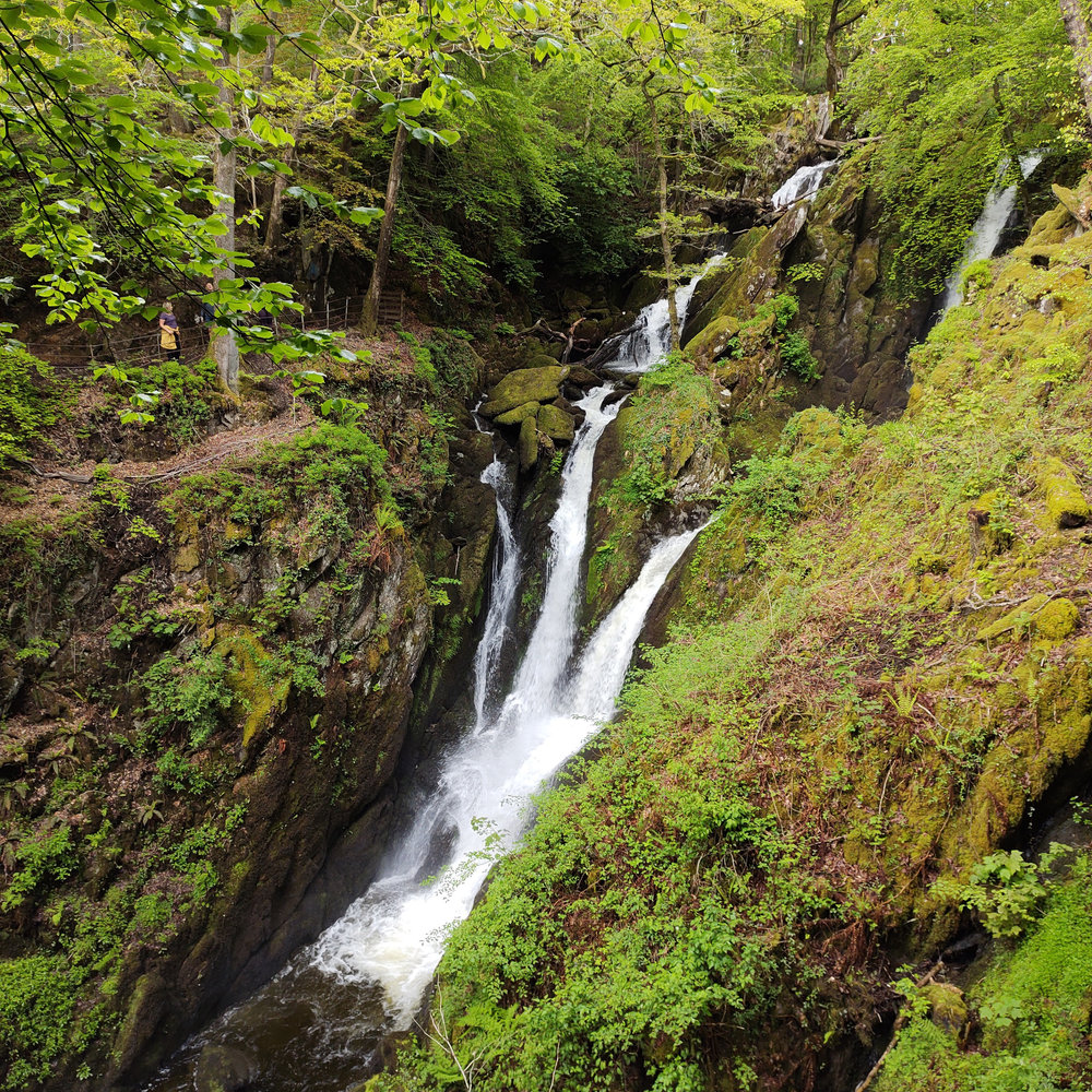
I’d been making regular visits to the Lake District for over five years, and one of the places I’d been meaning to visit was Stockghyll Force, a spectacular waterfall, a short walk out of Ambleside. I figured I could probably manage a short walk, so I drove into Ambleside and set off.
It had rained that morning, but now the day was brightening up. Just as well because I was in some pain as I made my way up the steep road leading to the waterfall. I was in no rush, so I took it easy and slowly made my way to the viewpoint. There were plenty of people about and I’m sure that in high season, this place would be impossible. I took a few photos on my phone (I hadn’t even bothered to take a camera), lingered just long enough to get a sense of the place, and then headed back down the steep road an into Ambleside.
And that was pretty much it for the day. I mooched around Ambleside for a little while, picked up a few things for a picnic supper, and drove back to the hostel.
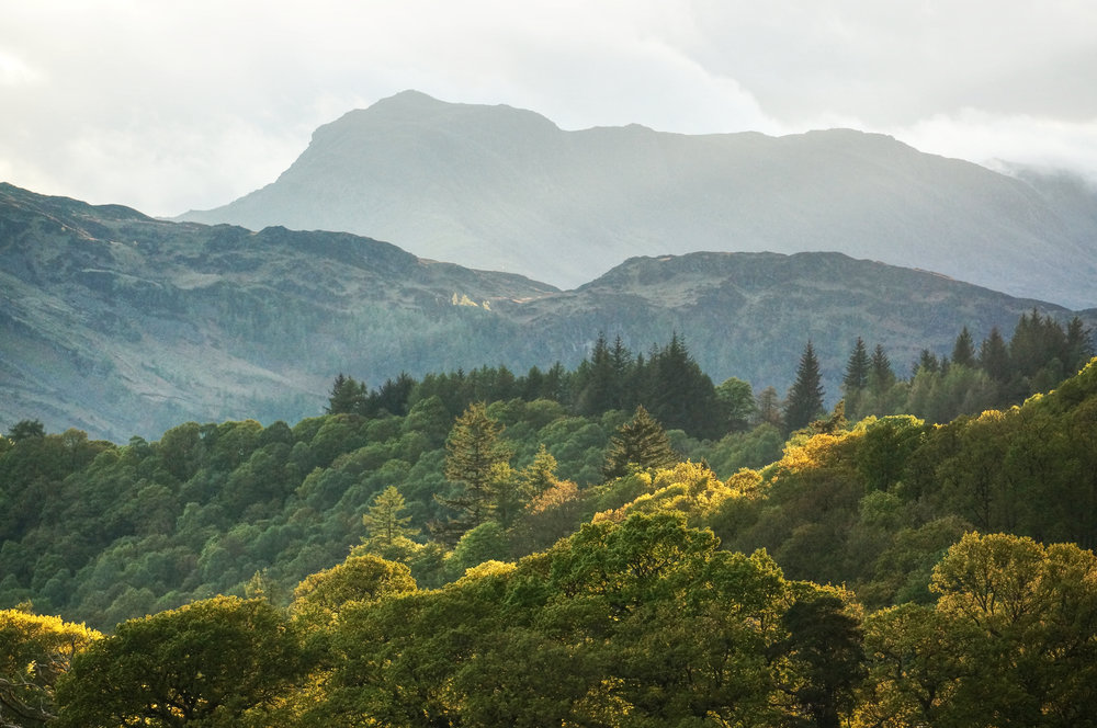
The evening brought some lovely light, and I got a few snaps, looking across Windermere to Bowfell but I wasn’t feeling confident that I’d be able to walk pain-free the following day. In any case, the forecast didn’t look good, so I went to bed, not having planned for Wednesday and hoped that all would be well in the morning.
Wednesday
I woke up to rain and although my feet were feeling a lot better, they certainly weren’t telling me to go on a long walk. I decided that the sensible thing to do would be to have another easy day of recovery so as not to jeopardise the rest of the week.
I decided to spend some of the day just taking photographs and learning how to use some of the new equipment I’d bought. I particularly wanted to get to grips with the set of neutral density filters, and I figured some moving water would be a good way to test them out.
After a slow and easy morning, watching the rain on the lake, I set off just before lunch to a place where I knew I’d have the opportunity to get some slow-shutter photos.

I drove up to the Kirkstone Pass, then through Glenridding and past Glencoyne Bay to the turn off at Aira Force. The waterfall itself wouldn’t be a good subject on this occasion, but the upper falls would. I arrived at the High Cascades car park at lunchtime. The rain was still coming down, so I sat in the car and ate my lunch. The forecast was for a dry afternoon.
After half an hour or so, the rain did go off and the sky brightened. I grabbed my photographic equipment, including tripod and headed down to the river. I spent a happy hour and a half framing shots and testing out the effect of different shutter speeds on moving water. The resulting photographs were not spectacular because the day was pretty grey and the light was flat, but the time was productive.
I hadn’t walked very far over the two “down” days, and my feet were feeling a lot better. I decided I’d be ready for a new walking challenge the following day, so I drove slowly back to the hostel to plan my next adventure. I didn’t know it yet, but I’d be returning to the very same car park on Thursday morning.
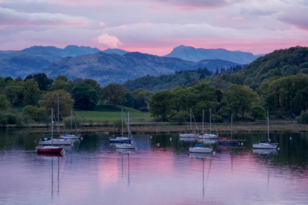
Wednesday evening brought a beautiful sunset, which I snapped from my bedroom window. I hoped that the red sky at night would bring a dry and delightful day on Thursday.
To be continued…
23rd May 2021
Sheffield Pike (675m)
Glenridding Dodd (442m)
24th May 2021
The Helvellyn Skyline
Dollywaggon Pike (858m)
Nethermost Pike (891m)
Helvellyn (950m)
White Side (863m)
Raise (884m)