I was very happy to be feeling fit again and, after a couple of wet-ish days, the weather was looking promising. After a quick breakfast I was driving back the way I’d come the previous evening. I planned to walk The Matterdale Dodds, the same walk I had completed just over five years ago, but this time using a different start point for a bit of variety. Five years ago, the walk had been a bit miserable, a thick mist had descended and I hadn’t seen much from the tops. Today was going to be a very different experience.
Thursday
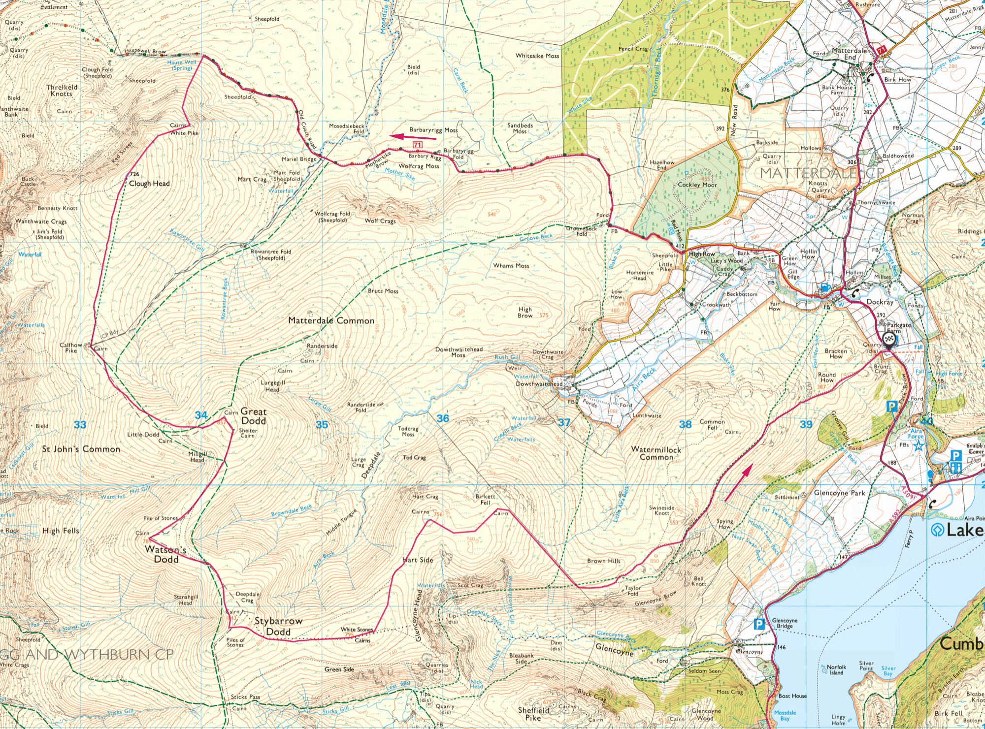
I parked up at High Cascades car park, pulled my boots on and set off up the road towards Dockray. It was a rather lovely morning, full of promise with big, dramatic clouds against a blue sky. I passed through Dockray and was soon at High Row, the more common start point for this walk and the place I’d parked five years before. From there I continued along the Old Coach Road.
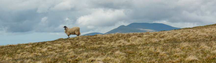
From High Row it’s about 5.5km along the Old Coach Road before the grassy climb onto Clough Head via White Pike. Along the way I had open views of Great Mell Fell to the north-east, passed under Wolf Crags, and met some fell ponies at the crossing of Mosedale Beck.
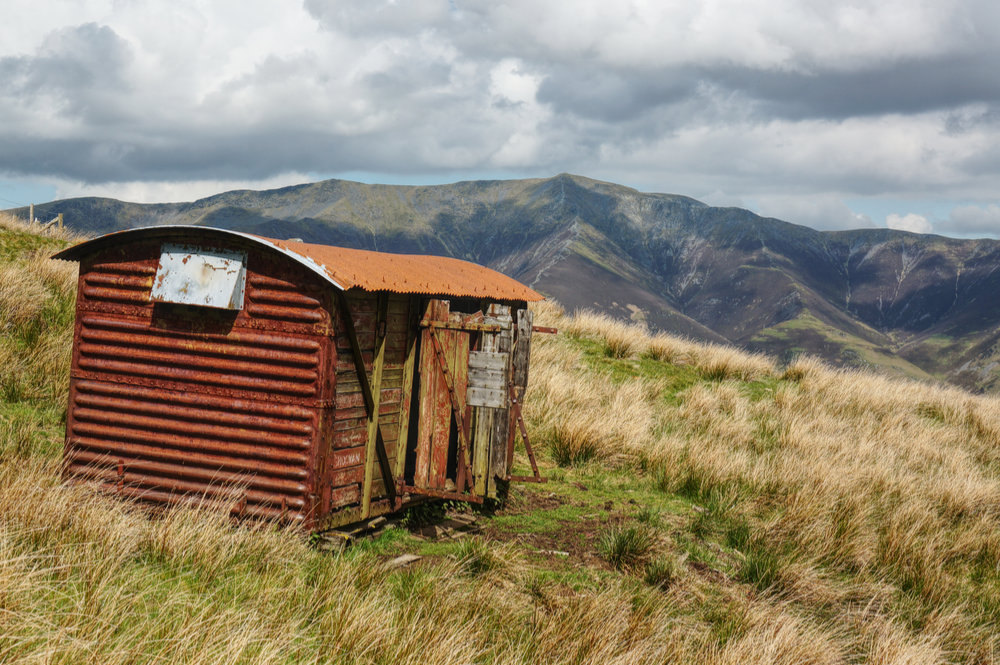
Eventually I reached the old shepherds hut that looks as though it may once have been a railway truck. The galvanised tin roof had long since lost its protection and was now a beautiful rust red – a lovely contrast with the green, blue and straw of the landscape.
Just past the hut, a gate in the fence on the left of the track marked my onward route. A dilemma. A previous walker had left the gate open, and a couple of sheep had wandered through. Should I close the gate behind me and lock the sheep out or should I leave it open and allow them to get back in? I went for the latter option, figuring that the sheep were in no danger, but I worried that a following walker might think that I had been the thoughtless one.
I went through the gate and started the steep, grassy climb to White Pike. It took a while, but after half an hour and many short stops to catch my breath, I made it to the large cairn at White Pike. From there I could look back down to the shepherd’s hut far below and along the length of the Old Coach Road. It’s a great feeling to have a visual confirmation of distance travelled and height gained.
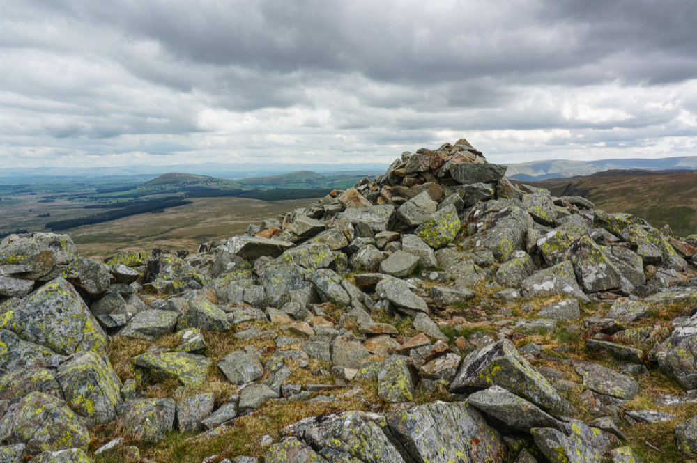
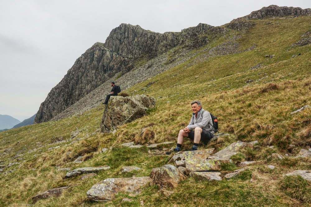
From White Pike, a shorter steep climb ends at the OS trig point at the summit of Clough Head. When I arrived, the summit was occupied by a mountain biker who was taking in the panoramic view across Threlkeld to Blencathra. We chatted for a while, two blokes on a fell top, loving the view and loving being out in the open with no thoughts of work.
After a few minutes of chat, he did me the courtesy of moving on and leaving me to enjoy the summit alone. I took my photos and spent a few more minutes just enjoying being there.

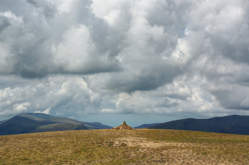
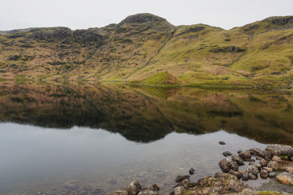
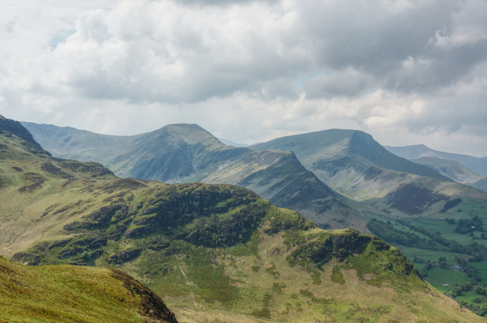
From Clough Head, the route drops down over undulating grassland to the minor top of Calfhow Pike. Despite its lowly status, it is a prominent feature from the West at High Rigg and the A591. It’s topped by a neat little cairn, and with excellent views to Keswick and Skiddaw to the north-west, it made for an excellent lunch stop.
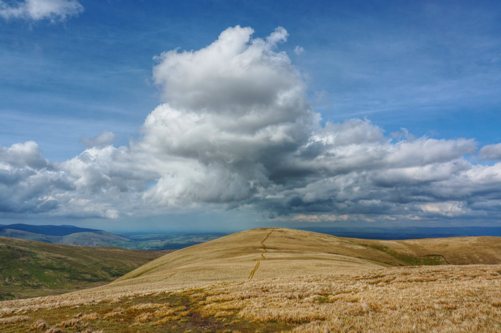
After a relaxed lunch, I continued the walk in good spirits. The route to Great Dodd climbs in a sweeping arc over more grassy terrain. It’s a lovely place to be on a sunny afternoon with only the sound of the skylarks for company.

I arrived at Great Dodd summit just after 3pm, the second and highest of five Wainwrights to be visited on this walk. The scene at the summit was characterised by open vistas and big skies – a lovely place to be.
The next target was my namesake, Watson’s Dodd, just a kilometre away and downhill from Great Dodd. The first time I visited Watson’s Dodd I can remember being disappointed by the rather mean cairn and undramatic aspect of this top. On this occasion it wasn’t wreathed in mist, and it wasn’t damp underfoot. The cairn is a little bigger than I remembered and there are some notable views.
From Watson’s Dodd it’s an even shorter hop to Stybarrow Dodd. Last time I almost missed it in the thickening mist and even on this occasion I had to backtrack because the path runs to the west and below the top and it is easily by-passed.
The next stop was White Stones, not a Wainwright but notable because of the eponymous feature which stands out in the otherwise green ocean of grass.
After White Stones, the route runs straight across a lovely saddle to Hart Side, the final Wainwright of the day. I was treated to a dramatic cloudscape and the late afternoon sun gave the surrounding landscape a warm glow.
I hung around at Hart Side summit for a while, reluctant to start the downward return leg too soon. Eventually I made my way down to the cairn at Birkett Fell and the straight-as-a-die wall that guides the walker down and off the Matterdale fells, towards Glencoyne.
On the way down, views across to Sheffield Pike opened up and I could see the path I’d taken across the fellside on my way to the top just a few days before. The sky was clearing, and the sun played across the scene, making everything look more three dimensional.
After following the wall for almost a kilometre, a hole in the wall with a wooden style marks the point where my route turns back towards the start point. Initially, the faint path is difficult to follow but it soon establishes a clear way forward.
I wasn’t expecting it but the path above Spying How was spectacular. For most of the way, the going is easy with the route following the contour and providing lovely views across Ullswater. The evening light was lovely, and the surface of the water was sparkling.
Eventually the path descends to Round How and then down into the disused quarry. There is some awkward scrambling required to get down to the car park – actually the most difficult part of the walk – but all of a sudden, I was back at the car.
It had been an excellent day and, most importantly, my feet felt great.
Friday
The previous evening, I’d packed everything away, ready for an early start. I’d arranged to meet my brother Rob and his son Tom for an 8am breakfast in Grasmere car park.
Months earlier Rob had talked about doing Wainwright’s Coast to Coast walk when he retires and had asked me if I’d come along with him. Obviously, I said “yes”. He suggested that it might be a good idea to start training as he was likely to retire in a couple of years (in fact, around the same time that I’m planning to retire). So I suggested he join me in the Lakes for a couple of days of walking and he’d readily agreed. We’d booked a couple of rooms at YMCA Lakeside for Friday night so we could spend a couple of days together on the fells.

When I arrived at Grasmere, Rob and Tom were already there and Rob had the little Campingaz stove going, frying sausages for breakfast. After an excellent sausage bap and fresh orange juice breakfast, we laced up our boots and set off into Grasmere.
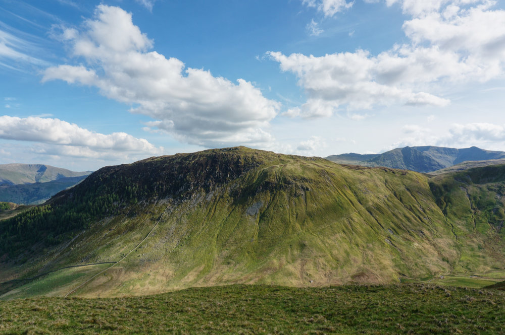
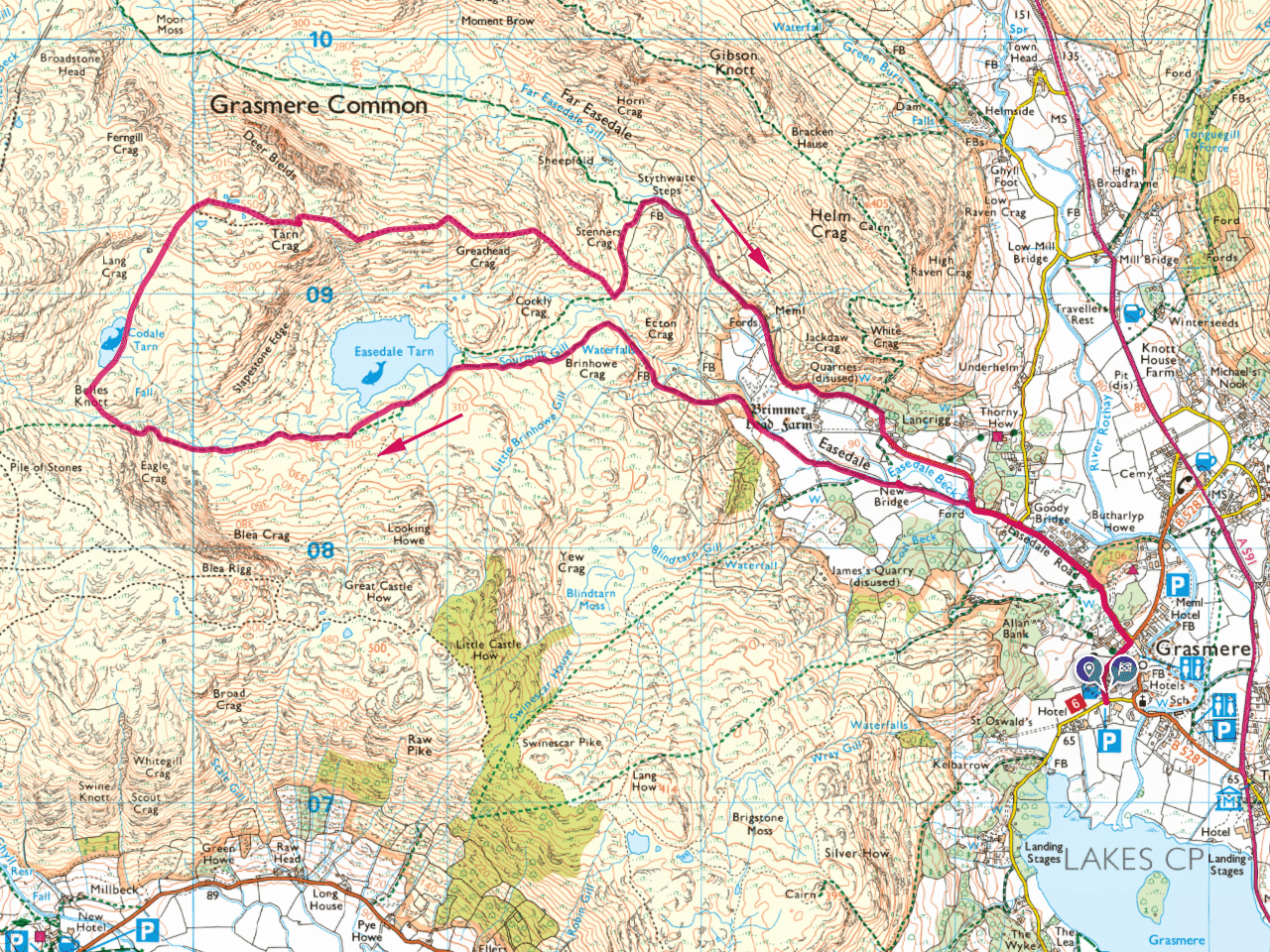
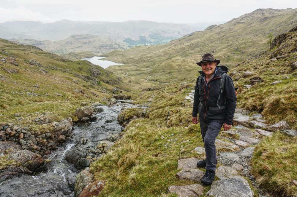
I’d thought carefully about what might be a best first walk for Rob and concluded that the Tarn Crag round would provide plenty of variety without being too taxing. There’s a great sense of moving away from civilisation and towards the “Heart of Darkness” after Easedale Tarn when all the tourists disappear and then some hands on rock during the climb under Belles Knott before entering the beautiful amphitheatre of Codale Tarn.
So, we set off through Grasmere and took the Easedale Road opposite the Sam Read bookshop turning left, onto the lovely bridleway to Easedale Tarn. There had been plenty of rain earlier in the week, and ahead of us, Sourmilk Gill showed as a white ribbon of cascading water.
The climb alongside Sourmilk Gill is quite steep, but the path is extremely well pitched and the going is easy. After some puffing and panting, we reached the top of the cascades where the path becomes less steep.
Tom had brought his drone with him and was able to get some aerial footage of the cascades.
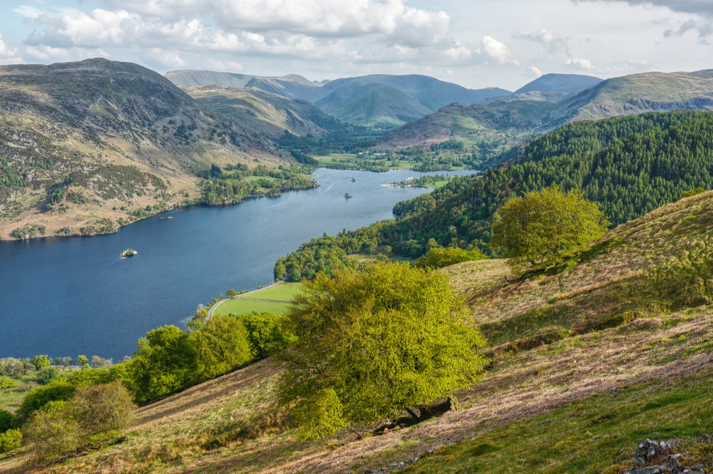
Soon enough we reached Easedale Tarn and sat down for a well-earned rest. We had plenty of time and took things slowly. I was bearing in mind the fact that I had another walk planned for Saturday and I didn’t want to tire anyone out!
The weather was a bit flat. The sky overcast with occasional spitting rain and only a very light breeze. It didn’t look like we would see any sun today, but at least it wasn’t raining properly.

After our break we left the tourists and headed off into the wild towards Codale Tarn and we were soon enjoying a light scramble over the rocky climb below the spire-like form of Belles Knott, a highlight of Lakeland fellwalking.
At the top, we left the main path and turned right, across the stream, and into the lovely environs of Codale Tarn. We rested here for a while, and I mentioned to Rob that this is the place where I would like my ashes scattered.
After a short break, we gained the ridge and then headed east towards the summit.
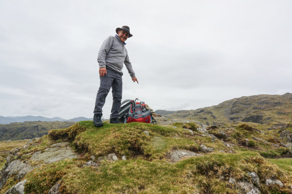
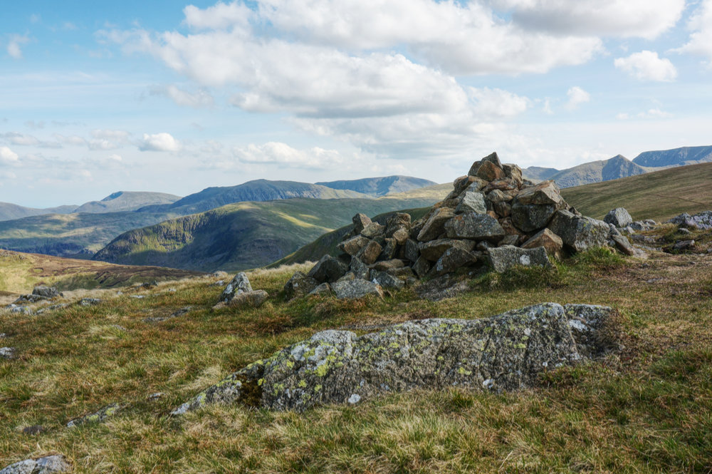
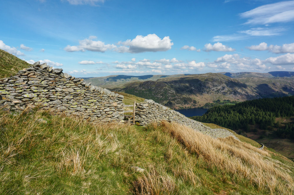
There’s always a little confusion in finding the Tarn Crag summit, it’s one of those tops with several potential candidates, but the actual top is marked by a small cairn, which we found ,and Rob was able to claim his first Wainwright.
We made a slow decent back to the car park at Grasmere, where we arrived at around 5pm. After packing away our kit, we drove south, stopping off at Booth’s at Windermere to pick up some supper before checking in at YMCA Lakeside.

It was a calm evening, so we sat out on the pontoon with the stove, cooking supper and drinking beer – a lovely way to end the day. We practically had the lake all to ourselves.
Saturday
On Saturday morning, we packed up, said goodbye to YMCA Lakeside, and set off to Little Town. Rob set the destination on his Satnav and I followed. It took us on an entertaining switch-back route, during which, I lost Rob in Keswick and decided to follow my nose. I ended up heading down to Borrowdale but found an interesting route across to Little Town. By the time I arrived at the start point, Rob already had the sausages on for breakfast.

For Rob’s second walk, I thought a simple ridge route might be ideal, with an easy start at Catbells and a low-level return through the upper Newlands Valley.
The Little Town parking area was full and there was a light-hearted atmosphere as groups of friends arrived and prepared for their day’s walk.
After an excellent breakfast, we set off via the disused quarry and onto the bridleway beneath Catbells. I had originally planned to start the ascent at the nose-end of the ridge, but Rob decided a more direct ascent of Skelgill Bank might be more efficient. I wasn’t too sure, but we started the climb. Tom shot off ahead and I stayed with Rob, who soon found it to be tough going.
It was still early in the day and there was no rush, so we took it slowly and after several stops, we made it to the ridge.
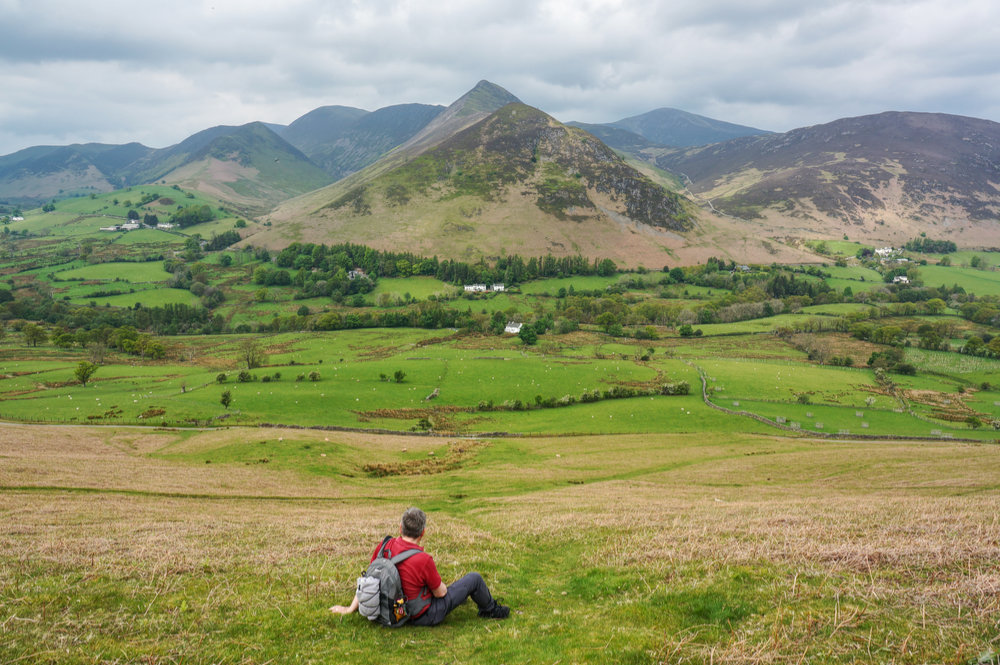
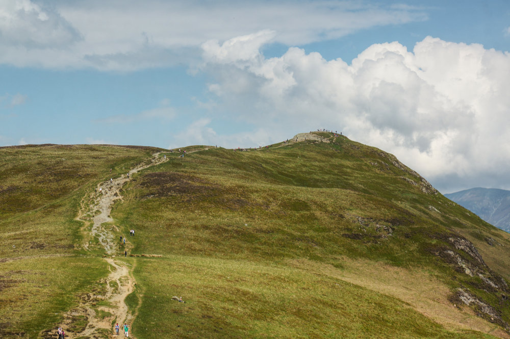
Once the ridge is gained, the going is much easier. Being a Saturday and this being Catbells in reasonably good weather, there were a lot of people about. Along with Scafell Pike, Catbells is probably one of the busiest summits in the Lake District. I didn’t mind because I knew that that beyond Catbells’ summit, the crowds would melt away and we’d eventually be on our own.

By the time we reached the summit, it was time for an early lunch, so we sat and admired the view with dozens of others, doing the same thing.
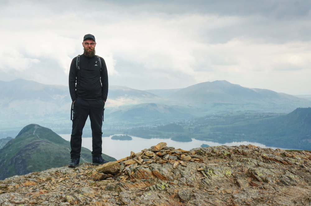
On my last visit to Catbells, a few years earlier, the slate column at the summit had not been built. It was clear at the time that this was a summit calling out for some sort of marker, and this one did the job (although I thought it might have been a little bigger).
What I didn’t remember from my previous visit was how good the views are over towards the North Western Fells. Everyone talks about the view over Derwentwater to Keswick, but I thought the view south-west to Hindscarth and Robinson was excellent.
After lunch, we headed south, along the ridge, to Maiden Moor. The crowds disappeared but there were still plenty of people at the summit when we arrived at around 2pm. Looking back to Catbells, we could see lots of people at the summit – it’s certainly an ideal goal for a first Wainwright or for a family with kids.
From Maiden Moor, there’s a 2km ridge walk to High Spy, which we covered in about an hour. The further south the ridge goes, the rougher the ground becomes.
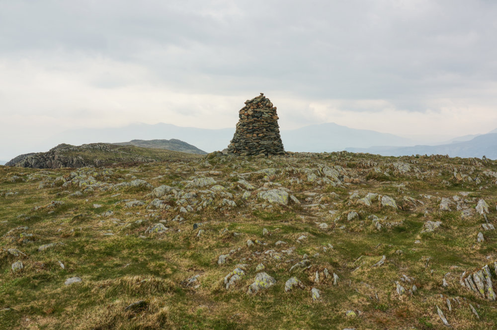
After an hour of walking, we reached the very impressive beehive cairn of High Spy. Tom had walked ahead and recorded some drone footage of Rob and I arriving at the summit. By the time we arrived, all other signs of life had disappeared, and we had the place entirely to ourselves.
The weather seemed to be closing in. The cloud had thickened, the sky turned grey, and the temperature had dropped but it was still dry.
From High Spy we were aiming for Dalehead Tarn, not an essential stop on the route, but a nice place for a short stop, so worth the little bit of extra effort. The path towards the tarn is less clear as the going becomes bouldery, but it was a good contrast to the simple and obvious route we’d been following up until this point.
Eventually, we found our way to the crossing of the upper Newlands Beck and climbed up to the tarn. It was calm and there were a handful of people milling about. We met and chatted with the Geordie Hiker, who was recording an episode for his YouTube channel, and we got a mention in the finished video.
When planning this walk, I had thought about including Dale Head, but looking up at the steep climb now, I was glad I had omitted it. It was a lovely walk, but it had been quite slow.
After a short break at the tarn, we retraced our steps to the crossing of the beck and with a little difficulty, found the descending route into the Newlands Valley. The upper valley is rough with crags and scree on either side and provides a nice contrast to the ridge walk.
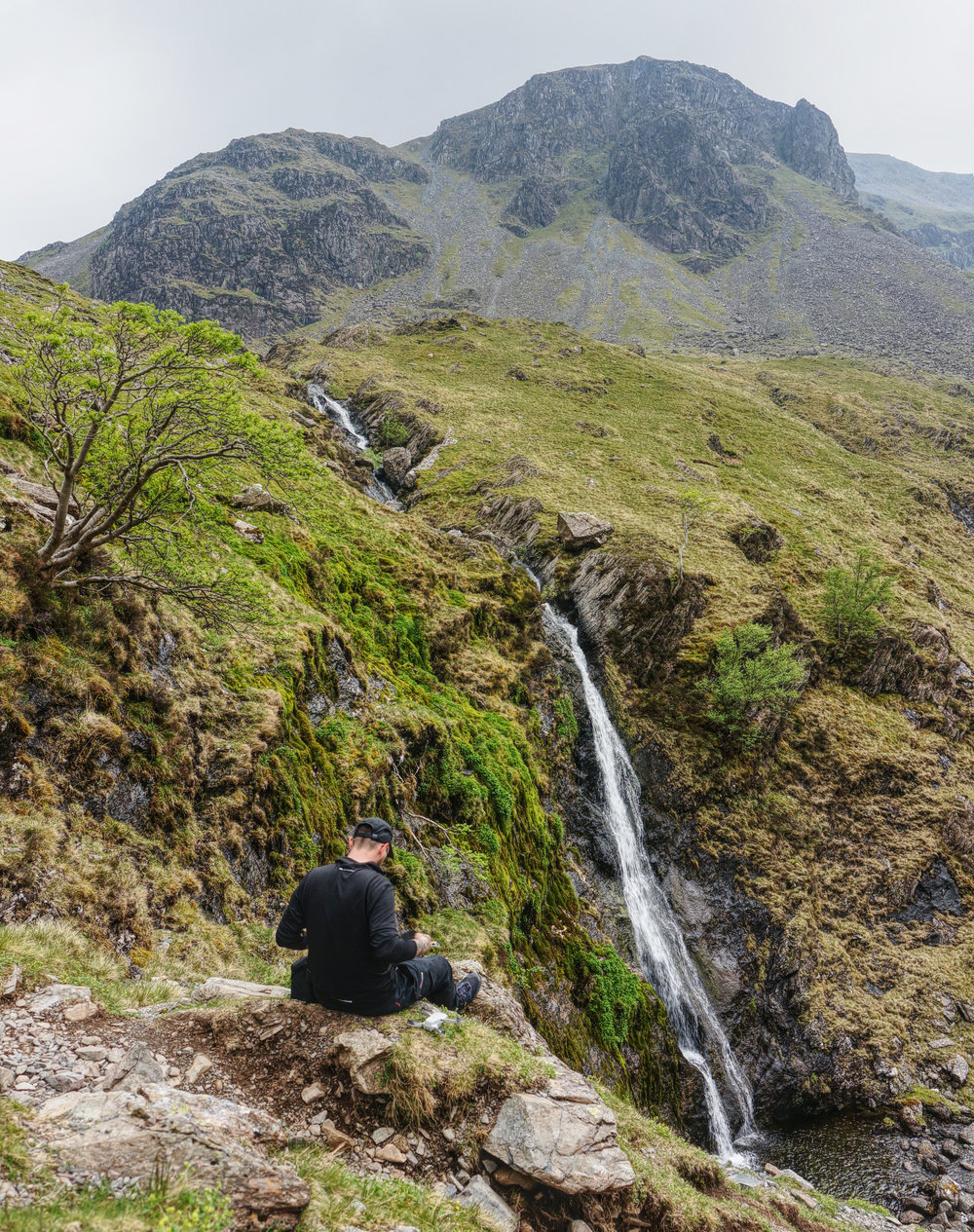
Around a kilometre from the tarn there are some fantastic waterfalls. We had a stop for some photographs, and Tom got some drone footage. It’s an excellent photo location, and I made a mental note to revisit in better weather – the diffuse light made everything feel a little flat, but I could imagine it looking fantastic in low-angled sunlight.
A little further on, a light rain began to fall, but it didn’t dampen our spirits and we made it back to the cars at a reasonable time, in fact, at around the same time that the alpacas (yes, that’s right, “alpacas”) that we’d seen coming down from Dale Head during the return leg. I think this was part of a guided tour, but it looked a little odd.
We were all a bit wet when we got back to Little Town but the rain had never broken into a downpour, so we counted ourselves lucky. We said our goodbyes, agreed to do this again, and set off for the M6. The end of another successful walking trip to the Lakes, with me getting stuck into a second round of the Wainwrights and with Rob bagging his first four. Good times.∗
27th May 2021
Matterdale and The Dodds
Clough Head (726m)
Great Dodd (858m)
Watson’s Dodd (789m)
Stybarrow Dodd (846m)
Hart Side (758m)
28th May 2021
Tarn Crag (551m)
29th May 2021
Catbells (451m)
Maiden Moor (576m)
High Spy (653m)