
There are a few reasons why I’ve been leaving the Scafells to the end of this challenge. First, as the highest of the Wainwright fells, in fact, the highest mountains in England, it seemed fitting to leave them to the end. Second, it made sense geographically. Broadly, I started in the east, moved round to the north and am finishing in the west and south. Third, they are difficult to get to, or rather, they are a long drive from the key centres in the Lake District. But most of all, they are popular. There would be no chance of getting to the top of Scafell Pike alone and although I don’t mind meeting the odd (in every sense of the word) traveller, crowds do not make for an enjoyable climb. However, on this occasion, I thought I might have a good chance of minimising congestion on the narrow paths. The weather forecast for the weekend was mixed, I had scheduled Scafell Pike for a Friday, avoiding the busier weekend and the quieter Scafell for Saturday. What could possibly go wrong?
I was in Manchester on the Thursday for our Web Teaching Today get-together. A gathering of a really lovely group of people who teach web design at FE and HE institutions. It’s a good forum to discuss contemporary trends and current teaching issues in a relaxed and supportive environment. We had what I thought was a very productive day at MMU and, as usual, a trip to Manchester is a great opportunity to mix business with the pleasure of walking in the Lake District.
Friday
On Thursday evening, I stopped over with Mum in Southport and on Friday morning, I set off for Wasdale Head. It was a long drive and I didn’t arrive at the National Trust car park until after noon. However, it seemed reasonably quiet as I entered the car park, which was about two thirds occupied. I parked up, got a ticket and went to the loo. At that point, I realised something was going on. There were two large marquees at the top end of the car park. One housed a St. John’s Ambulance team and the other housed a group of stewards with clipboards and high-viz vests. Oh no!
It turns out, I’d scheduled my climb of Scafell Pike for the same day as the “Pike” leg of the Three Peaks by Train charity challenge. I considered my options but decided that since it was already late in the day and I was here, I would just have to grin and bear it.
I figured a later start might be better, but I didn’t want to be too late because I still had to get to YHA Eskdale and pitch a tent! So, I had lunch before booting up and setting off.
Yes, that’s right, I said “tent”. On this trip I was going to camp.
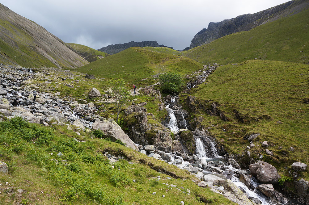
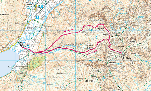
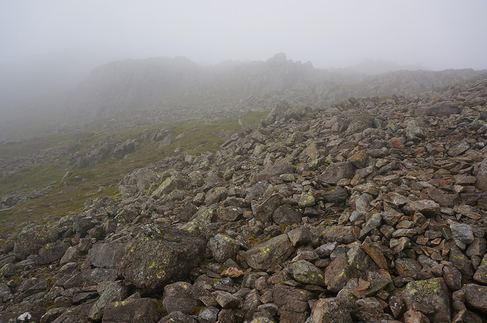
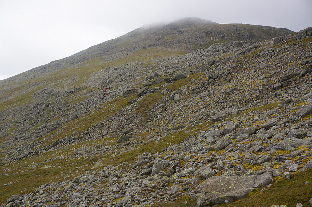
I set off on what is disparagingly known as the “tourist route” and although there were plenty of people about, it certainly wasn’t crowded. I began the steady uphill trudge, alongside Lingmell Gill, to the base of Brown Tongue and then continued on a steeper trudge up that.
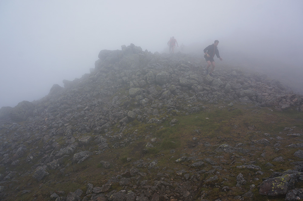
Above Brown Tongue, as the path swings left and upwards towards Lingmell Col, my progress was slowed by descending knots of Three Peaks revellers, many looking totally shattered and all wearing brand new kit, every one of them clicking and clacking their way down with box-fresh walking poles. All I could do was stand aside and allow each group to stagger past before continuing my climb.
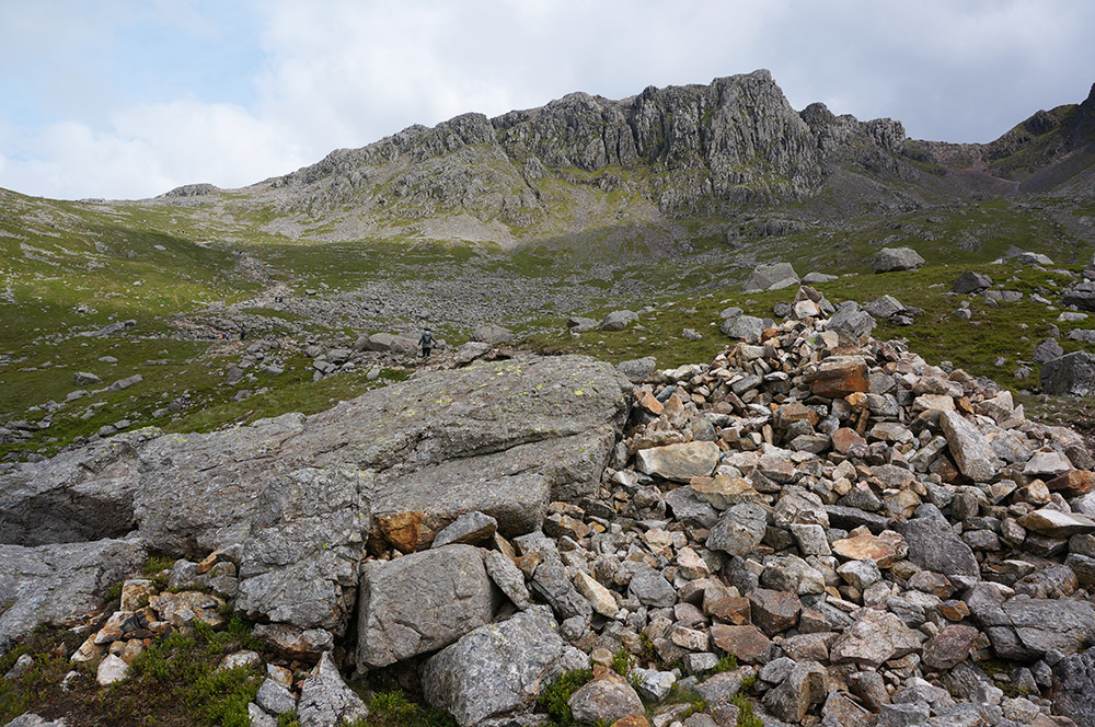
Above the col as the path becomes steeper with loose rocks, more groups swarmed down from the top with no regard for those climbing. Again, all I could do was stand aside and hope that I was seeing the tail-end of the event.
I should really have paid closer attention to Wainwright’s words; “The tourist route goes round by Lingmell Col and is a tiring and uninteresting grind, designed to preserve its users from fears and falterings… This is not a route for lovers of solitude”. Oh well, I consoled myself that I had now experienced both the best and the worst of Lakeland fell walking.
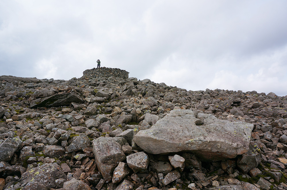
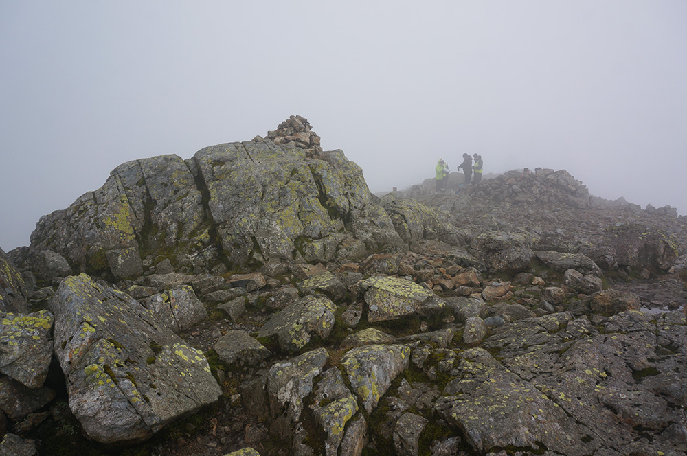
After the final rough climb, I reached the summit to the sound of whoops and shouts – another group had just reached the top. They had a banner out and were being photographed. No way was I going to have this place to myself!
I joined the queue onto the cylindrical, recently restored cairn to bag the top and then quickly retreated. It had taken two hours and twenty minutes to climb Scafell Pike from Wasdale Head. I found a deserted wind shelter to the north of the summit and sat down to a drink and a muesli bar.
After a fifteen-minute break, I made my way back to the summit. There was not a soul to be seen! The tail-enders had made it and left, and I had the place to myself, an unexpected treat.
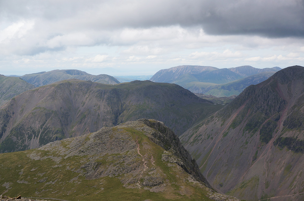
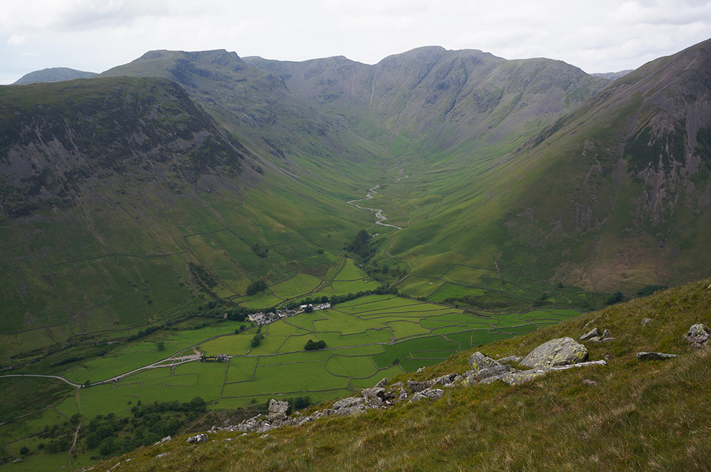
After a few rare moments of solitude at the summit of Scafell Pike, I returned to Lingmell Col, taking some time to appreciate the large slab of rock on the way down, a lovely platform for views over to Great Gable.
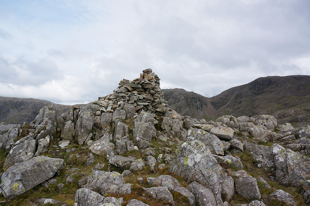
At the col I crossed to the base of Lingmell and climbed the relatively modest slope to the summit. There were still plenty of travellers on the Scafell path but fortunately, very few bother to visit Lingmell. It’s a rocky summit with a large cylindrical cairn and some amazing views down over a sheer drop. I caught my first glimpse of Piers Gill and made a mental note to someday walk the Corridor Route.
After taking my usual summit photos and a few moments of contemplation, I set off across the summit plateau, following a faint grassy path to the west ridge where I would make my descent back to the car park.

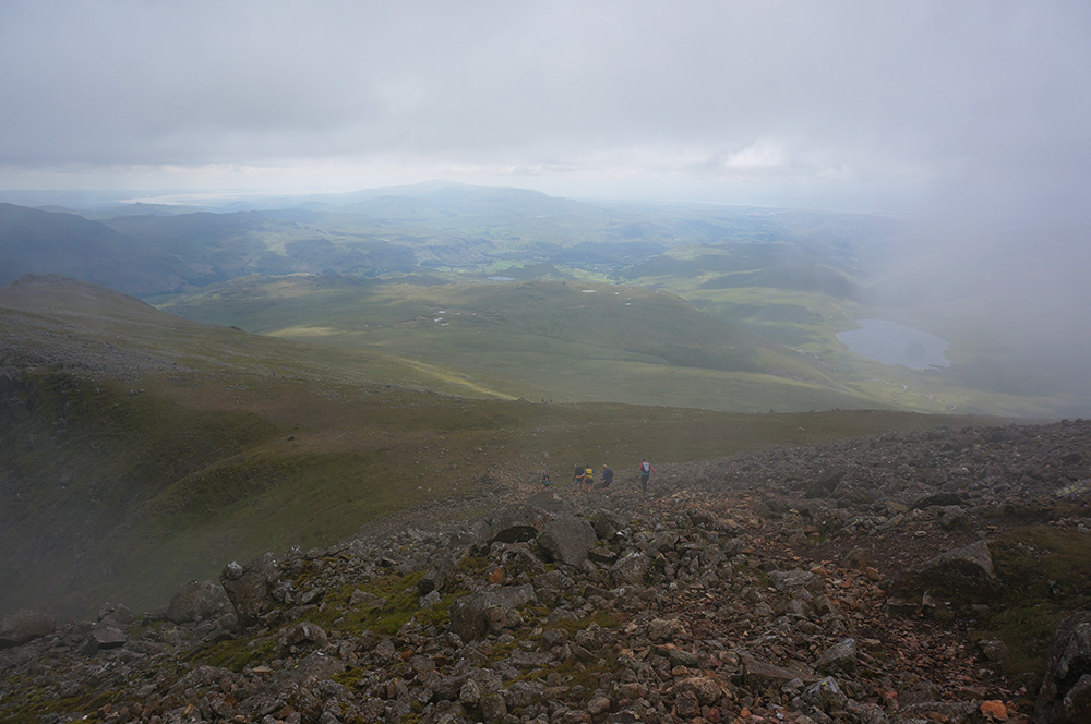
The west ridge is steep. Not only is it steep, it is relentlessly steep. About two thirds of the way down, my knees and thigh muscles were becoming painful and from that point onwards, I had to pause regularly to allow the pain to ease slightly before continuing.
Eventually, the slope eases and the path joins the main Scafell route just above the car park. As I headed back, one of the stewards asked if I was on the charity challenge. When I told him I wasn’t he said, “oh, you’re just a free spirit”. And I thought, yes, I am a free spirit – or at least that’s how I felt at that moment, having just taken a different route to almost everyone else in the vicinity.

It was a beautiful evening as I drove back along Wast Water and I was tempted to stop a while and take in the views, but it was already late and I had a tent to pitch.
I arrived at YHA Eskdale (my first visit there) just before seven and checked in. Supper was just about to be served, so I booked a place at the table and had a very enjoyable meal in the company of five other hostlers who were very interested in the fact that I was so close to finishing the Wainwrights.
After supper, I chose a camping spot near the stream and pitched the tent.
Saturday
At ten past four on Saturday morning I was awoken by the dawn chorus. It was already light and returning to sleep wasn’t easy. Around seven, I woke again to the sound of a soft rain falling on the flysheet. Ugh! I thought it was supposed to be dry this morning.
After a shower at the hostel, I joined a busy dining room for breakfast. Lots of people had arrived late on Friday night, presumably travelling to the Lakes after work.
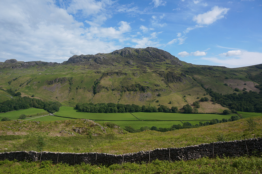
By the time I was ready to set off on my second Scafells walk, the rain had stopped and although the ground was still damp and the cloud low, the sky looked as though it may be brightening. I walked 500m along the road to the parking area at the start of the Terrace Route to Slight Side and Scafell and climbed the bank to find the path.
The next two kilometres of the walk give this route it’s title. On a good day, this would be a very pleasant way to spend time, walking a gently rising and distinct path through beautiful country on a valley side with rising land on the left and views across Eskdale on the right. On this day, the weather looked increasingly threatening the further I walked. Dense, dark-grey cloud shrouded the upper slopes of Harter Fell to my right and there was rain in the air.
There was no useful Wi-Fi at the hostel and no mobile phone signal in Eskdale, so I hadn’t seen the latest forecast. I wondered whether the day was going to be a wash-out. I continued anyway, knowing that I would probably have to negotiate the mist that was more than likely covering the upper section of today’s walk.

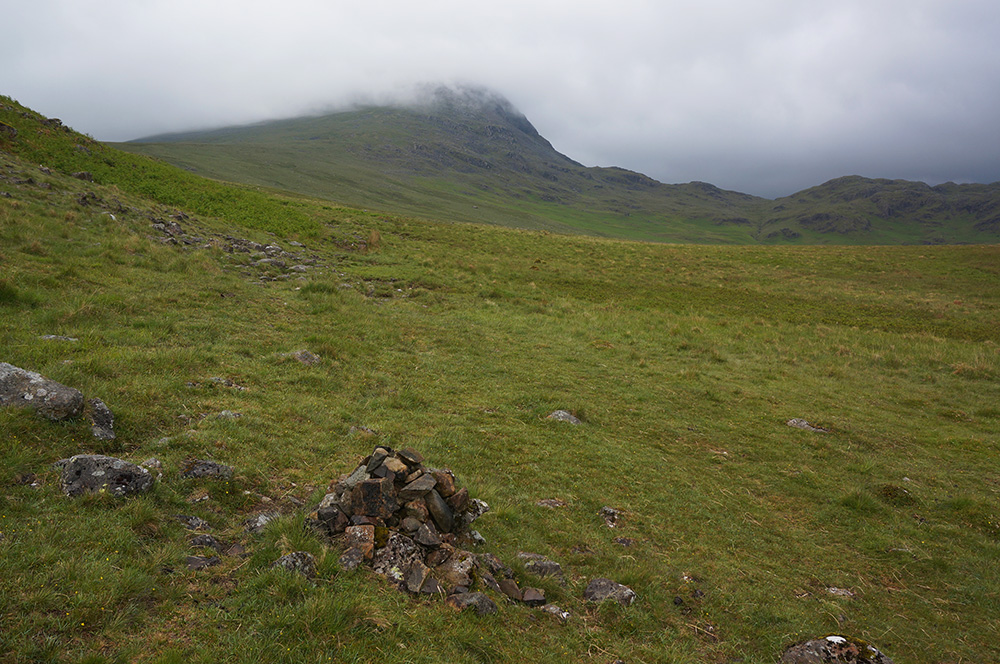
Beyond Cat Crag, the landscape opens out and I got my first sight of Slight Side, or rather, I didn’t because it was indeed swathed in mist. However, the wind had risen, and the mist was moving fast. There was a possibility that it might clear by the time I arrived.
The way became boggy and I crossed several streams before the path began to rise steeply, at first on grassy slopes, then eroded paths and finally shattered rock. Looking back the way I’d come, I could see a lone figure coming the same way but gaining on me. After a few more minutes of climbing, I was in mist and there were no more views back.
Just under the summit of Slight Side, I found a comfortable, flat-topped rock and sat down for a rest before taking on the final climb. I was probably there for ten or fifteen minutes before a young woman emerged from the mist. I recognised her as the figure I’d seen earlier. We said hello and she told me that she was on her way to the summit as a check-point steward for a race. She said there would be about 300 runners!
I’d done it again. Chosen a day when the fells would be crowded. By the time I reached the summit, a few people had already assembled and a checkpoint had been set up although there was no sign of any runners. It was getting colder and everyone there was wrapping up to keep warm. I bagged Slight Side and then moved off in the general direction of Scafell, the mist making it difficult to be quite certain. Shortly, I discovered a reliable path and the way was marked by some well-placed cairns.
Not long after that it started to rain, heavy rain. I put on my waterproof leggings and rucksack cover in the shadow of a large rock and continued following the cairns over rocky ground. Fortunately, it turned out to be a shower and after about fifteen minutes, the rain eased and eventually stopped.
Just after Long Green, as the path began to rise towards Scafell summit, I encountered the first group of runners, coming towards me. They had obviously already run some distance and I marvelled as they careered down over loose boulders, dressed in nothing more than vest and running shorts. I’ve always thought fell-running to be a mad pursuit, but I couldn’t help but admire these amazingly ultra-fit people, both men and women, especially the women.
The closer I got to Scafell, the more runners passed me, travelling in the opposite direction and headed for the Slight Side checkpoint. For the most part, they weren’t interested in following the path I was intent on, instead, choosing their own route over this dangerous terrain, the mist making it doubly difficult for them to navigate.
Eventually, I reached Scafell summit. Another checkpoint party had made a base at the wind shelter, but the summit cairn was freely accessible, so I took my customary photo and found a comfortable rock nearby to break for lunch.
Of course, there was no beautiful view as just reward for my efforts, the mist was still thick and there was no sign of it lifting.
After lunch I said goodbye to the cairn on England’s second highest mountain and set off, back to Slight Side in the company of sporadic groups of flailing fell-runners.
As the path descended from the summit ridge, all of a sudden, the mist parted and a most beautiful sunny view over Burnmoor Tarn and Wast Water revealed itself. While I’d been at lunch, the cloud base had risen, and I’d just dropped below it.
The journey back along Long Green couldn’t have been more different. Cold, raining and misty on the way up, warm, sunny and clear on the way down – the place was unrecognisable from barely an hour earlier. Now, instead of seeing small groups of fell-runners come and go in the mist, I could see them all strung out in a long snaking line, all the way to Slight Side.
I crossed paths with a very nice Dutch chap, and we stood a while, chatting and admiring the stamina of the runners. Both of us had experienced the poor weather earlier in the day and were now taking time to soak in our brighter surroundings.

When I got back to Slight Side summit, I took the photos I wasn’t able to take on the way up and then headed back down toward Eskdale. The runners were taking a different route, across to Pike O’Blisco, their seventh and final peak of the race, so my walk back would be a little quieter. I later discovered that I’d witnessed the Great Lakes Fell Race, organised by Ambleside Athletics Club and that the winner completed the formidable course in just under 2 hours and 38 minutes.
I had planned to take in Great How on the return leg, not a Wainwright but a Fellranger fell. However, two strenuous walks over two days and very little sleep was beginning to take its toll and I was feeling rather weary, so I reluctantly decided to head back to Eskdale YHA the same way I’d come.
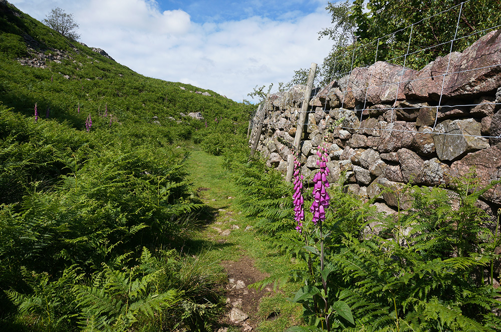
By late afternoon, the skies were almost clear, and the sun beat down on a lush green landscape. Foxgloves, which I hadn’t even noticed that morning now dominated the scene as the path dropped down into Eskdale.
I got back to the hostel just after 5pm and decided not to spend another wakeful night under canvas. I had to drive over to Leeds the following morning to pick up Tilly, so I took down the tent, packed the car and drove down to Southport and a comfy bed.∗
14th June 2019
Scafell Pike (978m)
Lingmell (800m)
15th June 2019
Slight Side (762m)
Scafell (964m)
So that completes the Southern Fells, leaving just two Wainwrights to finish the round when I return in July.