
Family holidays are becoming a bit of a rarity for us. With both kids now living away from home, Hannah and I had booked a week in a small cottage in Buttermere, not knowing what the kids’ movements would be over the summer. As it turned out, they both said they wanted to be there when I completed my round of the Wainwrights, and naturally I was delighted. So we booked a couple of camping pitches close to the cottage and we were all set.
If you’ve been reading this journal, you’ll know that I had just two Wainwrights remaining, Fleetwith Pike and Haystacks. Both tops are relatively easy walks from Buttermere and my priority was to bag those two; any additional walking would be a bonus and dependent on keeping the rest of the family happy.
Hannah, Tilly and I arrived at Yew Tree Cottage in Buttermere on Saturday afternoon. We unloaded the car, settled in to our temporary home and then pitched Tilly’s tent at the campsite nearby.
Max was working in Brighton over the weekend and would be joining us on Monday.
Sunday
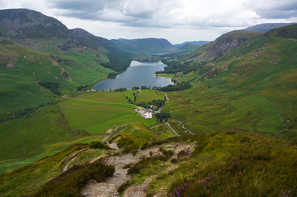
On Sunday morning we got up late and had a lazy breakfast. The weather was fine, I was itching to get out and the girls wanted to swim, so we planned an easy walk, clockwise around Buttermere. We decided on the same route as Walk 18 in Vivienne Crow’s excellent Low Level and Lake Walks but in the opposite direction. The walk is around four and a half miles with very little ascent and formed a perfect, relaxing start to a holiday in the Lakes. About three quarters of the way round, Tilly and Hannah decided they needed to get in the water, so we found a suitable place on the lake edge and they hobbled in over sharp stones.

I didn’t join them. Although I love being out in the wild and I also enjoy swimming, I’ve never really taken to wild swimming. It’s obviously a defect in my nature. So, I sat on the shore and guarded their belongings.
Monday
The weather forecast for the rest of the week was “changeable” and it looked as though Monday would be the only guaranteed day of relatively fine weather. I decided that we should do the Fleetwith Pike and Haystacks walk so I could complete the 214 Wainwrights in good weather. The only problem was that Max didn’t arrive in Penrith until 1.30pm.
The plan, therefore was for me and Tilly to set off for Fleetwith Pike before midday, while Hannah went to Penrith where Max would be picked up and we’d meet them at Honister Slate Mine at around 2.30pm and then head for Haystacks. I am very happy to say that, despite the complications, everything went according to plan.

So Tilly and I set off along the north side of Buttermere lake and with a quicker pace than on the previous day, soon arrived at Gatesgarth Farm at the foot of Fleetwith Edge.
From a distance, the Edge looks pretty formidable and although it is steep, there is enough interest along the way to ensure that it’s never a trudge. The first point of interest is the white memorial cross to Fanny Mercer, who was accidentally killed here in 1887. Below the memorial, the path zig-zags over very steep ground as it swings to the north of Low Raven Crag but once that obstacle is circumvented, the path gains the ridge proper and views open up.
Height is quickly gained and, looking back, Gatesgarth starts to look a long way down and Buttermere occupies a greater part of the scene.
On this route, the summit of Fleetwith Pike is never in view and there are at least two or three false summits. “Surely that must be the top?” and then “Oh no, there’s another one further up!”.
Towards the ultimate top, the path steepens and the way becomes rocky, requiring some light scrambling. With views of Haystacks over to our right, we were able to gauge how close we were to the summit (Fleetwith Pike is about 50m higher than Haystacks).
Eventually, and after a thoroughly enjoyable climb, we reached the summit cairn and sat down for a well-earned rest. It was 1.45pm and we’d made pretty good time.
Honister Hause was still over 2km away but from the top of Fleetwith Pike, it would be downhill all the way and the path was pretty clear.
After admiring the view and taking on refreshments, we left the summit and headed east, passing Black Star and coming down into Hopper Quarry, where we joined the haul road and followed it all the way down to Honister Slate Mine, where we arrived at 2.45pm.
Hannah and Max were running a little behind schedule, so Tilly and I got ourselves an ice cream and sat on the verandah of the visitor block, waiting for them to arrive.
Not long after, we saw the Honda pull into the car park and soon after that, after a few welcome hugs, we were on our way to Haystacks.
The path out of Honister is initially very steep but, thankfully it is well pitched and more like a rough staircase before the incline eases a little and the path continues more gently uphill to Drum House, where it levels out.
From Drum House, Tilly, Max and I continued along the dismantled tramway to Dubs Quarry where we were intrigued to see a bicycle parked outside Dubs Hut bothy. Apparently, the bothy was renovated in 2017 and was clearly being used.
From Dubs Quarry, we dropped down into Dubs Bottom and then climbed towards Green Crag. From this point on, the walk is really interesting and although there are lots of twists and turns, the path is never in doubt.

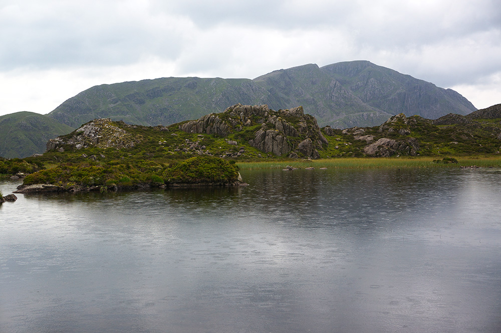
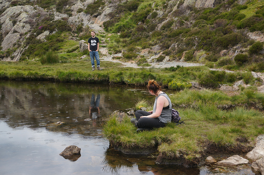
Eventually, we arrived at Innominate Tarn and I decided we should have a break before making the final pull up to Haystacks summit. In truth, I was a little reluctant for my journey to end without at least some contemplation. Fortunately, Innominate Tarn is the perfect place. The air was dead still, a very soft rain fell, making ripples on the water surface and a weak sun illuminated the clouds. All three of us eased into the calm.
We stayed at the tarn for a while, ate some vegetarian sausage rolls that Hannah had bought. Eventually and reluctantly I decided we should press on. It was almost 5 o’clock and we still had a longish walk back to Buttermere after Haystacks.
Twenty minutes later, we were at the summit ridge with only one question in our minds; which of the two cairns was the actual summit? A quick check of the Wainwright guide determined that, although both are of similar elevation, the one to the north is usually regarded as the true summit.
So, I firmly patted the steel post that marked the spot and ended my first round of the Wainwrights. I’d completed all 214 tops in 4 years and 21 days and, in truth, it didn’t feel like the massive achievement that I think it probably is. More importantly, it didn’t feel like an ending, more like the end of an apprenticeship that had proved my worth.
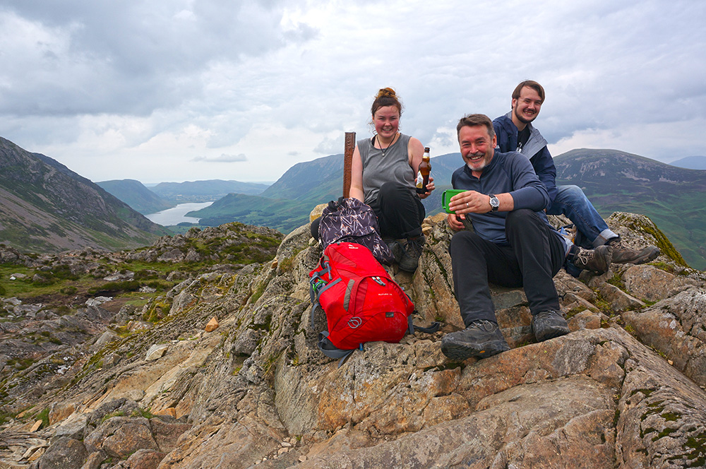
I set up the tripod I’d lugged with me on this walk and we took some lovely group photos of us celebrating my 214 completion with a bottle of Wainwright beer. I love walking solo but it was really nice to have Tilly and Max with me on this occasion.
We drank and ate and generally had a jolly time, staying at the summit for about half an hour.
After our summit celebrations, we clambered down into Scarth Gap and then followed the gently descending path to Buttermere lake, which we followed back to Buttermere village, arriving at Yew Tree Cottage at around 7.30pm.
That evening, we all went to the Bridge Hotel for a celebratory meal.
Tuesday
As predicted, the run of fine weather broke on Tuesday. We woke to low cloud and drizzle. Haystacks, bright and clear the previous evening was covered in a thick mantle of mist and fog.
When the kids arrived from the campsite, it was obvious that today was not a walking day, so we had a relaxed breakfast and decided on a trip to Keswick.
Wednesday
Wednesday set the weather pattern for the rest of the week, with rain at night and then improving conditions through the morning and fine afternoons. This was a good opportunity for the four of us to walk together and we decided on a clockwise circuit of Crummock Water, following the route in Vivienne Crow’s excellent book.
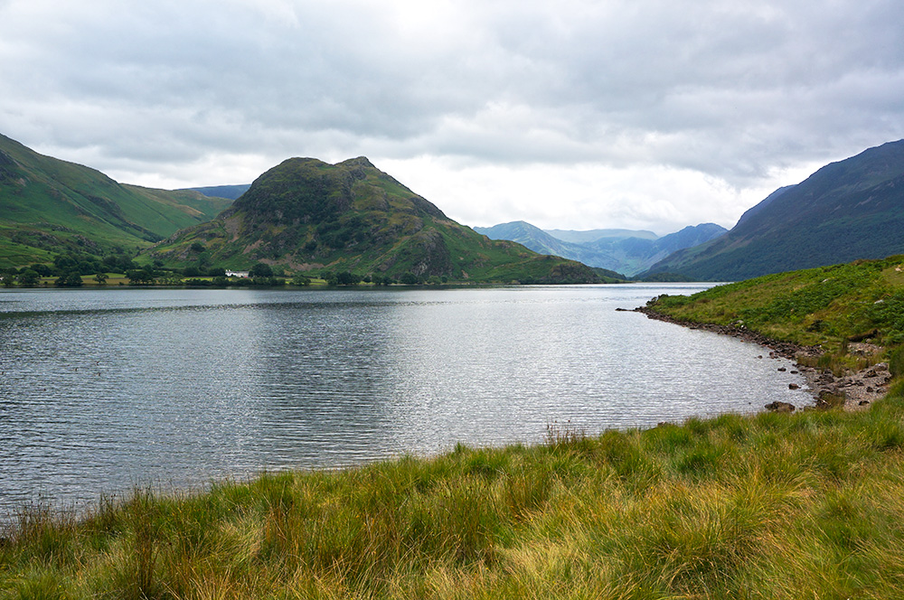
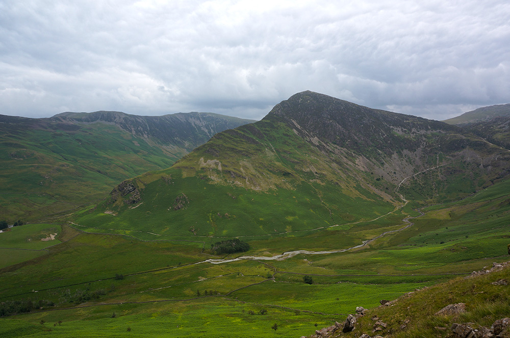
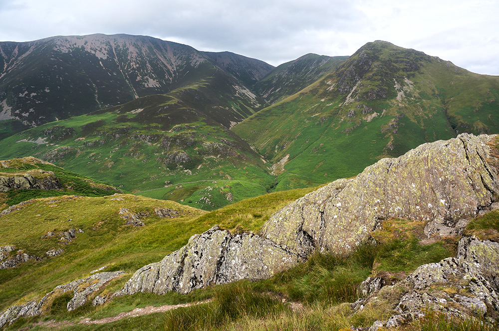
We packed a picnic lunch and set off just after eleven with the higher tops still shrouded in mist. However, it was a lovely, clear day with great views across the water to Rannedale Knotts and Grasmoor.
We had our lunch at the rocky spit of Low Ling Crag and then leisurely made or way north, staying a while at a pebbly cove where Hannah and Tilly threatened to swim but satisfied themselves with a paddle.
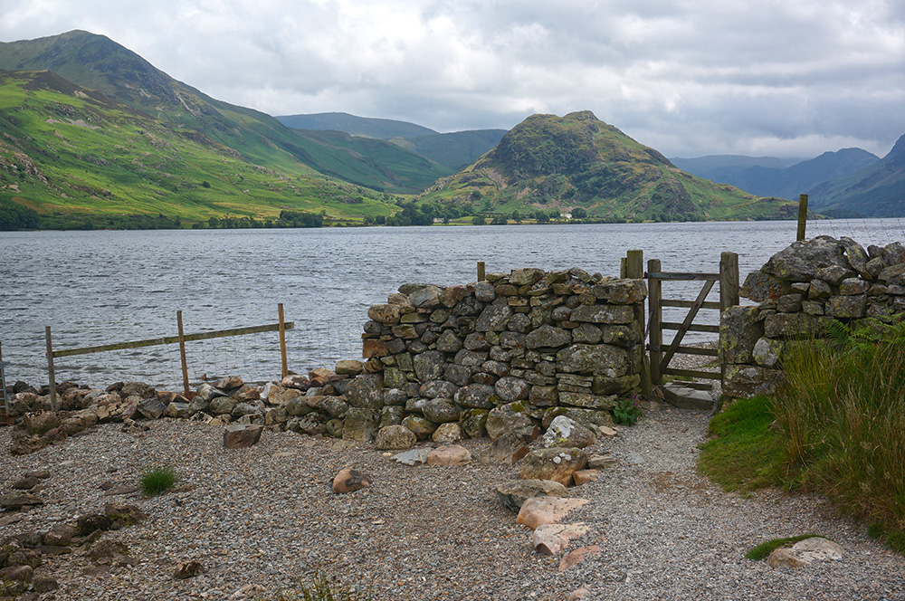
We rounded the north end of the lake, passing the pump house and the fish ladder and then took the path through Lanthwaite Wood and then to the road at Cinderdale Common.
I decided to keep with the original plan and follow the Squat Beck path to Rannerdale Knotts but it was a quarter to four and the other three were intent on getting to the tea room at Wilkinsyke Farm for cake. Not a bad objective, but I was already hankering to be high in the landscape again. So I waved them goodbye as they set off on the more direct route along the road.
As I climbed the lonely path and turned onto the Low Bank ridge path, I realised that completing the Wainwrights had not sated my appetite for walking in the fells and I was glad.
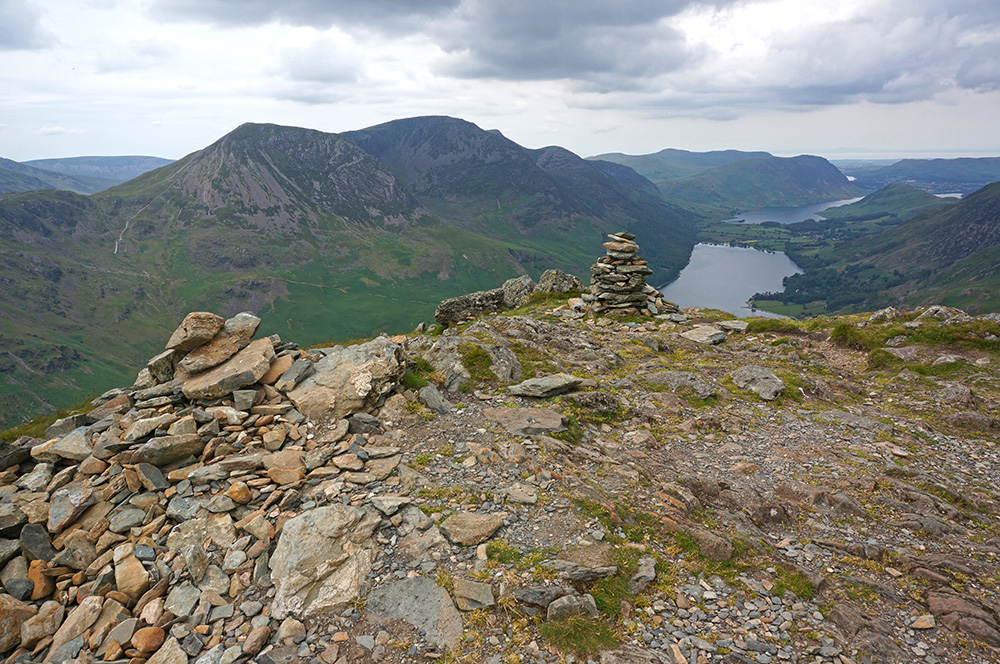
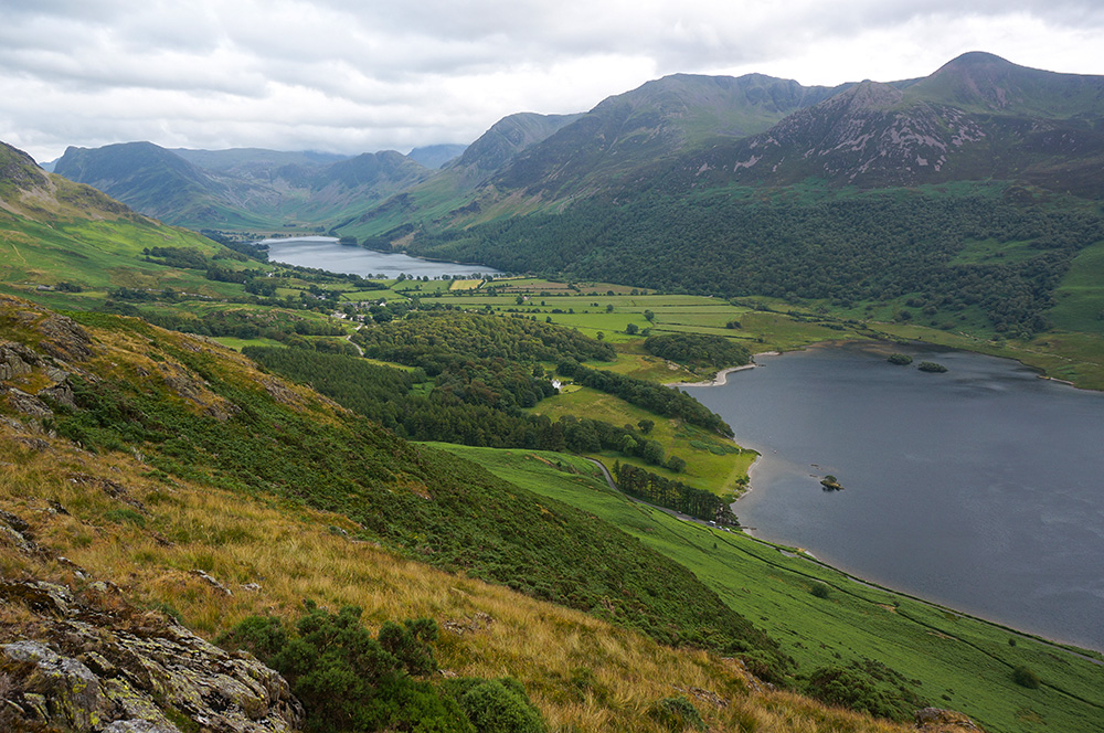
I reached the summit of Rannerdale Knotts (my second visit) at 5pm. The air was warm and still. In front of me, the views of Buttermere and Crummock Water were sublime and behind me the views of the Grasmoor Massif were majestic. On top of all that, I had the place to myself. Fell walking is not a numbers game, it’s about being in the outdoors and savouring the experience. However, I have to admit that bagging peaks is definitely the incentive that gets me out of my chair.
Thursday
Thursday was Max’s last day in the Lakes, he had a train to catch from Penrith that would get him back to Brighton at midnight. So we decided on a treat – a tour of Derwent Water by ferry.
The tour was great fun and we extended the treat with a lovely late lunch at the lakeside cafe.
After lunch, we visited Castlerigg stone circle and then I was dropped off near Wanthwaite Bridge and the others continued to Penrith railway station.
Although I’d completed the Wainwrights, I still had some loose ends to tidy up. Early in the challenge, I hadn’t properly recorded all the walks. Specifically, I hadn’t photographed the summits. In addition, I lost a couple of days of photographs when my SD card died at the top of Raven Crag. So I was short of a full set of summit photos, mainly from the Eastern Fells.
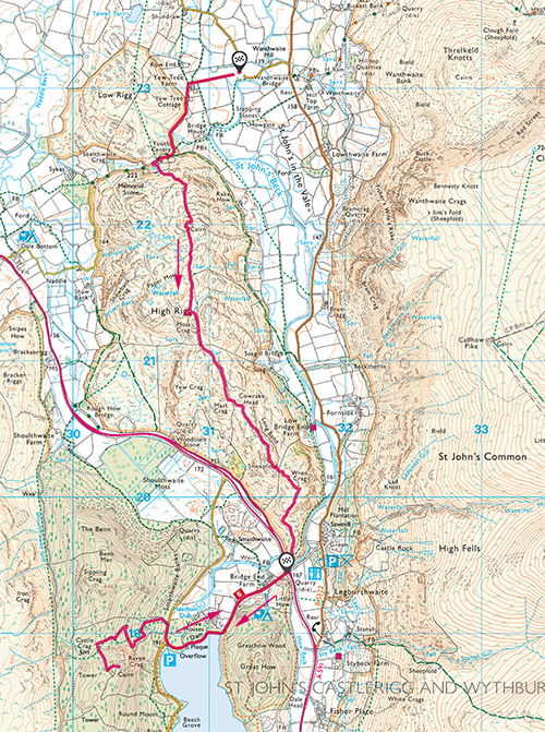
There were just two photos missing from the Central Fells, High Rigg and Raven Crag, so this would be a good opportunity to plug that gap. Having been dropped off, I would walk to High Rigg, then to Raven Crag, and be picked up by Hannah and Tilly on their return journey.
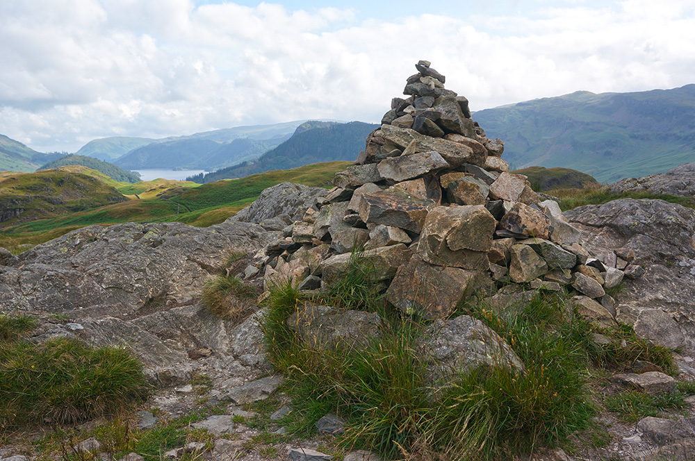
Surprisingly, everything went to plan. I remembered the climb to High Rigg from behind the youth centre and found the summit easily. The sky was still thick with cloud and the top of Blencathra was hidden but the air was warm and things looked promising.
I now had the freedom to do what I couldn’t do last time and walk south along High Rigg ridge, following the clear path to Wren Crag and then down to the A591.
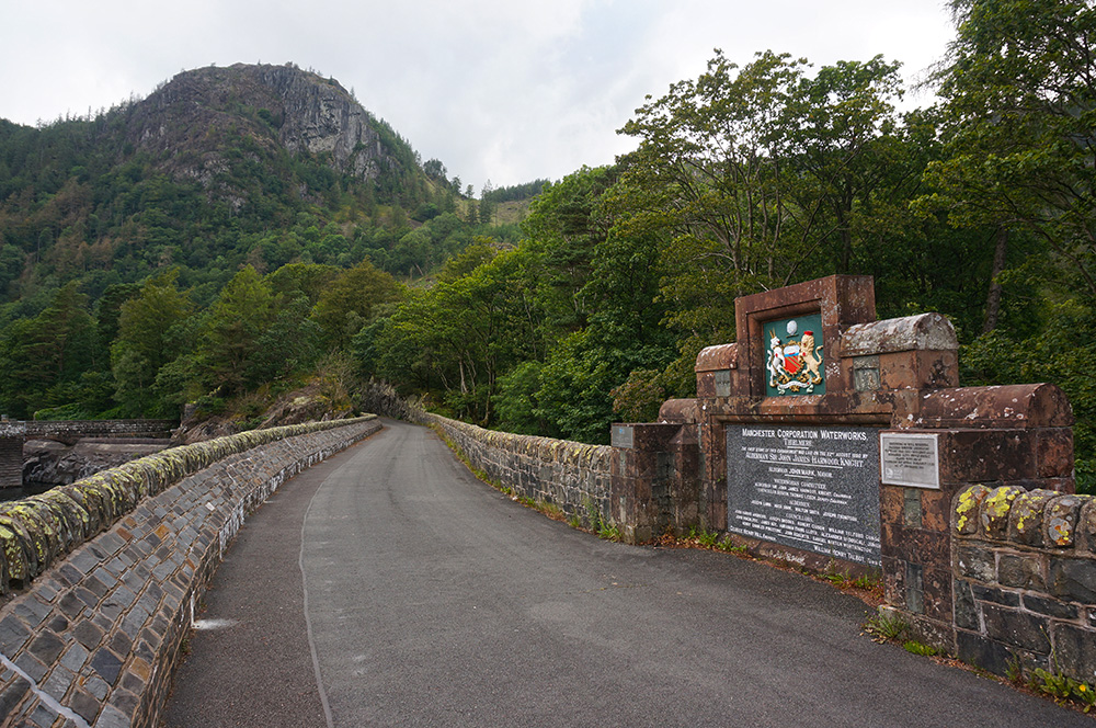
From Wren Crag, I could see a lot of civil engineering work going on at the head of the Thirlmere Reservoir. I subsequently discovered that this is all part of the West Cumbria water supplies project and is required because in 2022, the Environment Agency are to withdraw their water abstraction licence for Ennerdale Water. This requires a major new pipeline from Thirlmere to serve the region previously supplied from Ennerdale. Ennerdale is a very sensitive natural habitat and the abstraction licence is being withdrawn in order to protect the species that use it.
Having crossed the A591, I walked down the road and across the 130 year old dam to the footpath at the base of Raven Crag.
Things had changed a lot since my last visit, three years earlier. Much of the dense conifer woodland had been felled and the climb seemed a lot more pleasant than I remembered. There were open views back to High Rigg and to the Dodds beyond.

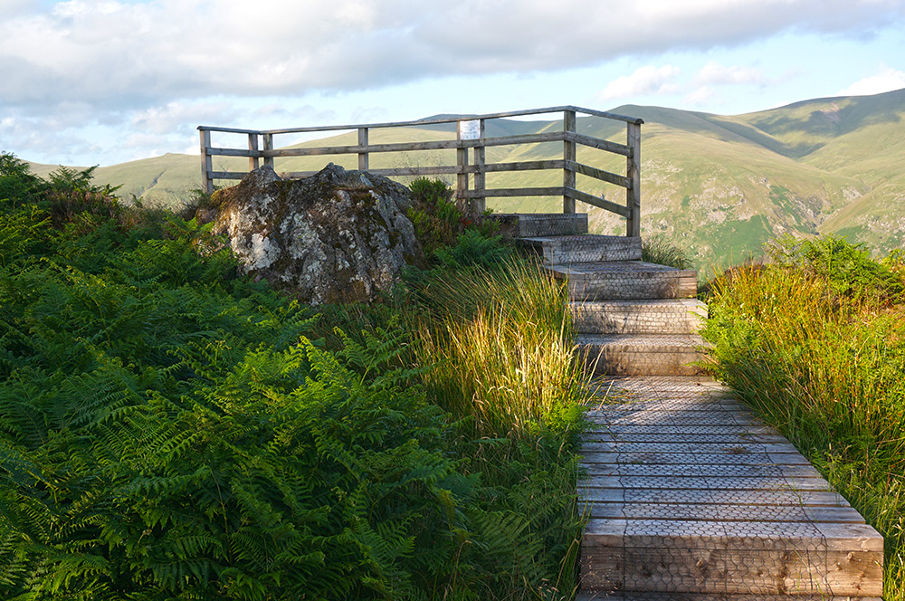
As I climbed, gaps in the cloud-cover became wider, revealing blue sky and the landscape was illuminated. I reached the summit just before 7pm and Thirlmere below looked stunning in the early evening sun.
The viewing platform at Raven Crag summit has divided opinion. Personally, I quite like it, although is does diminish the primacy of the actual summit rock. Nonetheless, it is the only Wainwright summit to be afforded such treatment, it is consistent with the surrounding landscape context and the view is certainly worthy of a platform.
After taking my fill of the views and atmosphere, I retraced my steps down to the dam and back to the road, arriving at our rendezvous point at the predicted time. Hannah and Tilly were already there, so I quickly took off my boots and we drove back to Buttermere.
Friday
The forecast was for fine, bright weather with a high cloud base and no rain. Hannah and Tilly were keen to see a little more of the Lakes and wanted to visit Beatrix Potter’s house at Hill Top. Needless to say, I saw an opportunity to fill in a few more gaps in my photographic record and, more importantly, to complete a walk I’d wanted to do for a while; The Fairfield Horseshoe.
Four years ago, when I started walking in the Lakes, I wasn’t sure of my fitness and was certainly a less confident navigator. As a result, I’d only completed this classic walk in sections and ever since, I’d been meaning to return and do it all in one go. Today would be my opportunity.
Hannah and Tilly dropped me off in Ambleside just after 1pm and I set off to repeat the approach (via High Sweden Bridge) that I’d taken on my very first walk, four years earlier. It was just as I’d remembered and I was amazed how familiar the route was despite having done it only once before.
Now I come to think about it, I can remember the details of all the fell walks I’ve done over the past four years even though I couldn’t tell you what I was doing this time last week. I guess it must be something to do with the level of concentration required while navigating and paying careful attention to the surrounding landscape.
High Sweden Bridge is a picturesque spot and there were several people having lunch as I passed through. From that point on, the route starts to ascend more steeply towards the ridge path and onwards to Low Pike (“low” is a relative term!).
This, first section of the walk is probably the toughest. It is steep in places (though not excessively), and there are rocky obstacles, walls and damp patches to negotiate. It’s not surprising that many people prefer to do this walk in a clockwise direction.
Low Pike is a surprisingly hard-won summit, perched as it is atop a steep, rocky climb. Many walkers simply by-pass the top. The most striking thing about it is the dry-stone-wall that runs across the summit to the west of the cairn. There are many mad-looking walls in the Lakes, and this is certainly one of them.
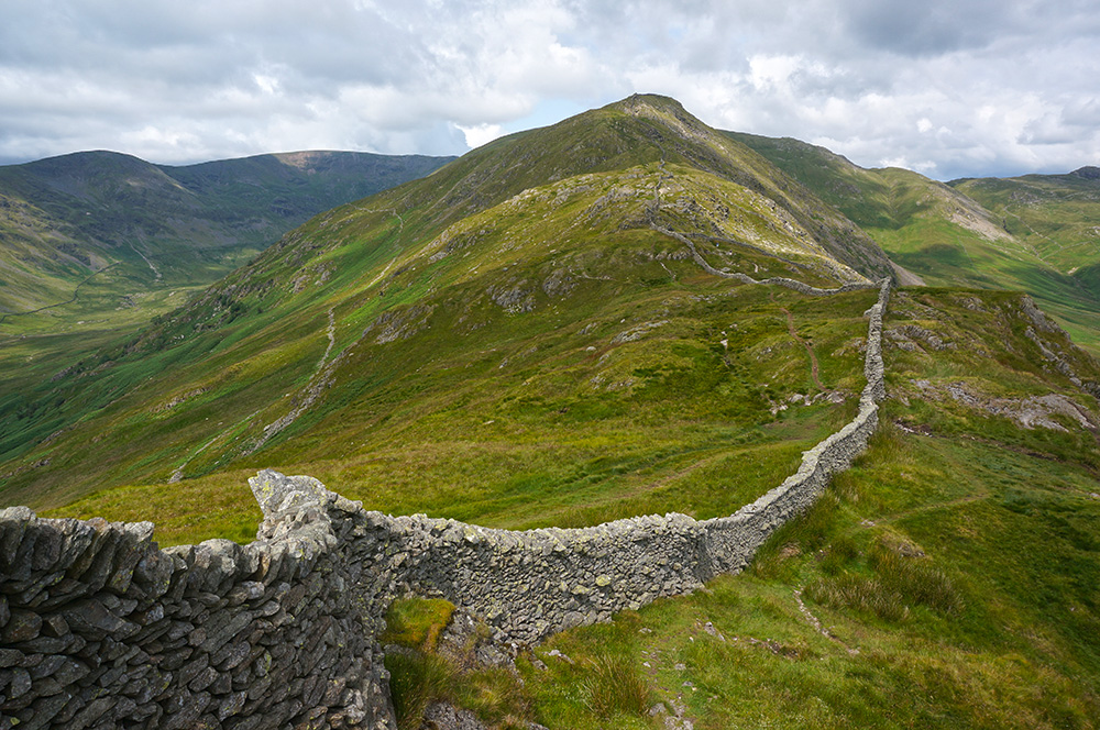
From Low Pike, the path to High Pike along the ridge is clearly visible and for a while, the way ahead flattens out. The only real difficulty is in deciding which side of the wall affords the easiest route.
Eventually, a steep and rocky scramble presents itself as a way to the summit of High Pike. In fact, it’s the last tricky bit of the walk. From this point on, there’s little need for the use of hands on rock – with the possible exception of the climb to Hart Crag summit.
I took a break for lunch at High Pike summit and sat against the ridge wall, which provided some shade and a little shelter from the breeze. The day was hot and it was good to be out of the sun for a while.
A couple with a small dog happened by while I was eating. The dog made a nuisance of itself by fussing around me and eventually sticking it’s head in my bag, presumably having smelled food. The owners made no effort to control the dog until I shooed it away. At which point, the woman said “you haven’t got any food hanging about have you?”, to which I replied, “only my lunch”. She then rolled her eyes and said “oh well!”, meaning, what did I expect?
I am pleased to say that such encounters are rare on the fells but you do have to expect that on popular routes, like this one, you are more likely to encounter rudeness.
Once High Pike is reached, the main climb is over and the route forward to Dove Crag is an easy stroll, a rise of only 140m over a kilometre and a half.
Dove Crag is a classic summit, with a generous cairn sitting on a substantial rock plinth and at a height where views have opened out sufficiently to see into the distance on all points of the compass – and today, the air was clear.
Over to the west, I could see the Western Fells shrouded in mist, just as they had been that morning when we left Buttermere. But here in the east there were clear skies. We’d obviously made the right decision with our plans as I was pretty sure our Buttermere base would still have been overcast.
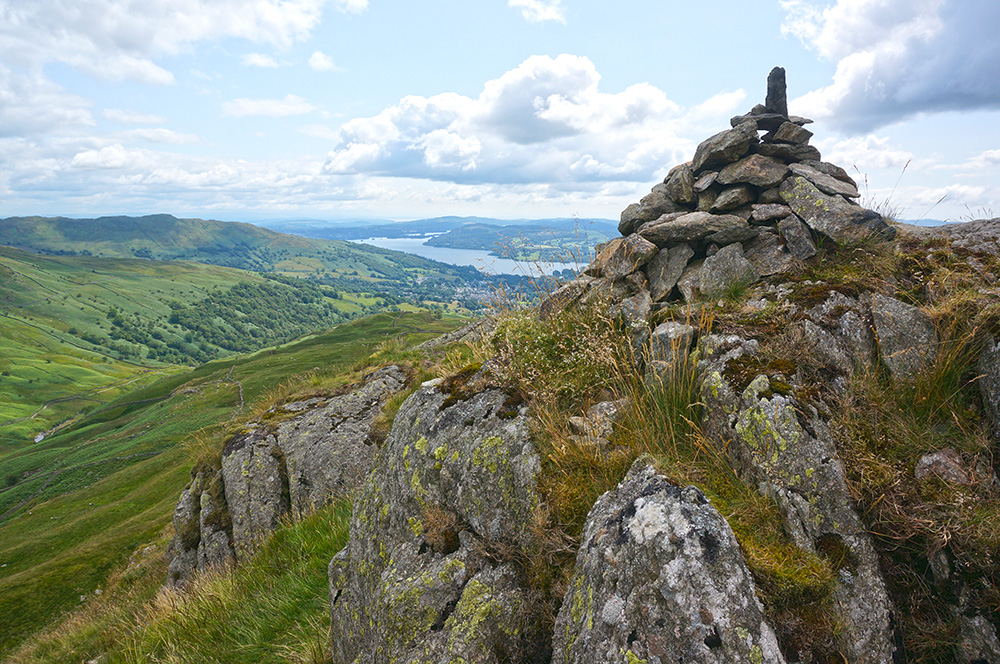
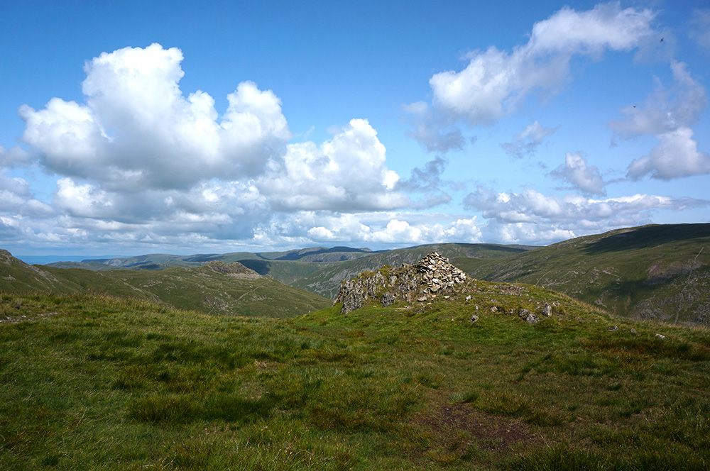
A few hundred metres on from Dove Crag summit is another cairn that, I think, is one of the most picturesque in the district. It’s a viewpoint cairn and from it, there are lovely views down into Deepdale and beyond. However, it’s the cairn itself that catches the eye. I photographed it on my first visit, four years earlier and that photograph has become one of the defining images of my walks. I photographed it again, for good measure.
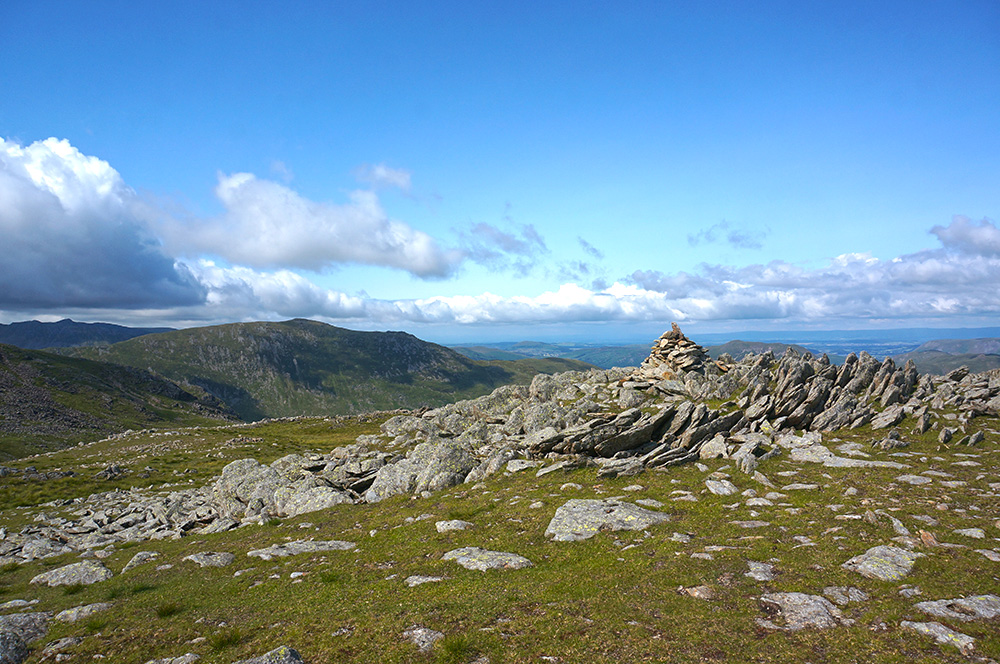
The path to Hart Crag is clear and pretty easy until the final pull to the summit. In fact, this entire horseshoe walk requires very little navigational nouse. The summit itself, is more tricky, there being two cairns at either end of a bouldery ridge, neither one looking higher than the other. A quick consultation with the guide established that the south-east cairn is the accepted top but, for some reason I contrived to photograph the north-west top (roll eyes emoji).
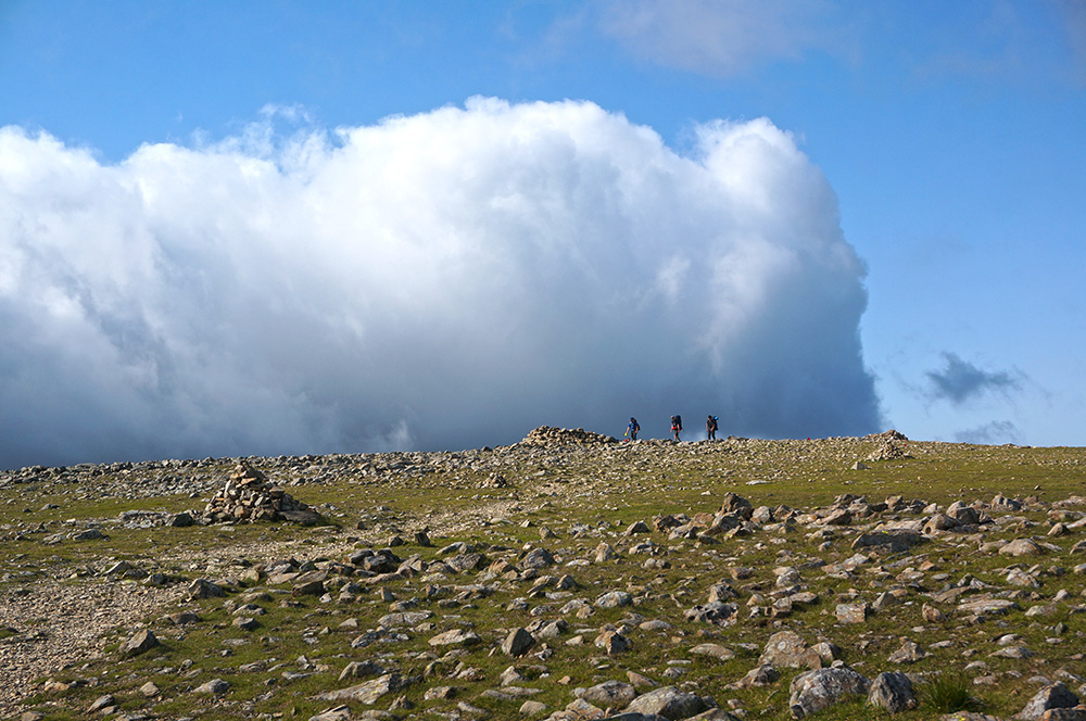
Once again, the way ahead is clear, a short drop and then a climb onto the broad top of Fairfield, the highest point on the walk. Wainwright describes the top as “an extensive grassy plateau” although he does concede that “The actual top is flat and its surface is too rough to bear the imprint of paths”. Mark Richards agrees, saying, “The fell name suggests a cricket pitch, and while there are areas of open ground… the plateau simply bristles with rock, sufficient to stifle an easy stride”.
It is a curious place with an open aspect and on previous visits it has been busy with travellers, it being a crossroads of several popular routes. Today though, I had the place to myself. I’ve noticed that most people like to get their walking done early. I saw plenty of people about at the beginning of the walk but by late afternoon (it was now 5pm), almost everyone else had gone. In some ways, it makes sense – it’s easy to underestimate the time it takes for a walk and the weather can be unpredictable. But when the days are long, it’s difficult to beat the effect of the early-evening sun on the landscape as shadows deepen and lengthen.
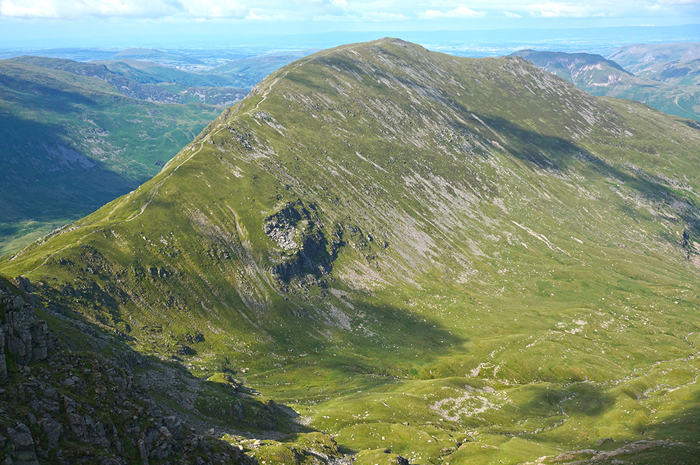
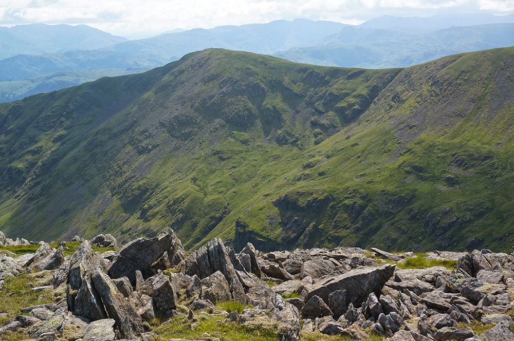
From Fairfield, there are fantastic views across to the whale-back of St. Sunday Crag and had I not been on a mission to complete the horseshoe, I would have been sorely tempted to change my route.
I was about half-way round the walk and it had taken four hours so far but I knew it wouldn’t take another four to do the second half. In fact, it took less than three. In truth, the second leg is pretty easy with a long and gentle drop along the western ridge of the horseshoe. It’s certainly not as interesting as the first leg but the evening light, the clear views to Lake Windermere and the solitude made it very enjoyable.
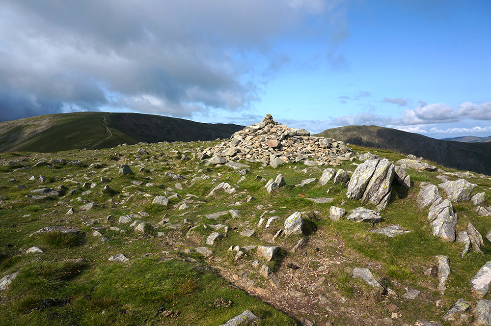
First up on the return leg is Great Rigg, not much more than a short hop from Fairfield and marked by a generous and shapely cairn. from which there are great views down into Rydal Valley and ahead to Ambleside.
The next high point on the descent is more debatable. Wainwright chooses to include Heron Pike (south top) but, in truth, it’s a pale substitute for the north top at Erne Crag, which is actually 9m higher. To be fair, Wainwright says of Heron Pike summit, “There is no cairn and nothing of interest except the view. The nameless north summit is better: at least it has a wall and a cairn and a few rocks suitable for backrests”. Mark Richards takes the more pragmatic view and awards summit status to the north top in his guide.
Heron Pike is notable because it forms the southern end of the long flatish ridge from Fairfield before it begins to fall more steeply towards Nab Scar. In truth, the surroundings become more interesting as the descent steepens and Lord Crag is a lovely section of the walk.
Nab Scar summit is not so easy to find. It’s not on the main path but on higher ground to the west of it. Unlike the other summits on this walk, the top is not indicated on the Ordnance Survey map although a cairn is indicated. Fortunately, the cairn is significant in size, so once found, it is unmistakable.
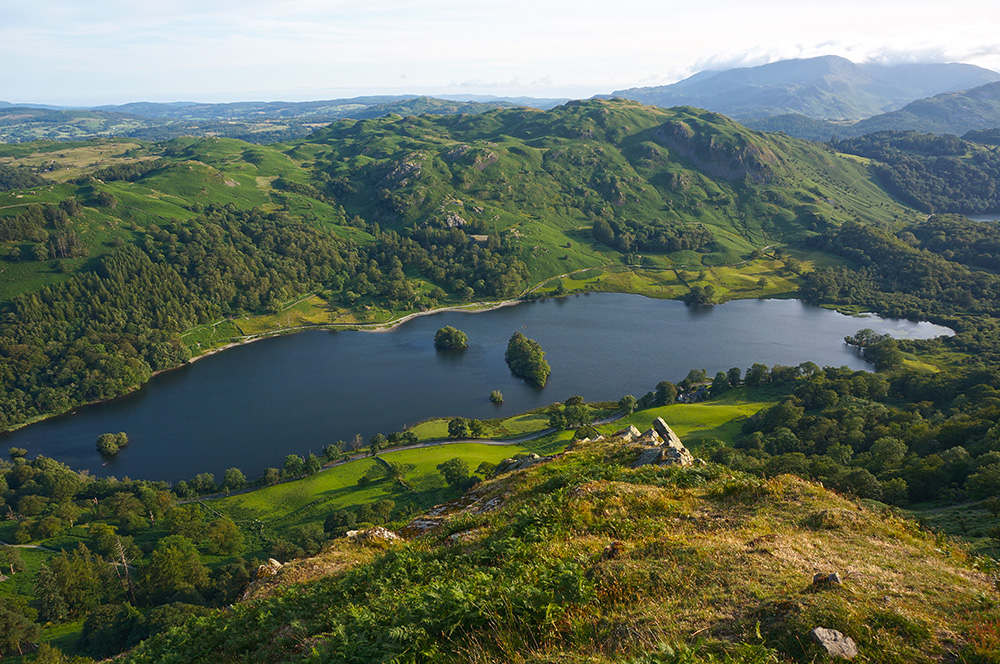
There are excellent views west from Nab Scar down to Rydal Water and across to Loughrigg Fell, looking very lumpy in the low, evening sun. Cloud was still hugging the tops of the Western Fells and I knew I’d definitely had the best of the weather.
After Nab Scar, it’s a steep drop down to Rydal and fortunately, much of it is pitched to prevent excessive erosion on this busy route. Not today though; I am happy to report that since leaving Fairfield, I had seen precisely two people.
I arrived at Pelter Bridge car park at a quarter to eight, where Hannah and Tilly were waiting with the car. They’d had an enjoyable day visiting Hill Top and didn’t mind that I’d arrived back 15 minutes later that predicted.
Saturday
Saturday was going home day and after we’d packed the car and cleaned the cottage, we took a walk down to Buttermere Lake to say goodbye. We’d planned to make a relaxed journey back and we began by visiting the very lovely Keld Chapel near Shap. After a make-do lunch, we began the long journey home.∗
7th July 2019
Buttermere Shore Circuit
8th July 2019
Fleetwith Pike (648m)
Haystacks (598m)**
10th July 2019
Crummock Water Circuit
Rannerdale Knotts (355m)*
11th July 2019
High Rigg (355m)*
Raven Crag (463m)*
12th July 2019
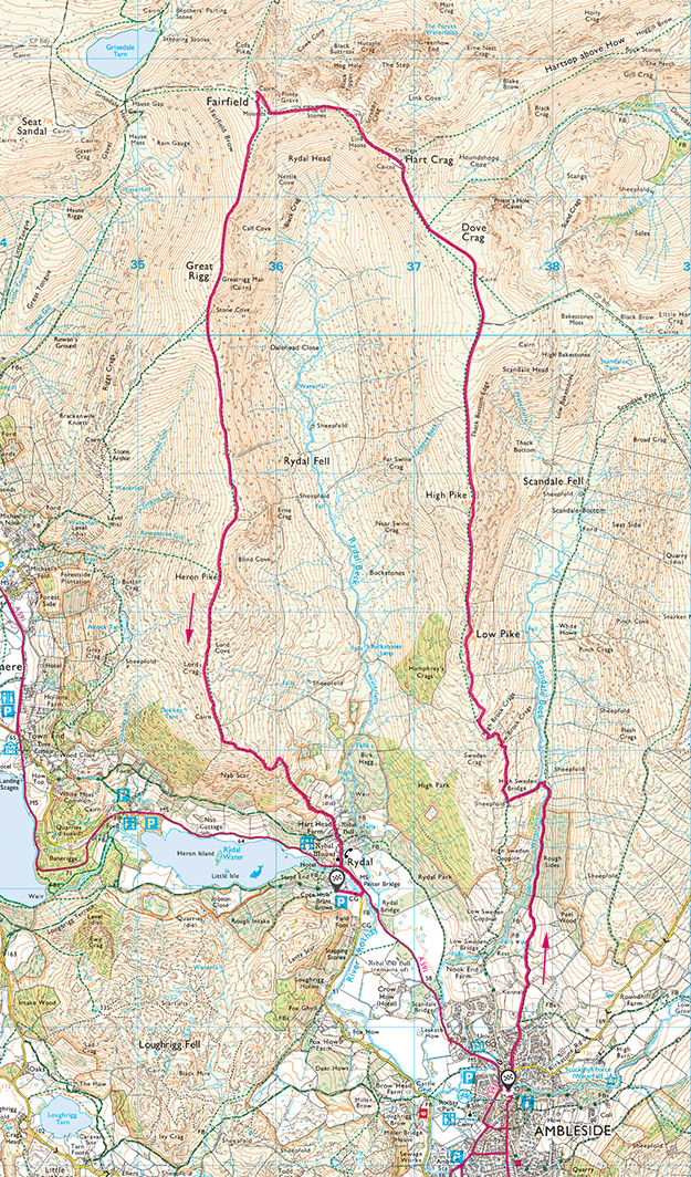
Fairfield Horseshoe
Low Pike (507m)*
High Pike (656m)*
Dove Crag (792m)*
Hart Crag (822m)*
Fairfield (873m)*
Great Rigg (767m)*
Heron Pike (612m)*
Nab Scar (455m)*
* Previously Bagged
** The final fell of the 214 Wainwrights
So that’s it. I’ve completed the Wainwrights and I feel like my fell walking apprenticeship is over. I’ve passed the test and now I can choose any walk I like (almost). There is the small matter of a few outstanding summit photos and the additional Fellranger Fells. I’m hoping to complete the photographic record on my next trip in August, weather permitting and the Fellranger Fells can wait until next year. I’m no longer in a rush!