
Teaching is now over for yet another academic year (my 23rd!) and the Lakeland Fells once again beckoned as a curative for the increasing stresses and strains of academic life.
I’m now happy to concede that these post-teaching trips to the Lakes, which have become a regular feature of my fell-walking challenge, are now an important part of my mental well-being regime.
Under normal circumstances, planning a trip to the Lake District over the Easter bank holiday weekend would be considered a special form of madness. But on this occasion, I had two good reasons. I usually plan my Spring trip in the week immediately following the end of teaching but this year I booked late (3rd of January) and couldn’t find any suitable accommodation in that week. Secondly, I had a long-standing agreement that I would try to be there when my friend, Remco van Essen was also in the Lakes. Remco caught the fell-walking bug after his previous visit in July 2018 and had been working on improving his fitness in preparation for this weekend.
I knew it would be busy, especially as the weather forecast was good, but I figured that since most of the walking would take place out in the quieter Western Lakes, we could probably avoid the worst of the crowds.
Good Friday
I set off from Southport on a bright and sunny morning and drove north. I started early and hoped that I might miss the worst of the bank holiday traffic. As it happened, the M6 was mainly clear with just a couple of brief hold-ups, so I arrived at Oxenholme in perfect time to meet Remco from the London train at 10.30am.
I figured that since we were in the South Lakes, we might just as well drive out west and take on one of the walks I’d planned. Most of the planned walks for the week were “moderate” walks so I didn’t think too carefully about which one to start with and Remco seemed to be up for a challenge.
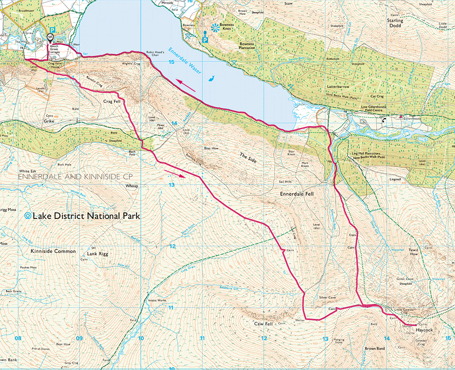
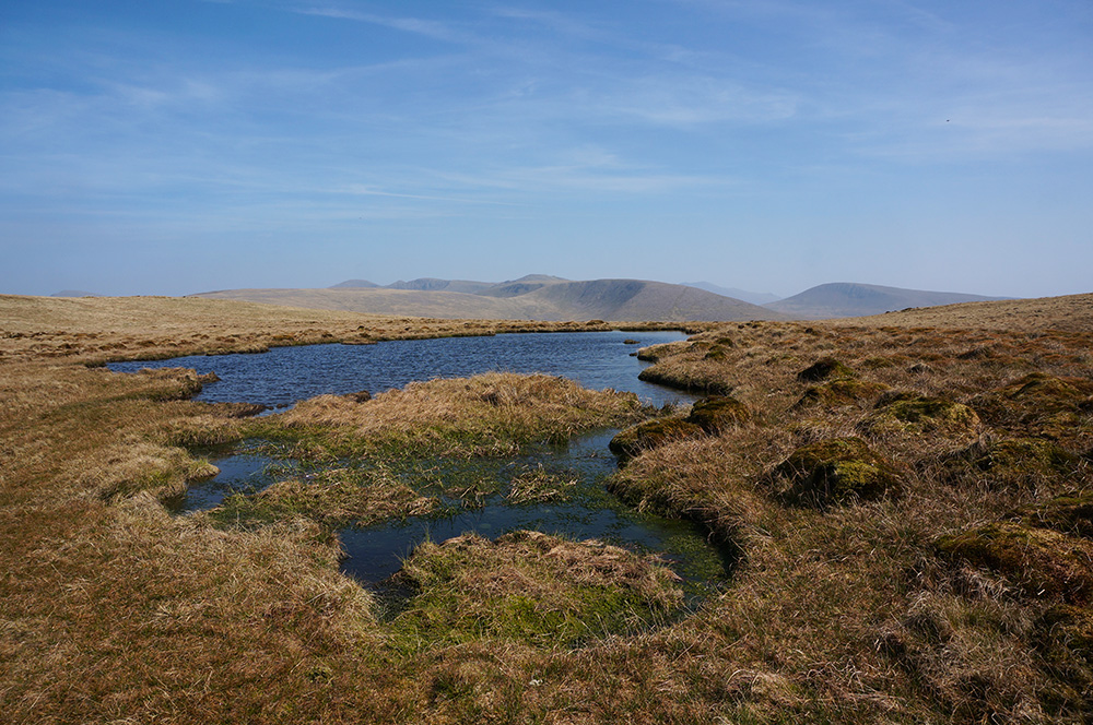
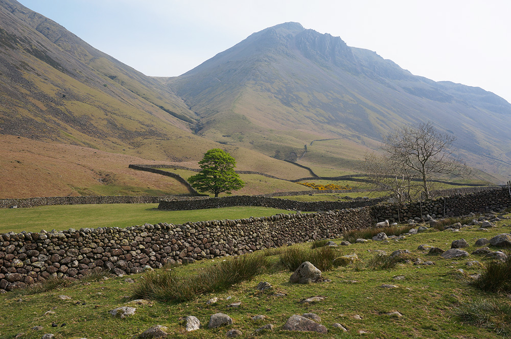
We drove to Bleach Green car park at Ennerdale. Despite being one of the quieter parts of the Lakes, it was busy but we found a parking space on the road, not far from the car park.
After booting up and charging our water bottles, we set off for Crag Fell. It was a lovely warm day and it was good to begin the climb through shady woodland.
A few minutes into the climb, I noticed that Remco was speeding ahead and I suggested he might want to pace himself, although I took this as a good sign. Maybe he had upped his fitness since last year? Twenty minutes later, I had my answer. The walk had slowed and there were plenty of drinking stops.
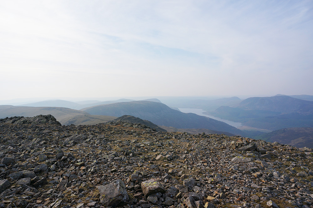
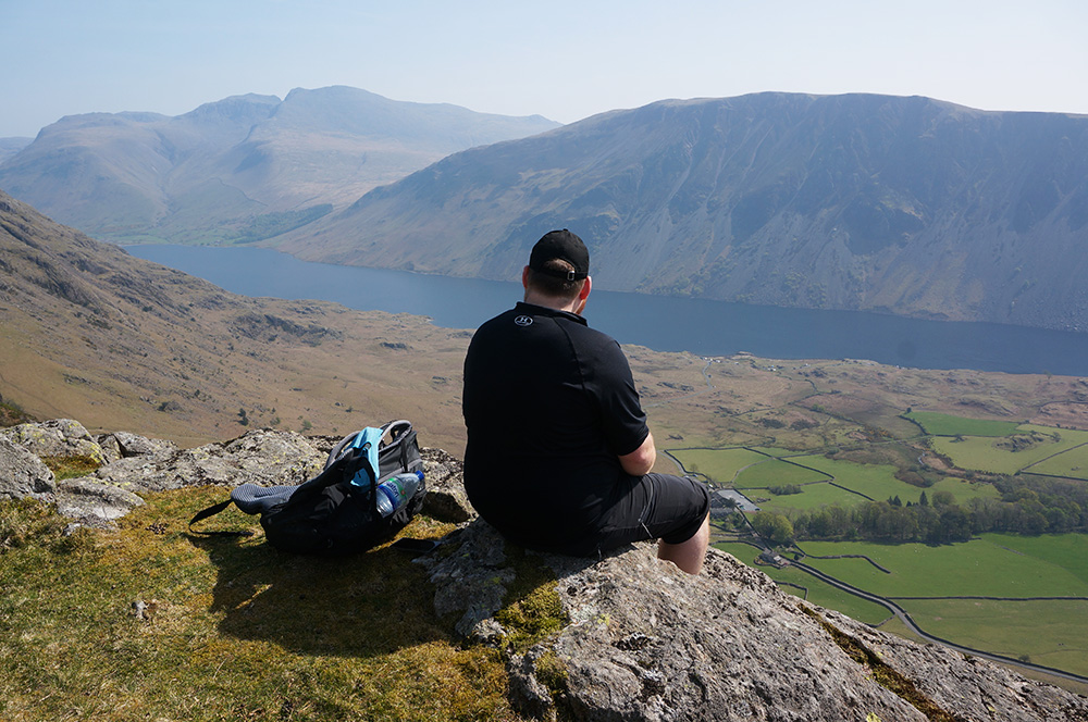
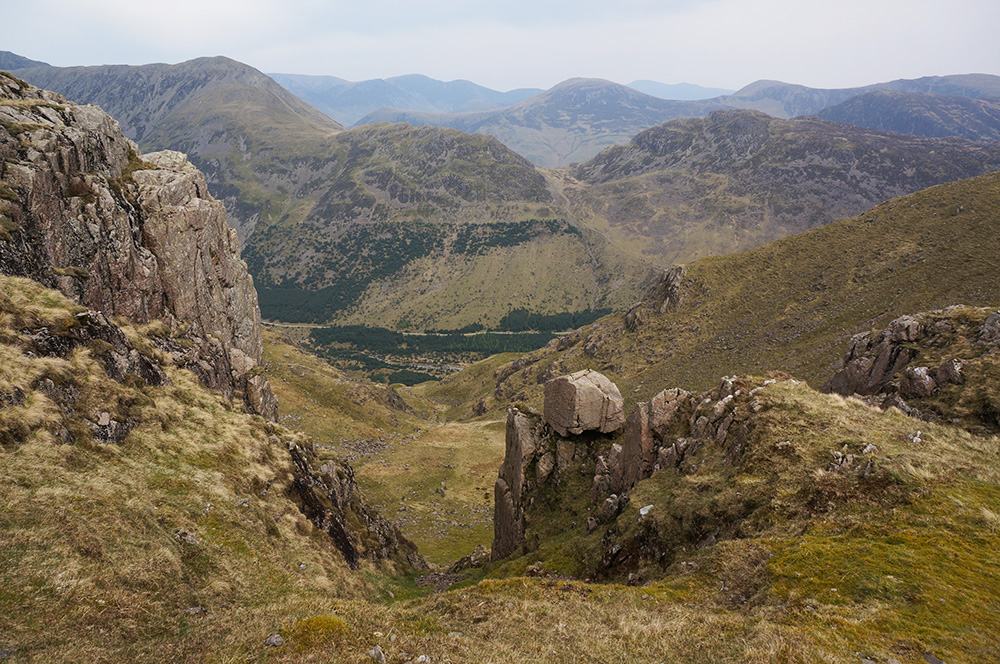
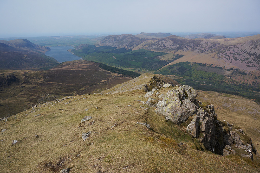
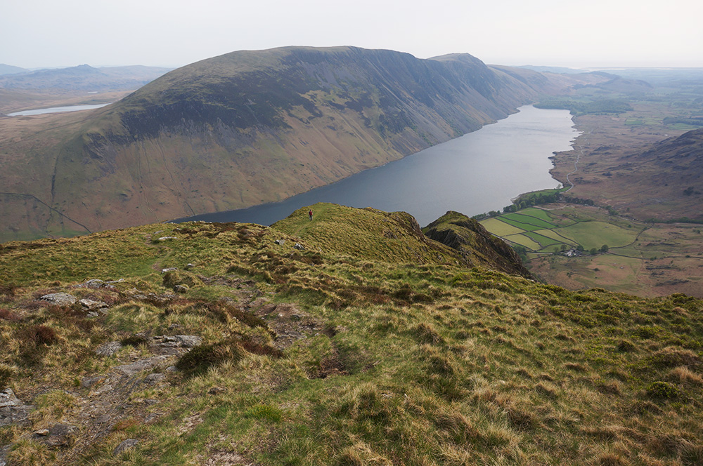
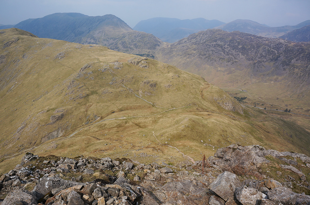
Above the woodland the ground was less steep and after a slightly longer than planned walk, we reached Crag Fell with its wonderful view over Ennerdale Water. I immediately felt good, as if the landscape were saying “welcome back”. We stopped there for lunch and sat admiring the view, a just reward for the steep climb.
Our next stop was four kilometres away and after the drop down into a spooky, felled woodland landscape, it was a tough but steady uphill trudge all the way to Iron Crag.
Although not a Wainwright, Iron Crag is a Fellranger fell and a thoroughly pleasant place to be on a hot, sunny afternoon. However, it was now 4pm and we’d been walking for about four hours and were nowhere near half-way. We needed to press on because we’d only have good daylight until 8.30pm.
Our next stop, Caw Fell was just over a kilometre away but to get there we had to negotiate a punishingly steep grassy slope. I found it really hard going and I think it just about broke Remco. It took us almost an hour.
We arrived at Caw Fell summit at 5pm and I could see that Remco was in no fit state to continue to Haycock so I suggested we walk to the point where our route began it’s descent to Ennerdale Water where he could wait while I did a quick-ish there-and-back bagging of Haycock. This turned out to be a very good idea.
I made it to Haycock and back to our meeting place in 40 minutes, having spent an interesting 10 minutes at the summit, the highest point of the day. Remco had already started his descent, hoping to make up some time, so I followed on.
At this point on the walk, there isn’t an obvious path and I’d rather blithely suggested that he could probably just follow his nose until a path emerged.
I started down and after maybe ten minutes, saw Remco ahead, standing at the top of a crag and wondering which way to go. I had a vague memory that a path ran to the left of the crag and I called to him and pointed in the right direction. After a bit of rock-hopping, we were both on a sure path down a tongue between Silvercove Beck and Deep Gill.
The descent to Ennerdale is about three kilometres and after a few trips and stumbles, we made it to the lake by 7.30pm – we had about an hour of daylight to walk the length of Ennerdale Water and back to the car, a distance of about four kilometres.
Naturally, we had torches with us but I’d rather not have to use them as it would signify rather poor planning.
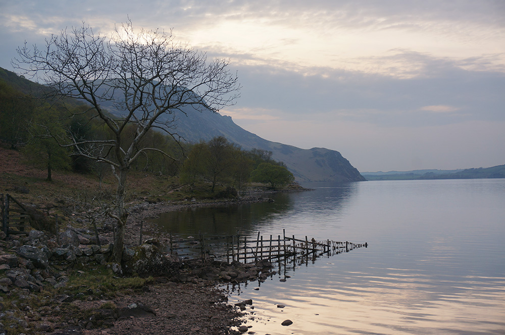
We continued on what, in other circumstances, would be a rather lovely walk along the south shore of the lake.
It was a clear path, rough in places but Remco was very slow and needed a lot of encouragement. He really wasn’t enjoying himself and I had to apologise for being too ambitious on our first walk of the weekend.
By 8.30pm the light was fading fast but we weren’t so far away and we arrived back at the car by 9pm with just enough light to see without a torch.
We drove to YHA Ambleside and arrived just after 10pm, checked in and had a customary pint of shandy. Neither of us felt particularly hungry, so we ate some snacks and went to bed.
Saturday
The next morning, we both sat down to a “full English” breakfast and planned the day ahead. Originally, I’d thought today might be a good day for the Fairfield Horseshoe but, being a long walk, that didn’t seem like such a good idea now. We decided that another, shorter walk in the Western Fells would be a best. It bagged me a few more Wainwrights and it would be manageable for Remco.
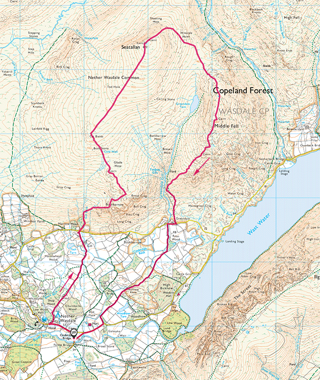
So, smartly after breakfast, we set off for Nether Wasdale via Coniston and Ulpha. Of course the route via Wrynose and Hardknott passes is shorter but I really don’t enjoy that journey and it was a beautiful morning for a more gentle drive.
We arrived at the small and largely unknown car park at Nether Wasdale just after 10am and set off on a gentle stroll across farmland. We were headed for Buckbarrow.

Ahead, we could see what we assumed was our destination, a large, craggy outcrop with an obvious summit, but on this approach, as with many others, the true top is not visible from the valley and what we were looking at was Bull Crag, not Buckbarrow.
We arrived at the foot of the fell and prepared for the obligatory steep climb by drinking water and adjusting clothing and backpack straps.
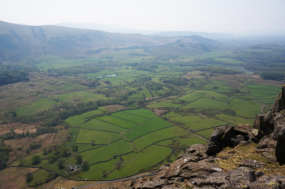
The first climb on any fell walk is always the longest and steepest – I guess it’s what puts a lot of people off. Sometimes there is no reward for your efforts until reaching the top but on this occasion we were constantly rewarded by a view over Wasdale that kept getting bigger the higher we climbed.
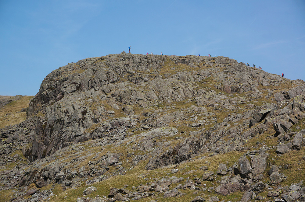
A few walkers had passed us on the way up but the place still felt quite quiet until, about three quarters of the way up to Bull Crag, we were engulfed by a party of around 20 walkers. All of a sudden, this remote-ish part of the Lakes felt like Piccadilly Circus. They were a cheery bunch who were all staying at Wasdale Hall, the YHA on the shore of Wast Water. Not wanting to get tied up with this throng and since it was nearing lunchtime, Remco and I took some time out and rested with a snack and a drink at Bull Crag. The view from here, down into Wasdale and along Wast Water is excellent. From our lunchtime perch, we watched as the walking party summited Buckbarrow.
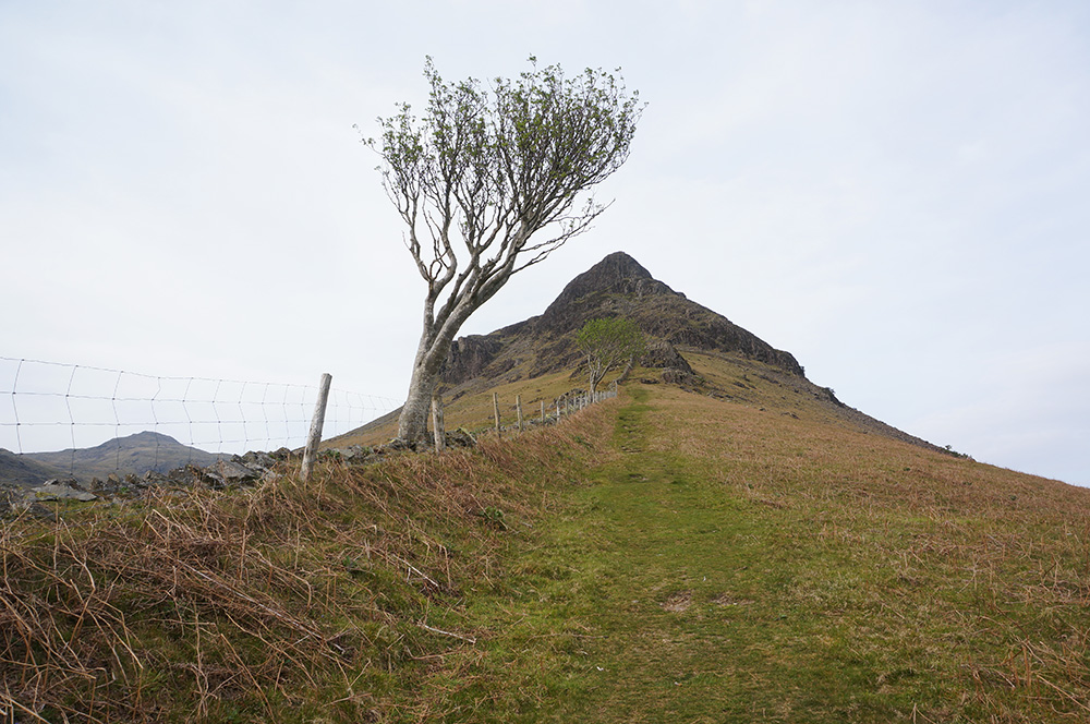
Shortly afterwards, we were on our way to Buckbarrow and arrived at the summit cairn just after 1pm. It’s always a good feeling to make the first Wainwright of the day; it’s usually a sign that the worst of the climb is over and that any other uphill sections only come in short bursts, between sections of easy gradient. That certainly was the case on this walk.
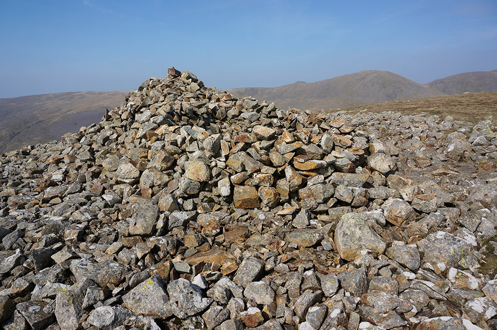
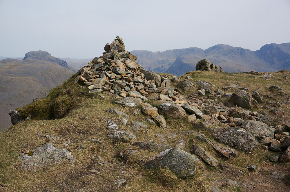
Our next objective was Seatallan and unlike the ambiguity of Bull Crag/Buckbarrow, there was no mistaking the route or the destination. A clear path showed the way and the walk was punctuated by some rather lovely cairns, a beautifully build cone at Glade How and another, more informal cairn at the right-hand turn of Cat Beilds. It’s a distance of just under 3km and for most of that, the incline is relatively easy, although our going was still relatively slow. We reached the OS trig column at Seatallan, the half-way point on our walk, at a quarter to three.
After a brief stop at the (almost) flat field of a summit, we headed off north-west, looking towards Great Gable and the Scafell Massif with the whale-back hump of Yewbarrow in the foreground. The path, leading down to the saddle between Seatallan and Hayckock was quite clear but we were looking for a right-hand path over Winscale Hows that would take us round to Middle Fell.
Eventually, it became clear that if the path actually existed, we’d missed it and we were now losing height unnecessarily. Fortunately, Remco was some way behind so I signalled to him to stop and I made my way back up. We walked back up the slope a little more to the point where I thought the path should be. There wasn’t one so we set off over open fell, contouring over Winscale Hows and then down to the saddle at the head of Greendale Tarn.

It was still a lovely day but I could see that Remco was flagging and he really wasn’t looking forward to the climb up onto Middle Fell. After a short break and some words of encouragement, we set off on the climb, taking our time.
A third of the way up, our mission was interrupted by what appeared to be a strange person shouting to us from about 100m away. Having caught our attention, he bound towards us and soon met us on the path. He explained that he and his family had walked up to Greendale Tarn and was wondering if there was a way back via Middle Fell. I explained that there was but that since he had two small children, they might find it a bit tough. I showed him the route on my phone and he thanked us and bound off again. It felt like one of those strange encounters in the Pointless Forest that Oblio has in Harry Nilsson’s The Point!
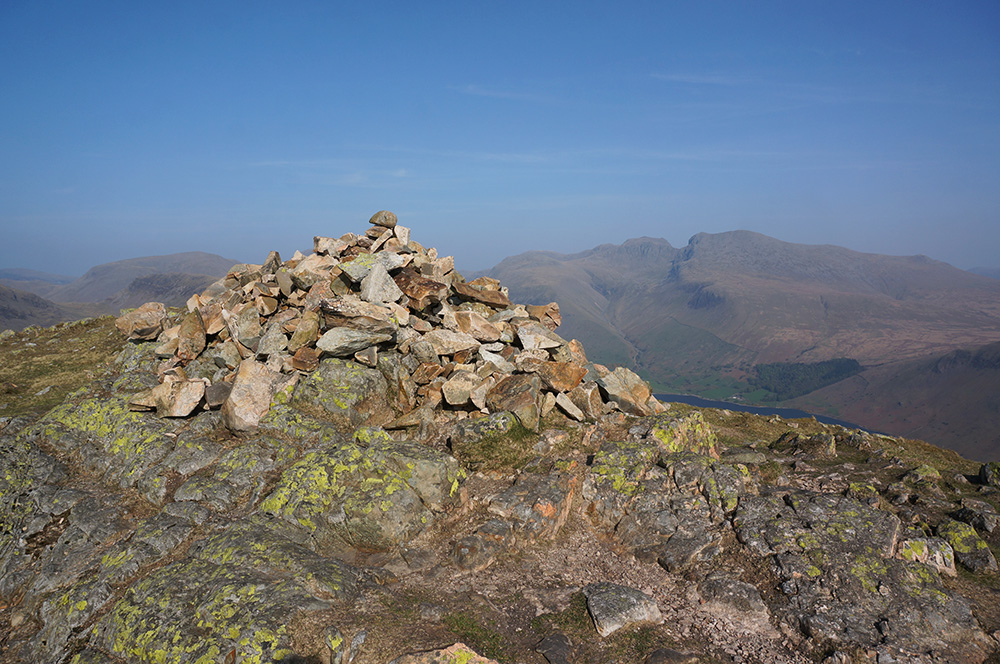
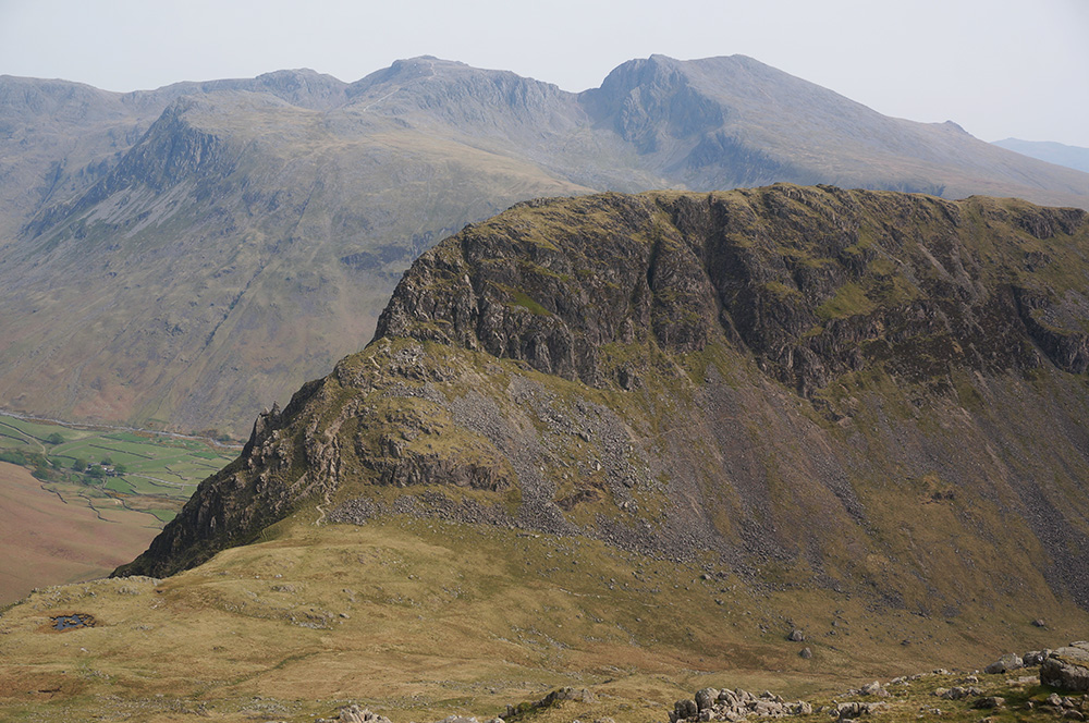
After a few more struggles, we reached Middle Fell summit at 4.30pm. The sun was moving into the west and casting it’s light directly upon the Scafells and Wast Water screes. It was a beautiful view and the glowing lime-green lichen on the cairn rocks gave the whole place a super-real feeling. I could easily have stayed in this place for hours but we were still just two thirds of our way round. Nonetheless, we took a well-earned break and soaked in the amazing atmosphere, knowing that it would be downhill all the way back to the car.

As it happened, the route back was pretty straightforward and well marked and once we were back at the road, there was a 3km gentle stroll across farmland and back to the car park and Nether Wasdale, where we arrived around 7pm.
This had been the second of two tough days for Remco, so we decided to return to Ambleside via Keswick and pick up some treats for supper at Booths.
Easter Sunday
Remco had decided he needed a rest day and wanted to take a boat on Windermere and see something of Ambleside, so I left him to it and set off early again, headed for the remotest of the Western Fells, Grike and Lank Rigg.
I drove to the Scaly Moss parking area near Ennerdale Bridge via Keswick and arrived to find several cars already there but with just enough room for me to park sensibly.
Surprisingly, I had a mobile signal, so I phoned Hannah to wish her happy Easter and sent texts to Max and to Tilly.
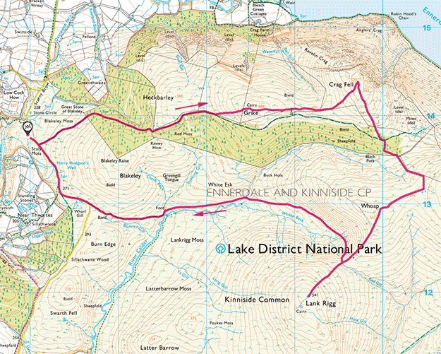
I lazily put on my boots, packed my bag and set off on another walk in the Western Fells but not feeling my usual self. The walk to Grike was mainly on well-made paths except for the final pull up a steep, grassy slope. The weather was good (again) but I was feeling a little low by the time I arrived at the summit. It was a drab place with nothing much of a view. Even the fact that the cairn stones were taken from a nearby tumulus didn’t interest me. As Wainwright put it, “Diligent search will not reveal anything else of interest”.
I took my usual summit photos and plodded on towards a second meeting in three days with Crag Fell, except that I almost didn’t. As I dropped down from Grike, my spirits fell further and I realised I was experiencing a sort of decompression of mood that I’d become used to in recent years after the end of teaching and the release of stress.
I considered giving Crag Fell a body-swerve and heading directly over to Lank Rigg so I could get out of the place as soon as possible. I checked the map to ensure there was a sensible route and I almost took it.
From somewhere I summoned the strength to keep going – in truth, it was easier to put my head down and just keep walking in a straight line than to veer off and find a new route. But I’m so glad that I stuck to my original plan.
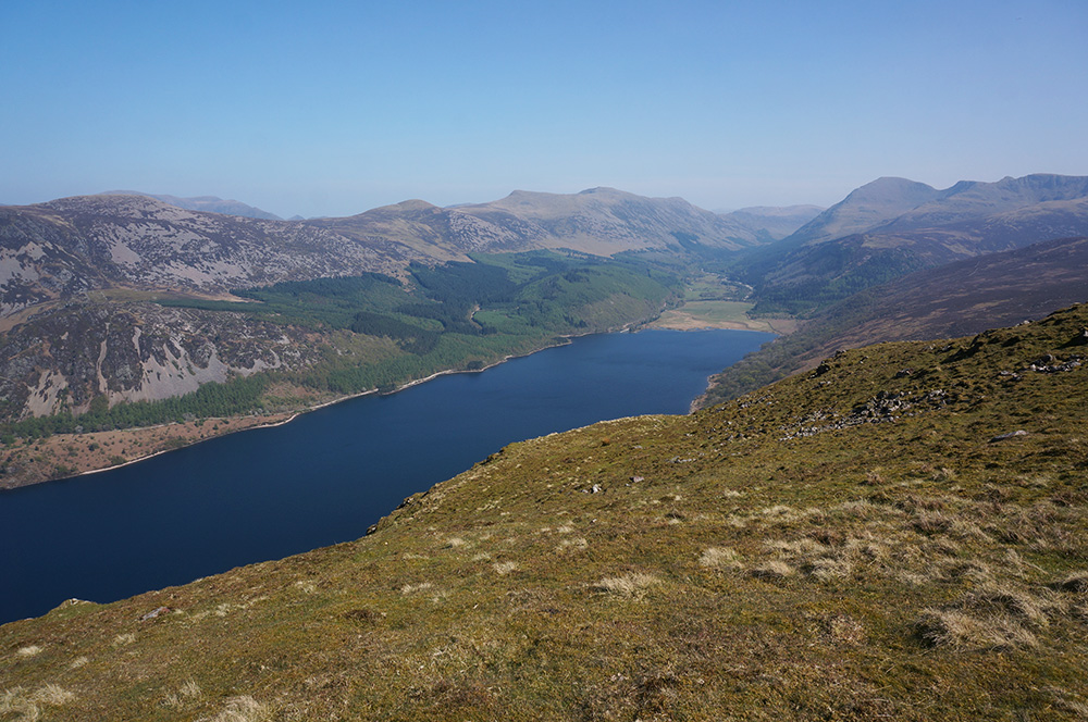
I had quite forgotten how sublime the view over Ennerdale Water is from the summit of Crag Fell. Even before I arrived, the returning memory was pulling me on and when I arrived, the place blew away all the base feelings I was having.
I stayed a while, healing my spirits. What a place to be? How lucky was I? This was walking as therapy, a stress enema.
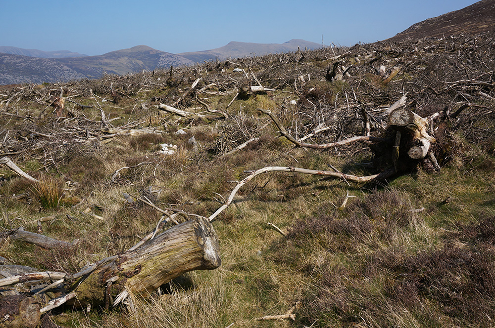
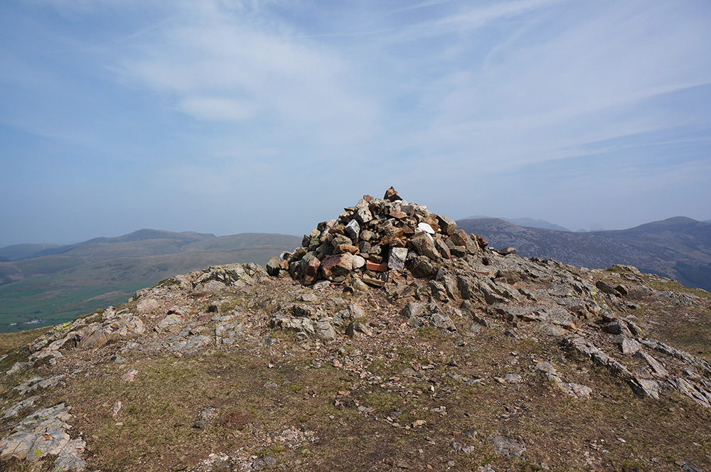
I left Crag Fell feeling a whole lot better than when I arrived and headed off in the direction indicated on the OS Maps app, to Lank Rigg. It soon became apparent that I was on the exact same route that Remco and I had taken two days earlier and I was soon down in the spooky felled plantation once again. The same steep climb out beside the wall followed but at the top, rather than following the wall round to the left and on to Iron Crag, I swung right, over rough ground and then picked up the ridge path.
Once the ridge path is gained, the walk takes on a very pleasant and gentle rise to the curiously named Whoap. From there, the path dips again before the steep-ish pull to the OS trig column at Lank Rigg summit.
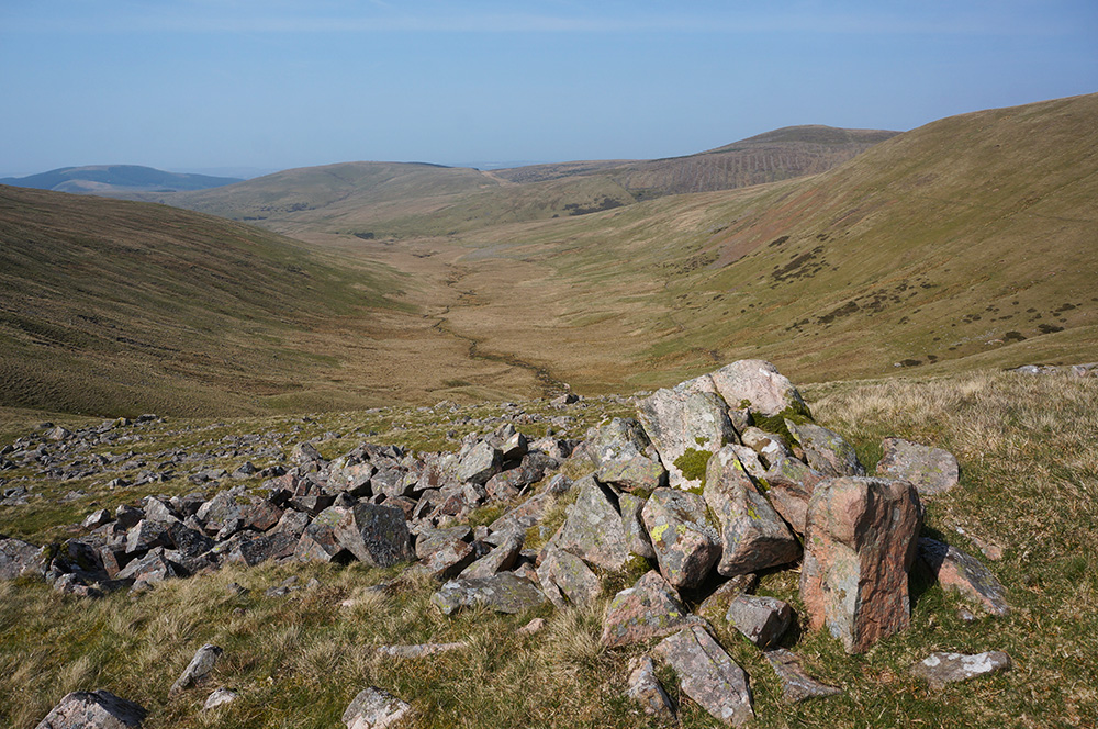
I’d made it to Wainwright’s most remote summit. His description is amusing and worth repeating here. “Meeting another human is outside the realms of possibility. Die here, unaccompanied, and your disappearance from society is likely to remain an unsolved mystery.”
Things have obviously changed since Wainwright wrote that back in 1966 because during the blissful lunchtime hour I spent at Lank Rigg, I counted ten other visitors. Of course, this was Easter Sunday and things would likely be very different on a cold and blustery November day.
After bagging Lank Rigg, I walked on, past the rather lovely tarn, to the south-west cairn and found a comfortable spot to settle for lunch. I’d reached my final goal for the day in good time so I rewarded myself with an extended stay in this lovely place.
After lunch (an apple, a muesli bar and a Capri-Sun), a reading of Mark Richards’ Fellranger guide and a short nap, I retraced my steps to the trig column and down the grassy slope where I took the left fork to follow Whoap Beck down into Lankrigg Moss.
This is a really lovely route, sheltered from the westerly wind, with the sound of running water and in full, hazy sunshine, it was a beautiful place to be alone.
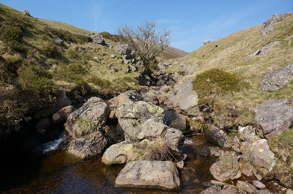
I made a number of stops en route to explore the streams that joined the swelling River Calder from side valleys. There is something magical about the dynamic of water cascading over rock.
I spun out the walk as long as I could before rejoining the road which led back to the car and eventually got back to the parking place at a quarter to five.
Easter Monday
Monday would be Remco’s final day in the Lakes and he had a train to catch that evening. Although I was feeling good, physically, I thought it best not to torture him any more than necessary and undertake an easy, local walk that didn’t require any driving and would set me up for the rest of my stay. Typically, I can manage four day-walks before needing a rest day but I figured that taking an easy day today might allow for another two day-walks on the Tuesday and Wednesday, before the weather broke.
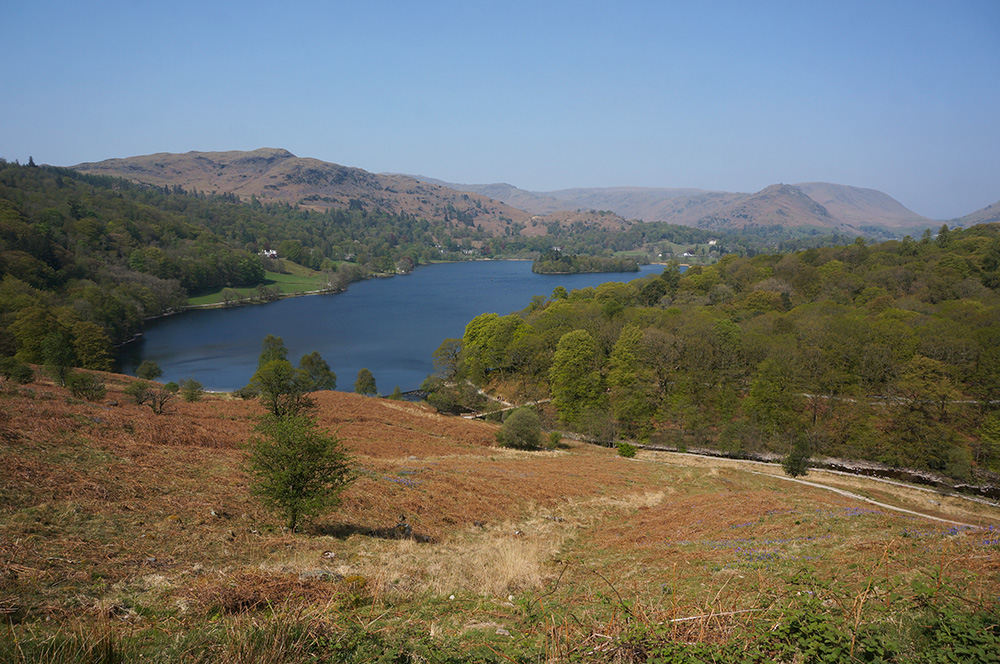
We decided a round of Rydal and Grasmere Lakes from the YHA would be a good idea. A pleasant walk, not too strenuous and we’d be back at the hostel in good time for a shandy before driving to Oxenholme.

It was another hot day, perhaps the hottest so far, and as we set off from Waterhead, the crowds had begun to arrive. We passed by the Roman fort and crossed the footbridge to enter the quiet back-road that follows the River Rothay to Rydal. It’s a lovely, relatively quiet and mainly shady walk, one of Ambleside’s best kept secrets.
At Rydal, we turned left up the steepening road to Rydal Water and then took a break at the bench at the top of the road with a great view over the lake.
We considered walking down to the water and walking along the lake edge but the crowds had already begun to occupy the best spots and neither of us fancied negotiating the lower route. Instead, we kept to the higher ground and headed to Loughrigg Terrace.
For some reason, I’d never been aware of the caves at the disused quarry above Rydal Water and so, stumbling upon them was a very pleasant surprise – they certainly add a deal of interest to the walk and the cool air inside was a welcome relief from the beating sun.
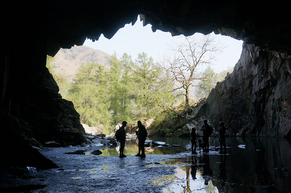
There isn’t an awful lot to explore but we entered into the touristy spirit of a sunny Easter Monday and followed the day-trippers into and out of the caves. I made a mental note to return at a quieter time of the year.
After our encounter with the caves, we kept to high ground, along Loughrigg Terrace and then onto the road above Grasmere Lake. By now, there were plenty of people around and we followed the road round to the north and into Grasmere itself.
The little town was not as packed as I’d feared, although there were plenty there. As it was now lunchtime, most were hunting food, including me and Remco. We decided a simple sandwich might be the most efficient option, so we passed by the Sam Read bookshop and made our selection from what remained at the Co-Op. We found a shady spot on the small green and ate our lunch.
We didn’t linger in Grasmere. As we walked out of the town, people were still arriving. We crossed the busy A591 at Town End and walked up the road, joining the bridleway back to Rydal. This is another lovely section of walk, mainly through woodland with the odd view out across Rydal Water.
At Rydal Mount, we followed the main road briefly to Pelter Bridge and once again entered the quiet back-road along the River Rothay, retracing the steps we’d taken earlier in the day.
We arrived back at YHA Ambleside at mid-afternoon to a crowded lakeside and a queue at the bar. Nonetheless, we claimed our shandy and found a shady bench to sit at.
After a pleasant hour or so at the shore of Lake Windermere, we drove to Oxenholme where Remco boarded the train bound for London Euston. I’m pretty sure he’d enjoyed his stay but I couldn’t help feeling that there was also a hint of relief as he boarded the train.
Tuesday
I’d saved the biggest walk of the trip until after Remco’s departure because even I was going to find this one a bit tough. I’d studied the route and I’d read up as much as I could on the various difficulties but I still wasn’t confident about taking on Yewbarrow. From all accounts, both the ascent, via Stirrup Crag and the descent via Dropping Crag were going to test my mettle as a fellwalker.
Knowing this would be a long day, I set off early and arrived at the National Trust car park at the Wasdale camp site at 9am. On the way, I’d stopped for a while at Birker Fell where, 12 months earlier, we’d scattered Dad’s ashes.
There was still plenty of room at the car park and I managed to find a convenient and shady spot. Today, the sky was a film of hazy cloud and, thankfully, the temperature had dropped – almost perfect walking weather.
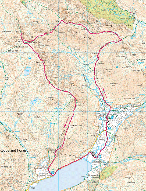
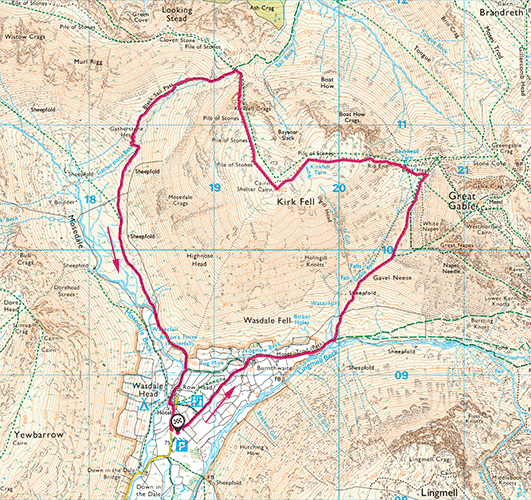
After carefully lacing my boots and packing a day’s worth of provisions in my pack, I set off on the first leg of the Mosedale Horseshoe. If everything went to plan, I’d end the day with five new Wainwrights bagged.
The weather forecast was suggesting a good day ahead and I reckoned the walk would take around 7 hours – in the end, it took 10.
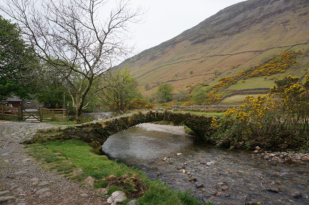
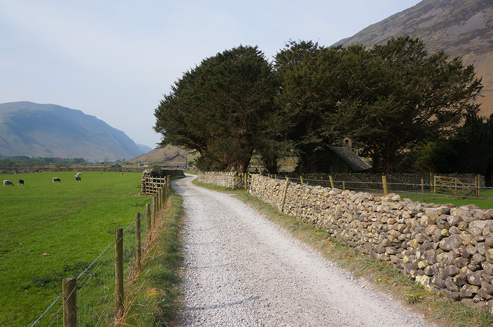
I set off round the back of the campsite, across the dry riverbed of Lingmell Beck and soon arrived at Wasdale Head, where I turned left at the Wasdale Head Inn and joined the lovely bridleway by the arched stone bridge.
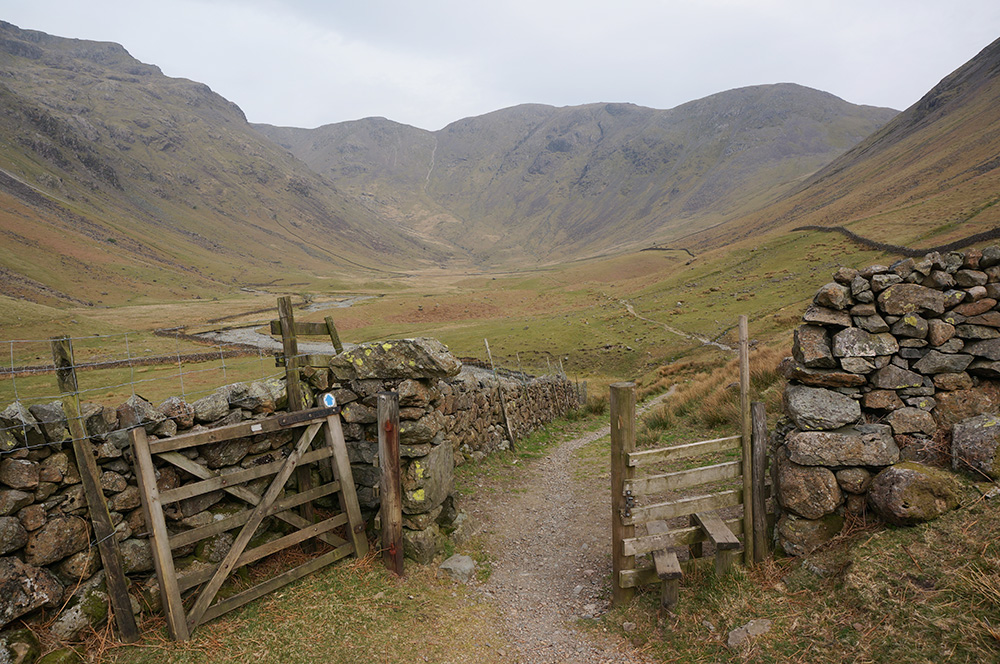
The path swings slowly round to the north-west and into lonely Mosedale, rising only gently as it goes. This was an excellent way to begin a day’s walking. The scene was already wild and remote despite the fact that I was only a couple of kilometres from the busy camp site. There was not another soul in view.
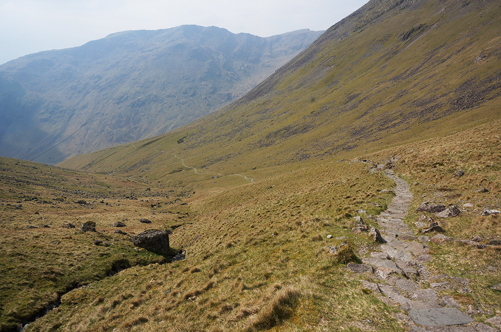
After another kilometre, the path swings round to the north-east and begins to climb steeply into Black Sail Pass. It’s a long, hard slog to the top of the pass but the path was good and pitched in places. I arrived there two hours after leaving the car, feeling exhilarated and totally alone. I hadn’t seen a single person since leaving Wasdale Head.
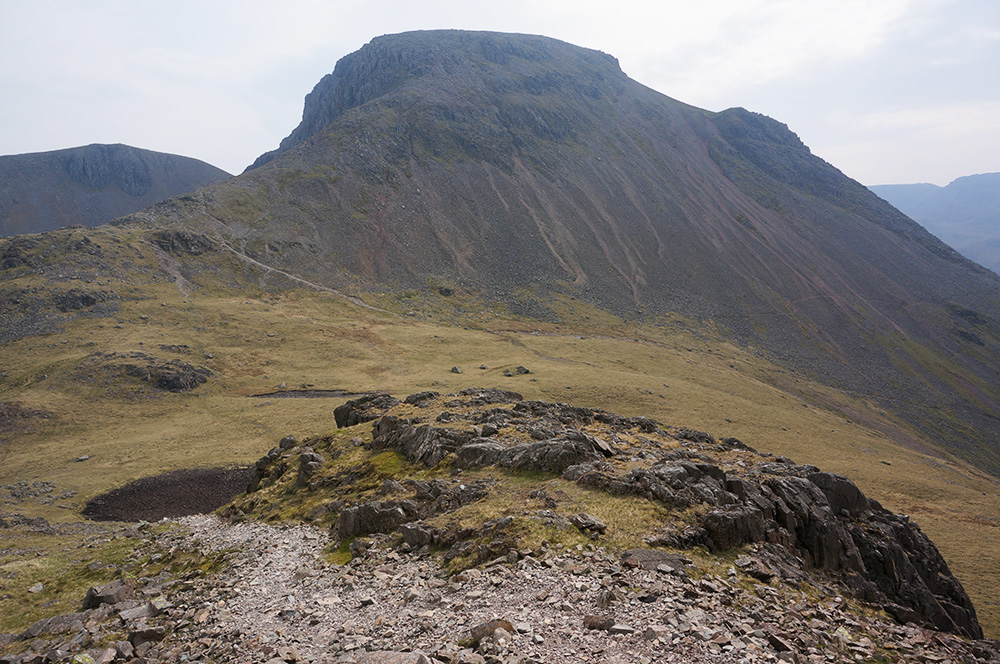
At the top of the pass, I had a short break before turning left towards Looking Stead. There was still a lot of climbing to do before reaching Pillar, at 892m, the highest point on today’s walk.
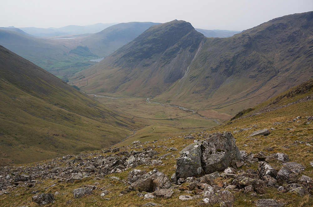
Beyond Looking Stead, as the path passes above Green Cove, there are some wonderful views down into Ennerdale and across to the Buttermere Fells. The hazy air giving a great sense of depth as each successive ridge of mountains became paler with distance.
The final pull to Pillar summit is quite rocky and there were still some small patches of snow remaining in craggy hollows.
I arrived at the summit triangulation column just after midday. The top is broad and rocky with a wind shelter and a cairn but no good place to sit. I was really pleased to have made it almost half-way round the walk in only three hours but conscious of the fact that I had the difficult bit still to come.
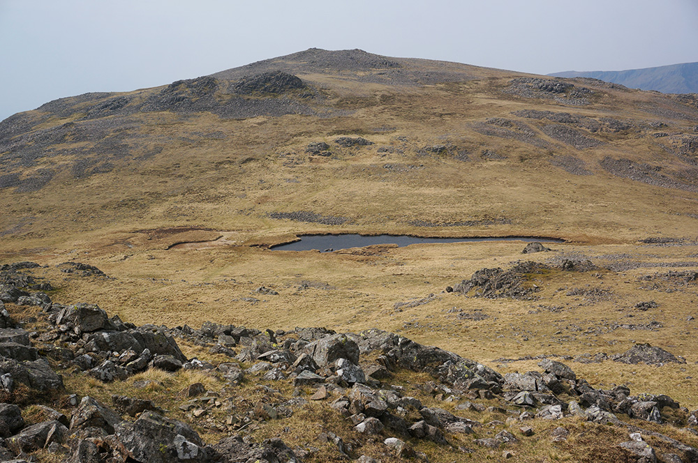
I left Pillar and descended the steep scree slope with care into Wind Gap. Today, there was just a stiff breeze, not enough to dent my enjoyment of this lovely place.
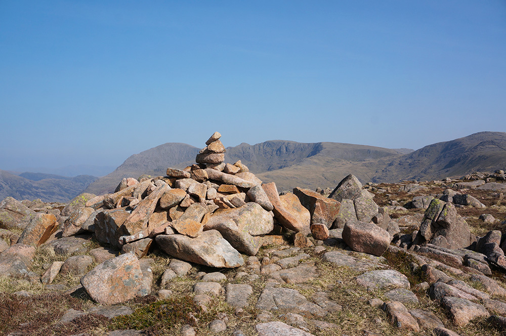
From Wind Gap, the path rises over Black Crag and it felt as though that top ought to be a fell in it’s own right. It’s topped with a fine cairn and a marvellous view across Mirk Cove to Steeple.
I followed the path as it dropped down to the rocky saddle between Mirk Cove and Black Comb and thought this would be an excellent place to stop for lunch. I found a large boulder, behind which I could shelter from the wind and which provided an ideal lunchtime view across to the impressive crags of Steeple and down to Ennerdale Water.
I’d made good time so I relaxed a little and took a generous half-hour break for lunch. Out of the wind, the air was warm and the views from my chosen perch were sublime. I may have taken some deep breaths and closed my eyes for a while.
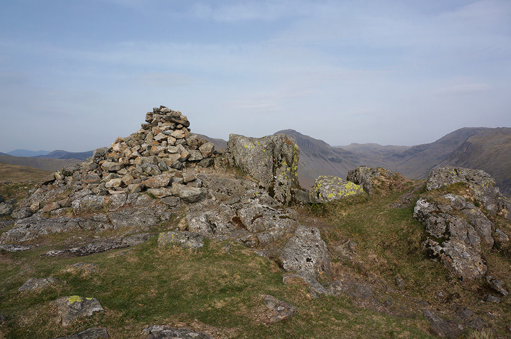
After my break, I made the short climb to the rather unsatisfactory top of Scoat Fell. The actual summit is crossed by a stone wall and the highest point is marked by a small cairn on top of the wall. The “official” summit, marked by a large cairn, is a little further west on obviously lower ground. I visited both, just to be on the safe side and then followed the path as it swung north to Steeple.
In truth, Steeple is not a separate fell, it’s just a descending shoulder of Scoat Fell but it’s such an impressive mass of rock and so eye-catching that it has been awarded a place in all the well-known lists.
Wainwright describes it thus: “The climbing of Steeple is a feat to announce to the old folks at home, who can safely be relied upon to invest the writer with undeserved heroism… Steeple in fact is no more than an excrescence on the side of Scoat Fell, and only its remarkable proportions have earned it a separate identity.”
Wainwright does, at least concede that, “Seen on a map, it commands the eye and quickens the pulse; seen in reality, it does the same”. That, certainly, is true and I thoroughly enjoyed my visit to the neat, small and airy summit of Steeple.
When I arrived, there were two older blokes at the summit. When I say “older”, I mean probably 10 or 12 years older than me. Both of them were super-fit fell-runners and one had a nasty, bloody gash on his calf. He was explaining to the other chap, who was maybe a couple of years younger that he’d done it on the way up but that it wasn’t anywhere near as bad as it looked. It did look bad!
I waited while the two of them climbed down from the top as I wanted to have this place to myself for a short while. It is a breathtaking location, with splendid views and a glorious sense of isolation and exposure.
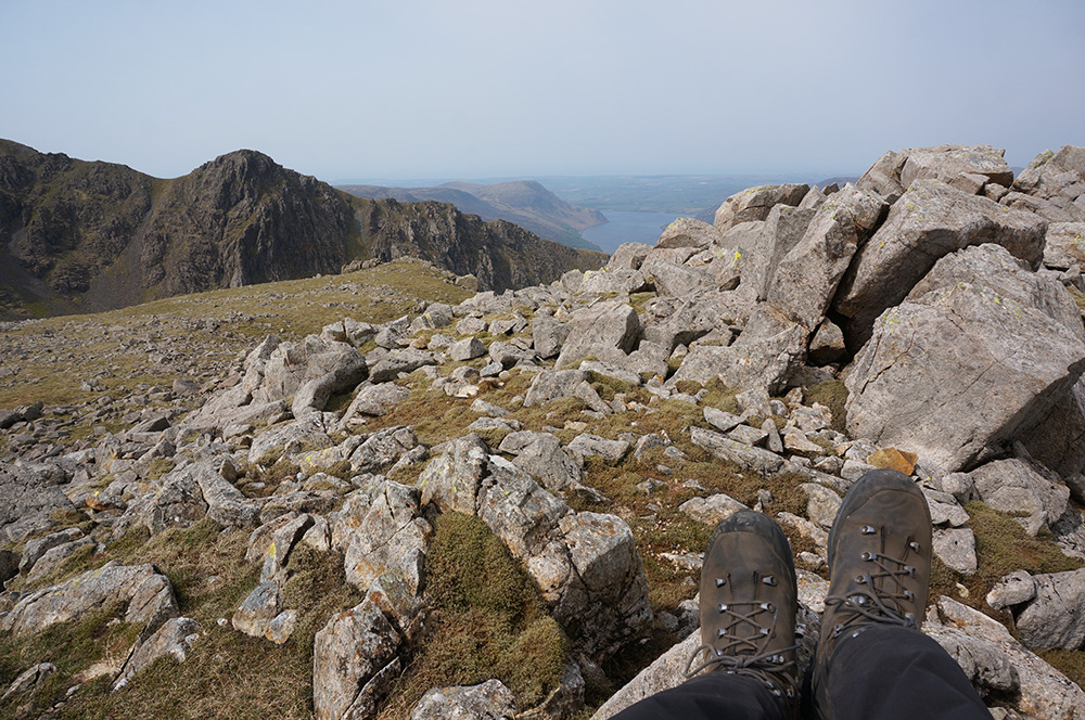
When I’d taken it all in, I returned along the narrow arête to Scoat Fell and then continued south-east on the gently descending path to Red Pike. After the fireworks of Steeple, this section of the walk seemed a little dull and I began to think ahead to Yewbarrow and wondered if it would be as difficult as I thought.
Pretty soon the path began to rise towards Red Pike and I arrived at the summit just after three in the afternoon. The approach to Red Pike summit requires not much more than a gentle stroll over well-trimmed turf but appearances can be deceptive. Wainwright notes: “The highest cairn, at 2707′, is dramatically sited on the very brink of the Mosedale precipice and is so much on the edge of space that it cannot be walked round”.
Red Pike is one of a number of fell tops in Lakeland that only reveal themselves to be fell tops from a distance. The classic example is Wandope in the North Western Fells, the least summit-like summit I’ve visited to date. However, the views here from Red Pike, across Mosedale to Great Gable and the Scafell range are dramatic so at least one has the sense of elevation.
I left Red Pike knowing that I’d completed four of the five Wainwrights planned that day and thinking to myself that I’d done pretty well and it wouldn’t be a disaster if I didn’t manage to bag Yewbarrow. So far, the day had gone really well but I was still a little nervous about the last leg.
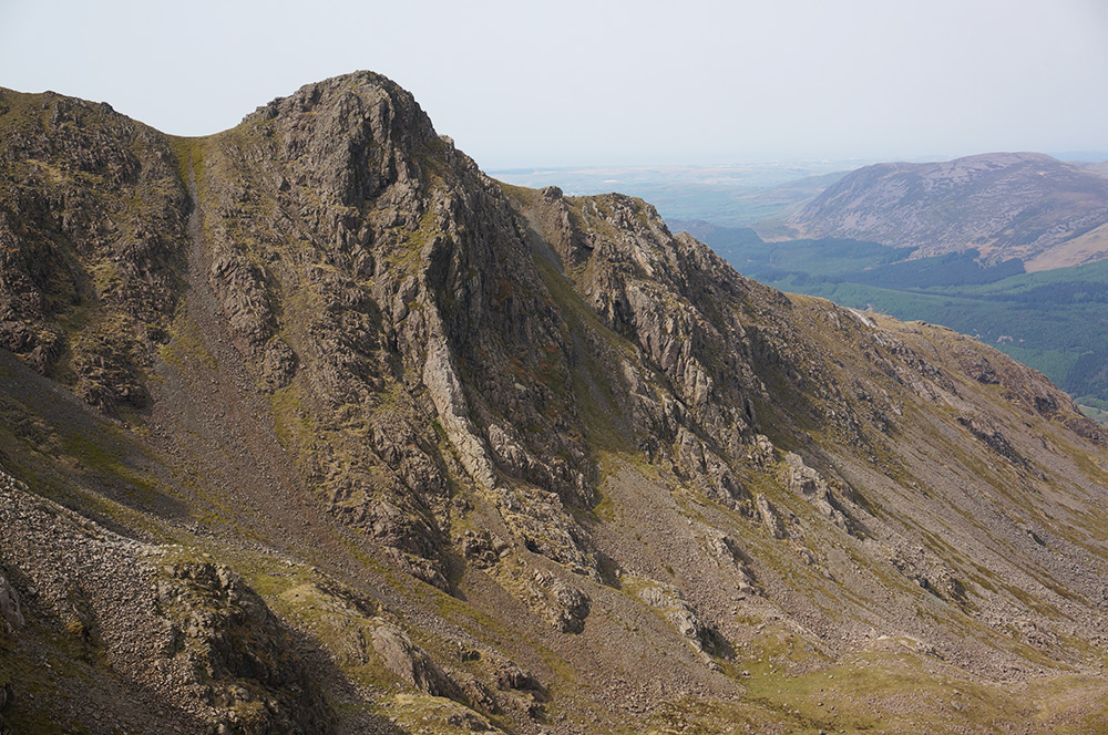
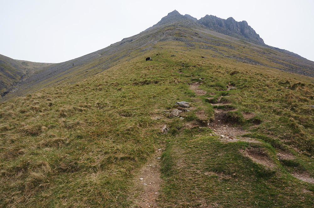
As the path from Red Pike drops to the south-east, the first full view of Yewbarrow is revealed from an elevated viewpoint. About 500m out from Dore Head, I found a comfortable perch and sat for a while studying the rocks of Stirrup Crag. As hard as I looked, I couldn’t trace a route up and over the intimidating crags.
Wainwright’s words came back to me as I sat there. “From Dore Head, Stirrup Crag looks very formidable, but getting up it is nothing more than a strenuous exercise in elementary gymnastics and unusual postures. The way lies within the confines of rocky cracks and chimneys…”. Mark Richards has similar advice, “climb up to the base of Stirrup Crag and dig your spurs into the task of scrambling up the early cleft. Other gullies follow, making this a close-run thing to proper scrambling – certainly harder than normal ridge-path terrain. But it is nothing for the average fell wanderer to fear”.
After almost four years of Wainwright bagging, I’ve come to realise that, by and large, slopes and scrambles always look a lot more difficult from a distance. I’m pretty sure that it’s only perspective that makes steep slopes look decidedly steeper than they really are and rocky scrambles more complicated, so I continued down to Dore Head and then up the scree path to the base of Stirrup Crag, expecting to find an obvious route up the face of the crag. I did not.
For several minutes, I walked up and down, along the base, looking for a good start point. I couldn’t find one and began to wonder whether I should just accept defeat and look for the easier but more circuitous route along the flank of the fell. I was on the verge of doing so when I spotted a slight change of colour in some of the rocks. There was less lichen on them as if prevented from growing by the frequent touch of hand and boot.
The start didn’t look promising but I gave it a go anyway and discovered that after the first difficult few manoeuvres, the number of hand and foot holds increased. The going was not easy but I never felt out of my depth and pretty soon, I was relieved to be at the northern cairn with Stirrup Crag conquered and behind me. All I had to fear now was the descent at the southern end!
The summit of Yewbarrow is a special place. Few casual walkers visit it but the view of the Scafell range across Wasdale is one of the best I’ve come across. Curiously, from this angle, it is Scafell and not Scafell Pike that looks much the higher of the two main peaks. Before modern survey techniques, it was always thought that the former was the highest, and form this viewpoint, it’s not difficult to see why.
It was now a quarter to five and the sun, which was lowering into the west, lit up the Wasdale screes that for most of the day are dark with shadow.
I remained at the southern and highest summit for over half an hour, knowing that I’d achieved my goal of five Wainwrights and with only the remaining difficulty of the descent via Dropping Crag to negotiate on the way down. While I was there, another brave soul passed in the same direction I was travelling and strode confidently towards Great Door. Surely the descent couldn’t be so difficult!
Shortly after, I followed on and at first, the path gave no difficulties but I couldn’t help recalling Mark Richards’ words, “The ridge S to Great Door promises hope, but on the way down to the right passes the remnants of a sheep-deflecting crag-top wall and, down the loose gully beside Dropping Crag, is not a nice affair…”.
Well, he was quite correct. The steep gully path was loose and unstable and this was one of the very few occasions on these walks that I wished I owned a pair of walking poles. The only other occasion I’d experienced anything like this was at Gamlin End on the way down from High Crag.
Mercifully, the difficulty didn’t last too long and below Dropping Crag, the path emerges onto firmer ground. From that point on, the steep walk down to the road is uneventful but the view back towards Bell Crag is positively Alpine.
I arrived back at the car shortly before 7pm feeling very pleased after a thoroughly entertaining day on the fells.
Wednesday
The final walk I’d planned for this trip was a quick round, taking in Kirk Fell and a revisit to Great Gable. However, after a full week of walking and a long and difficult walk the previous day, I was feeling a little feeble so I decided to miss out Great Gable.
Also, the weather forecast was suggesting rain after 4pm and limiting the walk would mean I could easily complete it before the weather was due to break.
I made another early start from YHA Ambleside and arrived at Wasdale Head at 9.30am, finding plenty of space to park. The weather was bright but hazy and the temperature had dropped a little more.
I decided to take Kirk Fell in an anti-clockwise direction, going up via Moses Trod and returning via Black Sail Pass. I liked the idea of coming down via the same route I’d used to go up the previous day. I often think to myself, on the way up a steep path, “this would be great to come down”. Well, now I’d be doing just that.
I set off from the Green, passing St. Olaf’s Church, reputedly the smallest church in England and the inspiration for the name of the fell I was about to climb. The pathway is fairly level for almost 2km but starts to climb steeply after the crossing of Gable Beck.
After another 500m, the path becomes even steeper as it crosses the curiously named Gavel Neese. At this point I began to feel very weary indeed and noticed that I was really labouring. During a short pause, I realised that I wasn’t feeling great and that I might be coming down with something. For a couple of seconds only, I wondered whether it would be sensible to cut the day short but I decided to keep going – slowly.
Further up the slope, just when I thought it couldn’t get any steeper, the firm grassy sward gave way to loose, rocky scree, making the way not only steep but potentially dangerous. Once again on this trip, I wondered how much easier life might be with a sturdy pair of walking poles.
For the next 800m, all the way up to Beck Head, the path is narrow, rocky and unstable as it traverses the steep scree slope on the flank of Great Gable – at once unpleasant and exciting.
Eventually, I reached Beck Head at 11.30am and was happy to stand on stable ground for a while. I briefly considered popping up to Great Gable but then remembered how I was feeling and realised I needed to focus my energies on Kirk Fell.
It was pretty windy at Beck Head, so I didn’t linger and set about scaling Rib End. As I climbed, I looked across Beck Head to the Great Gable screes and tried to work out how it was that in May 2018, I managed to find myself out on that scree slope during a misguided descent from Great Gable summit. I couldn’t work out how it had happened and it looked even more scary from this vantage point.
The steep, rocky climb was relatively easy and I was soon approaching the lower, eastern summit. Naturally, I thought it must be the main summit, until I arrived and looked across Kirkfell Tarn to the more distant and higher western summit. This was a big fell-top!
After a short pause, I headed down to Kirkfell Tarn and then up to the main summit. The wind was strong on the top and I was grateful that the summit was marked by a wind shelter. As it was now lunchtime, I hunkered down in the shelter to eat, knowing that it would be downhill all the way back to the car.
I took my time over lunch, enjoying the fact that I’d now reached 208 Wainwrights and knowing that I could easily complete the round during the summer.
After half an hour in my little bunker, I set off north-west, following the fence posts to Kirkfell Crags and the steep, rocky descent to Black Sail Pass. With care, this route was rather fun, especially as the wind on this side of the mountain had dropped to almost nothing.
The day had become brighter and warmer, and as I descended to Black Sail Pass, I took off the waterproof I’d been wearing since meeting the wind at Beck Head. I was looking forward to a slow and gentle stroll back through Mosdale in the spring sunshine.
There were a few groups of people at the head of Black Sail Pass, all enjoying lunch and the atmosphere was quite different to the previous day when the place had felt very lonely.
It was now 1.30pm and I had plenty of time to finish the walk before the rain, so I took plenty of breaks and drank in as much of the landscape as I could, a store of good feeling to last until my next visit.
About half way down, I was sitting on a large stone by the side of the path when a chap of approximately my own age stopped for a chat, obviously recognising me as a kindred spirit. He asked how I was doing and we got talking about the Wainwrights – it turns out we were both on our first round. He asked me how many I had left and I told him just the six. He looked at me suspiciously and said, “I’ve got seven left”. We then compared notes, which ones we still needed to do etc. He suggested I could probably finish off in the next week or so but I told him where I lived and that I’d be returning the next day. He lived in Penrith and told me he had the luxury of waiting for the best weather – how nice! We wished each other good luck and he went on his way.
Occasionally, one meets people on the fells who in another life could have been great friends. I certainly felt that way about this chap.
As I neared Wasdale Head, the cloud became thicker but there was still no sign of rain by the time I arrived back at the car at 3.30pm. In fact, the rain didn’t begin until later that evening as I passed Grasmere on the way back to the hostel.
So that was the final walk of my April visit. The following morning I half thought about taking on Fleetwith Pike but decided instead to spend the morning mooching round the shops in a damp Ambleside. I bought Hannah a copy of the Tove Jansson biography and a couple of Eccles Cakes and then set off on the long journey home after lunch.
Violets
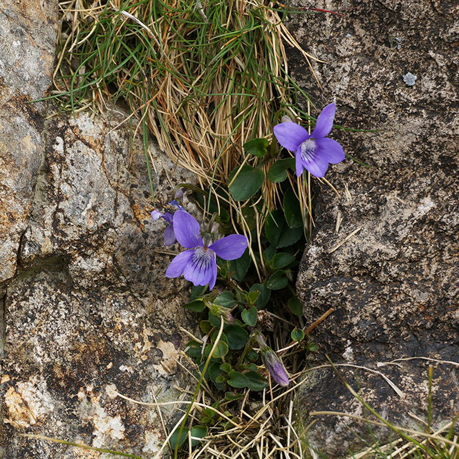
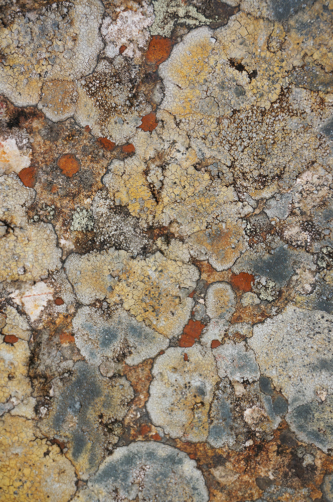
The plant that caught my eye on this visit to the Lakes was the Common Dog-violet (Viola riviniana), a tiny flower that I found on many of the walks and generally located near or even on footpaths across the fells. I noticed them particularly in the joints between stones on sections of pitched footpath and they became a familiar and welcome diversion on some of the steeper sections.∗
19th April 2019
Crag Fell (523m)
Iron Crag (640m)*
Caw Fell (697m)
Haycock (798m)
20th April 2019
Buckbarrow (430m)
Seatallan (693m)
Middle Fell (585m)
21st April 2019
Grike (488m)
Crag Fell (523m)**
Lank Rigg (541m)
23rd April 2019
The Mosedale Horseshoe
Pillar (892m)
Scoat Fell (843m)
Steeple (819m)
Red Pike (Wasdale) (828m)
Yewbarrow (628m)
24th April 2019
Kirk Fell (802m)
* Fellranger Fell
** Previously Bagged
On this trip I’ve added a respectable fourteen more Wainwrights to my total in five walks, bringing the tally to 208. That means I have just six more to bag to complete the magic 214. The plan is to finish on Haystacks in July with Max and Tilly… and then what?
Kit Notes
At the end of last year’s walking season, I’d come to the reluctant conclusion that my beautiful Meindl walking boots could not be used for my 2019 walks, they had become too painful to wear for any length of time. That’s not to say that there was anything wrong with the boots, the problem was, and still is my toe joints, which I had come to suspect were starting to become arthritic.
During the winter I did a lot of online research and realised that I needed a pair of boots with a generous toe box that would minimise any pressure on my toes, a firm fit around the heel to avoid any movement and a three-zone lacing system so I could adjust the fit.
Only one brand of boot seemed to fulfil all three criteria and I identified the Mammut Trovat Guide II High GTX as being the most likely boot for this season. To finance the purchase, I sold both my Meindls and Asolos on eBay and bought a pair (UK size 11) well in advance of this trip.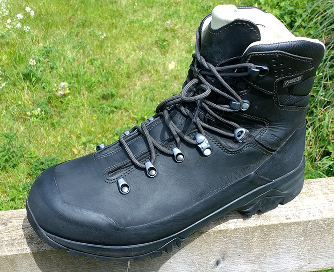
Over a couple of weeks, I managed 10 hours of walking without any pain and thought I should next try them on a full day-walk. Hannah and I were due to visit our friends John and Fee in Wales, so I planned a 24km walk across the Preseli Mountains from their base at Brynberian. At the end of the walk, I was in agony. I thought I’d cracked it but it seemed that these boots were no better than the ones I’d just sold.
The following week, Hannah did some research for me and discovered an interesting article on how best to lace walking boots for different foot conditions. I took the advice and re-laced my boots so that the laces started at the second pair of lugs. Bingo! I walked through the entire week in the Lakes, pain free. It’s the simplest of solutions, but what a difference it made.